Incredible Photos Display Power of Volcanic Eruption in Chile
American and European satellites captured images of a Chilean volcano before and after it erupted on March 3. More than 2,000 people had to evacuate the region as ash and lava spewed into the air, but so far no injuries have been reported. [Read the full story on the new images of the volcano]
Before the eruption
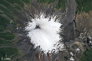
This image was captured by the Advanced Land Imager (ALI) on NASA's EO-1 satellite on Feb. 22, a little more than a week before the volcano erupted in Chile. The sides of the volcano are covered in snow. (Image credit: Jesse Allen | NASA Earth Observatory)
After alternations
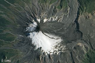
This image, taken after the eruption, shows ash blanketing the east side of the Chilean volcano. The image was taken on March 5, two days after the eruption, by NASA's Operational Land Imager (OLI) on the satellite Landsat 8. (Image credit: Jesse Allen | NASA Earth Observatory)
Pristine view

Jeffrey Johnson, a geophysicist at Boise State University in Idaho, took this photo of Villarrica before its eruption while he was living in Pucón, a city in Chile, about 11 miles (17 kilometers) northwest of the volcano. (Photo credit: Jeffrey Johnson)
Sign up for the Live Science daily newsletter now
Get the world’s most fascinating discoveries delivered straight to your inbox.
Ashen face
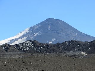
After the eruption, the eastern side of the mountain was completely covered with volcanic materials called tephra, which are fragments from a volcanic eruption that were once airborne, but now lay on the ground. (Photo credit: Jeffrey Johnson)
Bird's-eye view
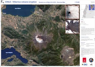
This overhead view of Villarrica was taken after the eruption taken by RapidEye, a group of five earth-observing German satellites. Of the two inset photos in the top corner of the image, the top image was taken Jan. 7, before the eruption, and the bottom image was taken March 4, just after the volcano blew ash and lava into the sky.
(Image credit: Copyright BlackBridge AG, ©DLR 2015. Map produced by ZKI (Center for Satellite Based Crisis Information))
Volcanic scan

This image is a composite made from two satellite scans, taken on Feb. 20 and March 4. It shows how Villarrica physically changed during the eruption. The scans were taken by Sentinel-1, a European Space Union satellite.
The areas in the image that are pink and blue are the parts of the volcano surface that changed during the eruption, between the time that the first image was taken and the second. The areas of the volcano that underwent no change between the time the two images were taken appear grey, according to a statement from the European Space Union.
(Image credit: Sentinel-1A © Copernicus 2015. Map produced by the German Remote Sensing Data Center of DLR)
Follow Laura Geggel on Twitter @LauraGeggel. Follow Live Science @livescience, Facebook & Google+.

Laura is the archaeology and Life's Little Mysteries editor at Live Science. She also reports on general science, including paleontology. Her work has appeared in The New York Times, Scholastic, Popular Science and Spectrum, a site on autism research. She has won multiple awards from the Society of Professional Journalists and the Washington Newspaper Publishers Association for her reporting at a weekly newspaper near Seattle. Laura holds a bachelor's degree in English literature and psychology from Washington University in St. Louis and a master's degree in science writing from NYU.

