Capitol Reef: Photos of Southern Utah's Majestic Beauty
In the south-central part of Utah, a 100-mile-long (161 kilometers) formation, dubbed Waterpocket Fold, has created a landscape that is not only spectacular to view but is also a geological treasure for research and study.
A treasure
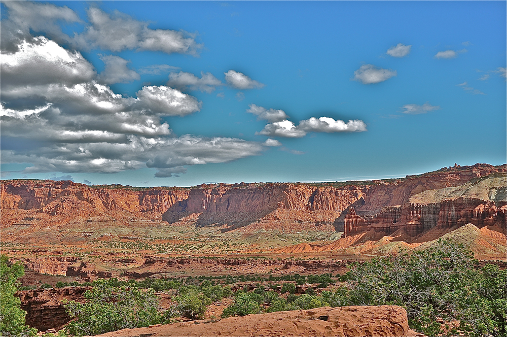
Seventeen unique geological formations are found along this long and warped portion of the Earth's surface. Each has its own special types of soil, minerals and land slopes. (Credit: Linda & Dr. Dick Buscher)
A step up

As a classic monocline, Waterpocket Fold is a regional fold whose western lands have risen more than 7,000 feet (2,134 meters) above the lands to the east. The underlying faults that resulted in this region of more than 390 square miles (1,010 square kilometers) became active some 50 million to 70 million years ago, during a mountain-building era in North America known as the Laramide orogeny. (Credit: NPS)
A beautiful effect
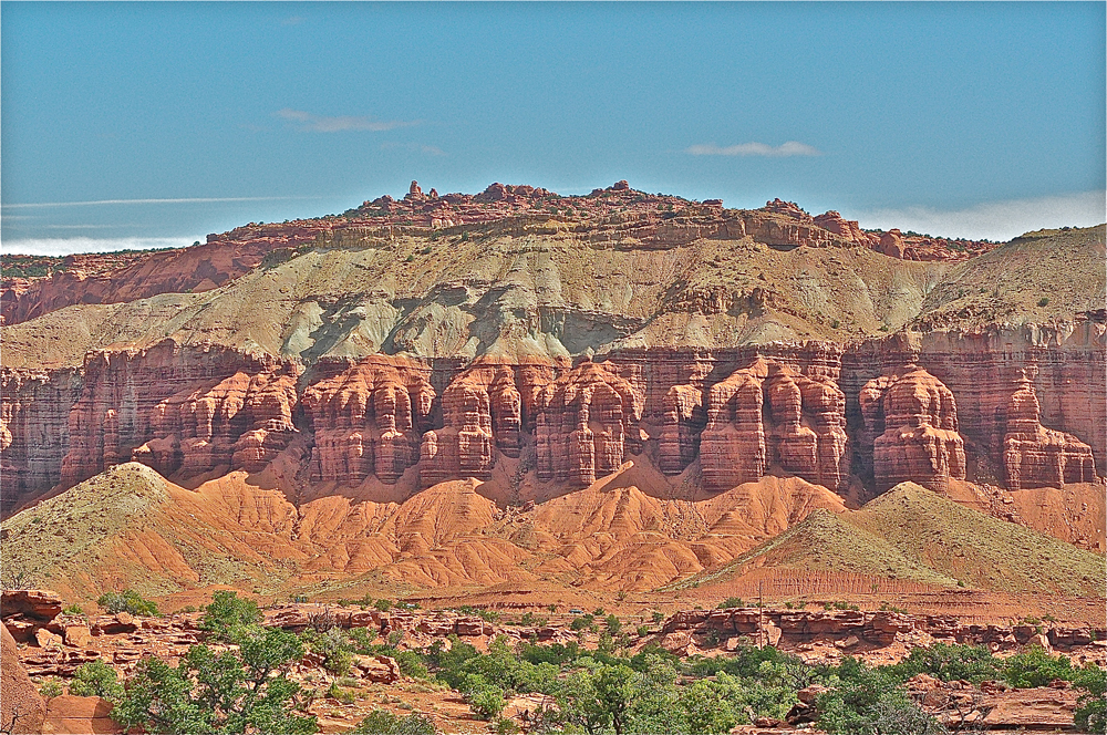
The name Waterpocket Fold comes from the continuous erosion of the sedimentary rock layers found here. "Waterpockets" are depressions found in the sandstone layers that have been eroded by water. These hollows are common throughout this region and give rise to the name. Millions of years of water erosion have created a landscape of meandering canyons, high-rising spires, massive domes, radiant cliffs and elegant arches. (Credit: Linda & Dr. Dick Buscher)
Sign up for the Live Science daily newsletter now
Get the world’s most fascinating discoveries delivered straight to your inbox.
A dividing line
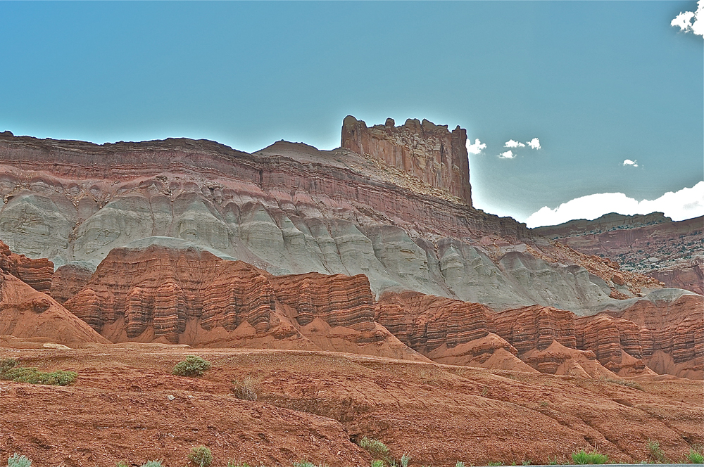
In this cold, high desert region of Utah, the sedimentary rock is nearly 10,000 feet (3,048 m) thick, created over time by the ebb and flow of the shallow Western Interior Seaway. The oldest strata found here were laid down in the Permian Period, some 270 million years ago. The younger Cretaceous Period strata settled to the sea bottom some 80 million years ago. The bending caused by the Waterpocket Fold has resulted in the youngest rocks being found in the eastern part of the region, while the oldest rocks are found in the western part. (Credit: Linda & Dr. Dick Buscher)
A unique name
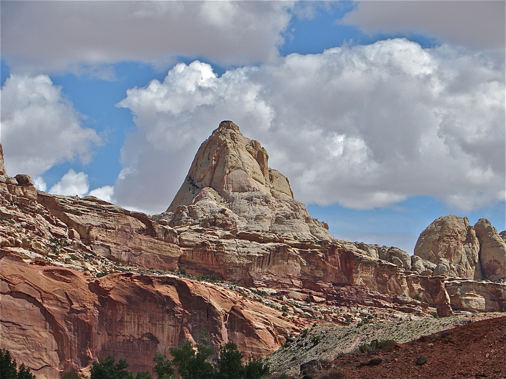
The most scenic lands of this southern Utah region have been set aside for preservation and are known today as the Capitol Reef National Park. The name "capitol" comes from the many white domes of Navajo sandstone found here; the name "reef" was given for the many spectacular rocky cliffs found here that were a barrier to travel for early American settlers, similar to a "coral reef" found in the ocean. (Credit: Linda & Dr. Dick Buscher)
Distinct geography
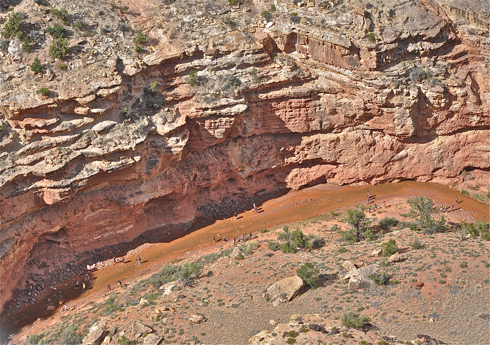
The Fremont River is one of the few rivers that flows year round in this part of Utah. Geologist think the river established its course shortly after the Laramide orogeny, when the land was a level plain and when the Waterpocket Fold was buried under hundreds of feet of sediment. Over time, and during the gradual uplifting of the Colorado Plateau, the Fremont River eroded downward through the sediment, creating the unique geological landscape seen today. (Credit: Linda & Dr. Dick Buscher)
Diversified ecology
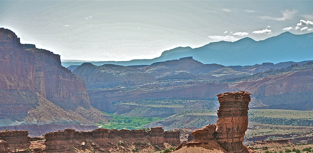
The ever-present source of flowing water from the Fremont River has created wide valleys with lush green riparian areas that are rare in this generally high-desert region. These riparian areas create a diverse community of flora and fauna and have been a refuge for both prehistoric and historic human cultures. The Fremont River flows west to east, cutting completely across the Waterpocket Fold, and eventually joining the Colorado River near Lake Powell. (Credit: Linda & Dr. Dick Buscher)
A shrine in the wilderness
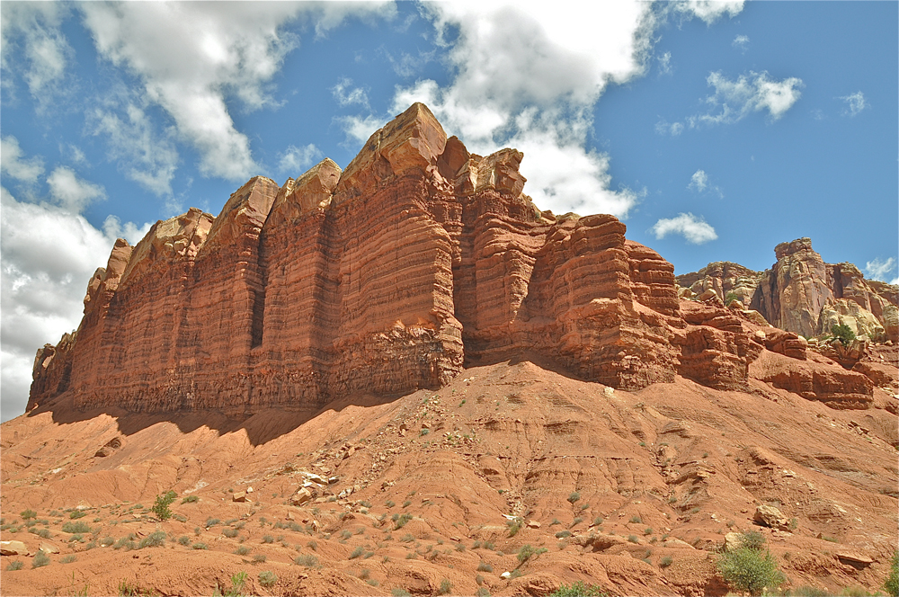
Huge cliffs of sedimentary stone are common throughout the Capitol Reef region. This structure, known as the Egyptian Temple, is found at the end of an escarpment that is nearly 2 miles (3.2 km) long, and is at the base of the Waterpocket Fold. The Egyptian Temple is composed of soft Moenkopi Sandstone covered by a thick layer of harder Shinarump Sandstone. (Credit: Linda & Dr. Dick Buscher)
High and low
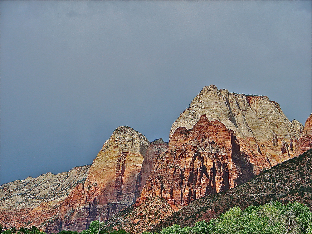
Domes composed of white and yellow Navajo Sandstone are common throughout the region. These folded rock pinnacles, along with the massive buttressed cliffs, rise some 1,000 feet (300 m) above the canyon floors. (Credit: Linda & Dr. Dick Buscher)
A recurring pattern
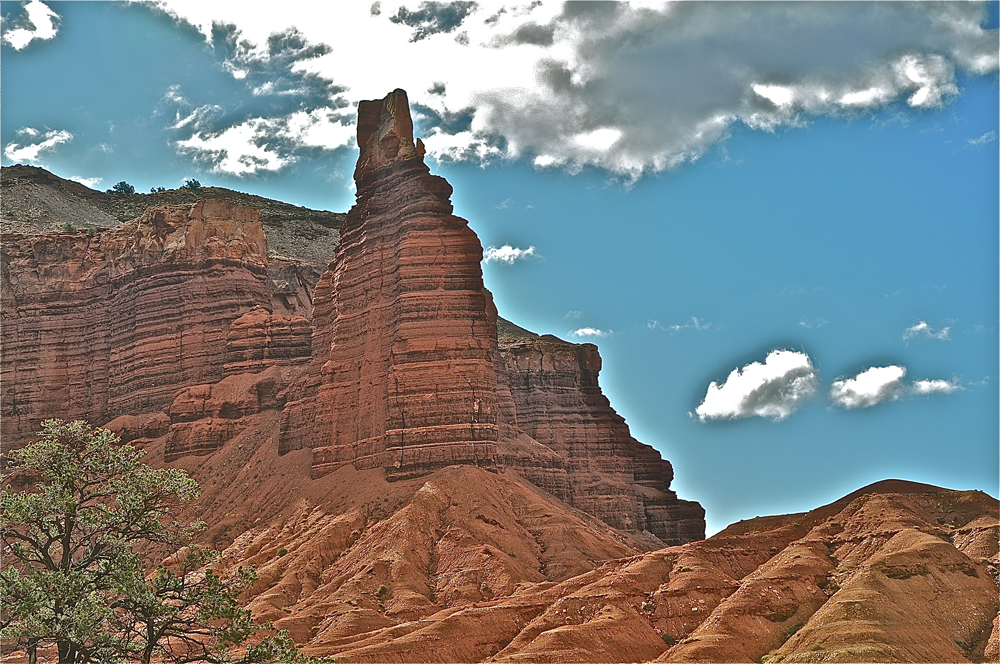
Soft rock covered by harder rock is a common theme when explaining the many beautiful formations found in and around Capitol Reef. This structure, known as Chimney Rock, is a spire created by the forces of wind and rain and is another example of Moenkopi/Shinarump Sandstone strata commonly found in the area. (Credit: Linda & Dr. Dick Buscher)
Eroding effects of nature
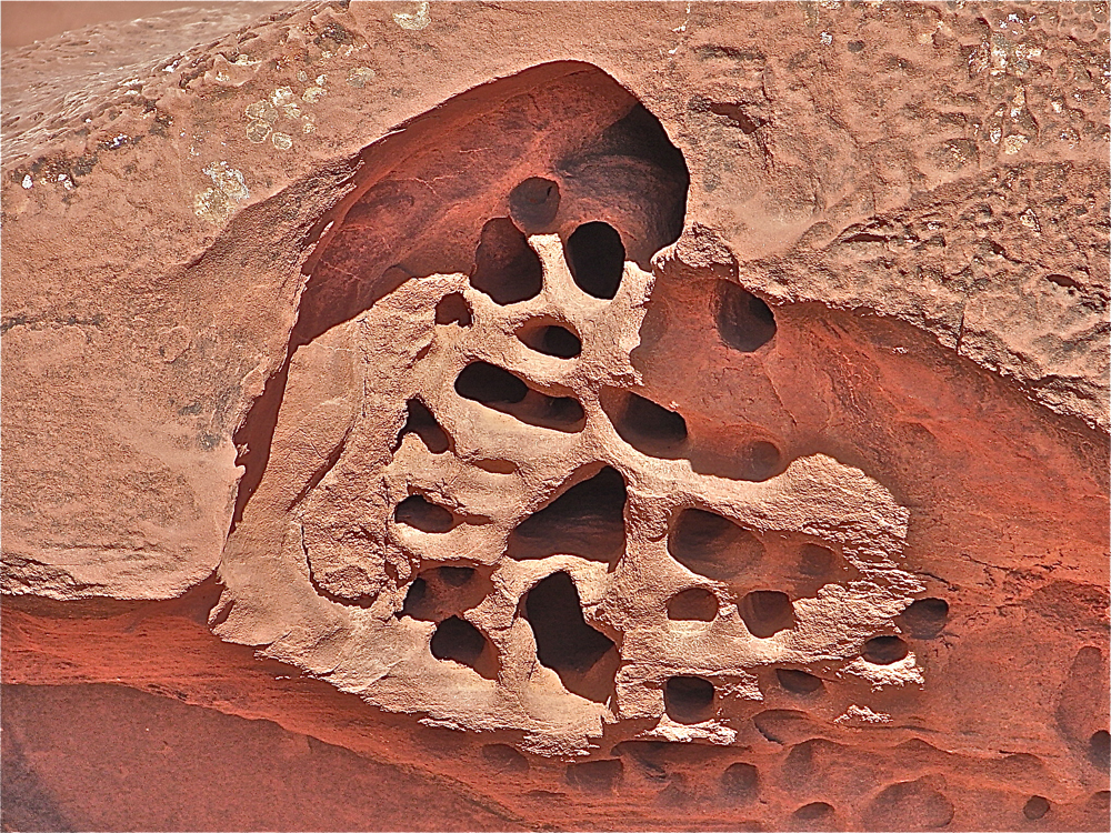
Evidence of the power of erosion can be seen everywhere throughout the Capitol Reef region. Here, small wind caves have been carved in a soft sandstone cliff by blowing wind and rain. Such wind caves are created over a long period of time and can often resemble the artistic work of a master stone sculptor. (Credit: Linda & Dr. Dick Buscher)
Evidence of cultures

Man has long made this region his home. Archaic hunters and gatherers crisscrossed the land, following the abundant riparian areas. The Fremont Culture is known to have farmed corn, squash and beans along the river bank as early as 500 A.D. These individuals left behind not only the remains of their pottery, stone homes and tools, but also an incredible display of petroglyphs and pictographs for modern man to see and ponder. (Credit: Linda & Dr. Dick Buscher)
Home to the rare and endangered

Capitol Reef is an arid region ranging in elevation from 6,000 feet (1,829 m) to 9,000 feet (2,743 m), with an average annual precipitation of 7.2 inches (18 cm). Amazingly, more than 887 species of plants have been documented within the boundaries of the national park. The park is also home to more than 40 endemic and rare plant species that are found on federal threatened or endangered lists. During the spring, wildflowers are profuse in the area. Shown here is the Indian paintbrush, Castilleja chromosa. Indian Paintbrush is a "root parasitic," meaning the plants intertwine their roots to the roots of nearby plants, taking lifesaving nutrients from their new host. (Credit: Linda & Dr. Dick Buscher)
Mountains high
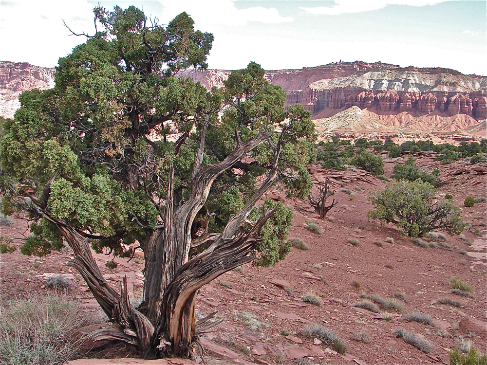
Along the Fremont River, groves of indigenous cottonwoods and willow trees flourish. So, too, does the invasive tamarisk (commonly known as salt cedar), which came to this land with early American settlers in the 19th century. Away from the river and below an elevation of 8,000 feet (2538 m), pinion and juniper trees are found scattered across the landscape. At higher elevations, on the highest mountaintops of the Capitol Reef region, large stands of ponderosa pine (Pinus ponderosa) grow. Shown here is the Utah juniper, Juniperus osteosperma. (Credit: Linda & Dr. Dick Buscher)
Diversity abounds
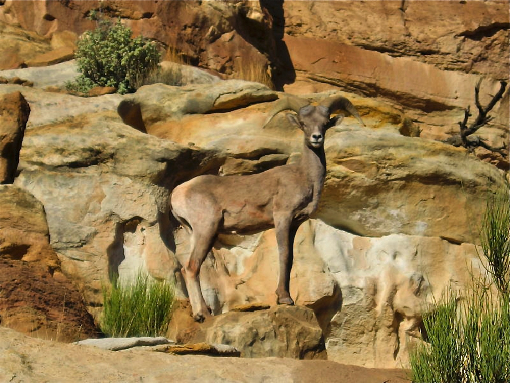
The animals of Capitol Reef are as diverse as the many different habitats found here. Dry, rocky cliffs cut with dry washes give way to the environments found alongside a perennial running stream. Nearly 60 species of mammals have been documented in the national park, as well as 230 species of birds. Multiple species of reptiles, amphibians, insects and fish make this dry, high desert an area that is teeming with life. Shown here is the Desert Bighorn Sheep, Ovis canadensis nelson, whose species once disappeared from Capitol Reef. Reintroduced in the mid-1990s, big horn sheep are once again a common sight along the high cliffs of Capitol Reef National Park. (Credit: NPS)
Abundant life
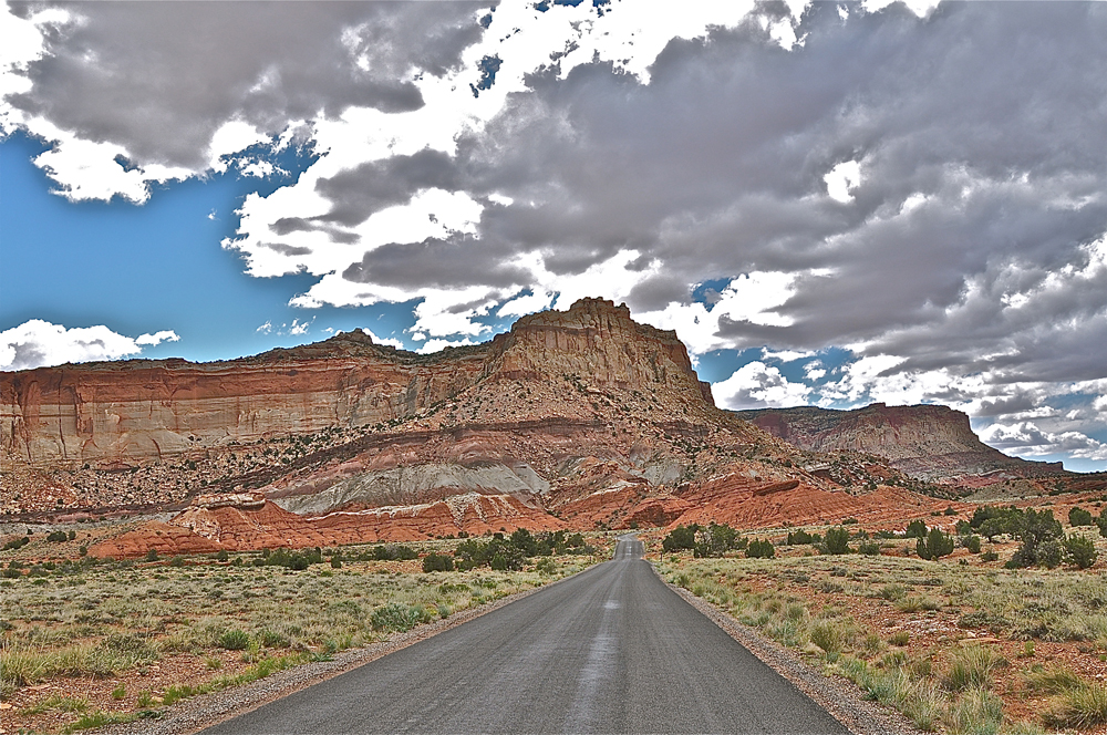
The geological forces of nature that came together in the Capitol Reef region have created an area of tremendous rock beauty and diverse biological habitats. Within those habitats, a wide variety of plant and animal species thrive in the high desert climate, making this region of southern Utah a special laboratory for anyone who enjoys viewing and studying the wonders of nature's creations. (Credit: Linda & Dr. Dick Buscher)
Follow us @livescience, Facebook & Google+.


