Interactive Map Lets You Find Dinosaur Tracks, Extinct Volcanoes

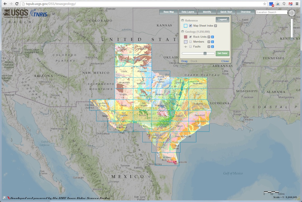
Want to trace the footsteps of dinosaurs or pinpoint the exact location of extinct volcanoes? A new interactive geological map of Texas lets people browse everything from where dinos once roamed to the whereabouts of oil and gas formations.
The U.S. Geological Survey map, which can be accessed for free online, offers a unique window into the history of the ground beneath the Lone Star State. The map shows Texas at a scale of 1:250,000, and allows users to zero in on geographic layers of interest, such as specific fault lines or types of rocks.
People can search places by name, or narrow down locations by latitude and longitude. The map displays information on features of interest such as their names, ages and descriptions of their geologic composition.
Timothy Bonner, a biology professor at Texas State University in San Marcos, said he and his students use the interactive map to understand how springs and rivers across the state are linked to each other.
"The ability to overlay surface geology onto road maps and terrain, along with succinct geologic descriptions, provides amazing perspectives and enables insight into our physical, chemical and biological environments," Bonner said in a statement.
The USGS Texas Water Science Center first embarked on a digital map project in 2002, working with the Texas Natural Resources Information System. The goal at that time was to transfer 38 hard-copy map sheets from the Geologic Atlas of Texas to an online site.
The initial project was finished in 2007. The first map showcased more than 145,000 geology points of interest in the state, as well as some that neighbor Texas.
Sign up for the Live Science daily newsletter now
Get the world’s most fascinating discoveries delivered straight to your inbox.
Follow Live Science @livescience, Facebook & Google+. Original article on Live Science.

Elizabeth Howell was staff reporter at Space.com between 2022 and 2024 and a regular contributor to Live Science and Space.com between 2012 and 2022. Elizabeth's reporting includes multiple exclusives with the White House, speaking several times with the International Space Station, witnessing five human spaceflight launches on two continents, flying parabolic, working inside a spacesuit, and participating in a simulated Mars mission. Her latest book, "Why Am I Taller?" (ECW Press, 2022) is co-written with astronaut Dave Williams.


