Polar Vortex to Slam East Coast with Frigid Weather This Valentine's Day
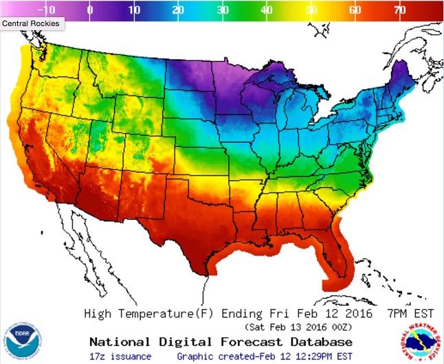
This Valentine's Day, some couples may have to cuddle up for warmth as the polar vortex moves south, bringing an icy blast and the coldest temperatures of the season to the northeastern United States this weekend, meteorologists say.
Temperatures are projected to be well below average — about 25 to 30 degrees Fahrenheit (14 to 17 degrees Celsius) lower than normal — over a good portion of the eastern United States, said Bob Oravec, a lead forecaster at the National Weather Service (NWS) in College Park, Maryland.
"Saturday and Sunday look very cold and very windy," Oravec told Live Science. "We'll have much-below-average temperatures, and with the wind chill, values are going to be well below zero for a good chunk of the eastern United States." [Photos: The 8 Coldest Places on Earth]
Winter weather, such as freezing rain and snow, is also predicted for Monday (Feb. 15) in that region, he said.
The polar vortex is the main reason for the frigid temperatures. Typically, the vortex spins around the Arctic, circling from west to east and trapping cold air in the high northern latitudes. However, if the spinning weakens, cold air can escape and head southward.
"It's farther south than normal," Oravec said. "It's helping to support the southward push of very cold air out of Canada and into the eastern United States over the weekend."
The freezing cold this weekend could break some winter weather records, he added.
Sign up for the Live Science daily newsletter now
Get the world’s most fascinating discoveries delivered straight to your inbox.
The areas downwind of the Great Lakes are expecting 6 to 10 inches (15 to 25 centimeters) of snow Friday and Saturday, and the Northern Plains and Midwest will likely experience temperatures 10 to 20 degrees F (6 to 11 degrees C) lower than usual, according to the NWS.
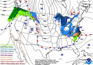
North Carolina is expected to get some light snow or freezing rain today (Feb. 12), according to the NWS. This weather pattern — a weak area of low pressure — may move up the coast and "clip coastal Maine with up to a foot of snow," NWS officials said.
Meanwhile, the West Coast will have relatively warm weather this weekend, although rain is predicted for the Northwest. "That's pretty typical, too — you often have the opposite effect on the one side of the country to the other," Oravec said.
His advice? Stay inside and avoid frostbite if you're in the Northeast.
"The takeaway is that it's going to be very cold," Oravec said. "As we come into the beginning of next week, we'll start to see a warming trend, even though it will probably be more midweek."
Follow Laura Geggel on Twitter @LauraGeggel. Follow Live Science @livescience, Facebook & Google+. Original article on Live Science.

Laura is the archaeology and Life's Little Mysteries editor at Live Science. She also reports on general science, including paleontology. Her work has appeared in The New York Times, Scholastic, Popular Science and Spectrum, a site on autism research. She has won multiple awards from the Society of Professional Journalists and the Washington Newspaper Publishers Association for her reporting at a weekly newspaper near Seattle. Laura holds a bachelor's degree in English literature and psychology from Washington University in St. Louis and a master's degree in science writing from NYU.
