Photos: Ruins of Mysterious Wall Found in Jordan
Archaeologists have mapped a nearly 100-mile-long wall that stood in what is now Jordan long ago. Ruins of the wall have left the scientists with more questions than answers, such as what was the purpose of the wall. Here's a look at what they found. [Read full story on Jordan's ancient wall]
Khatt Shebib
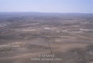
Using aerial photography, archaeologists in Jordan have mapped a ruined wall known today as the "Khatt Shebib." They found that the wall runs for up to 150 kilometers (93 miles). Who built it, when and why are all unknown. (Credit: APAAME_20051002_RHB-0068 © Robert Bewley, Aerial Photographic Archive for Archaeology in the Middle East)
Stone structure

The wall was built of stone. While it lies in ruins today, archaeologists believe that it was about a meter (3.3 feet) high and half a meter (1.6 feet) wide when it was originally built. (Credit: APAAME_20051002_RHB-0141 © Robert Bewley, Aerial Photographic Archive for Archaeology in the Middle East)
Farm line?
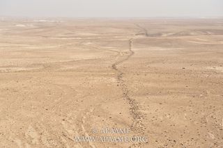
The wall's short height and width means that it probably didn't have a defensive purpose. One possibility is that it marked a boundary between ancient farmers and nomadic pastoralists. (Credit: APAAME_20101017_DLK-0129 © David L. Kennedy, Aerial Photographic Archive for Archaeology in the Middle East)
Sign up for the Live Science daily newsletter now
Get the world’s most fascinating discoveries delivered straight to your inbox.
On and on

The wall's awesome length is eloquently captured in aerial and on-the-ground photographs. The ruins of the wall seem to go on and on into the horizon… (Credit: APAAMEG_20040527_RHB-0010 © Robert Bewley, Aerial Photographic Archive for Archaeology in the Middle East)
Tower power
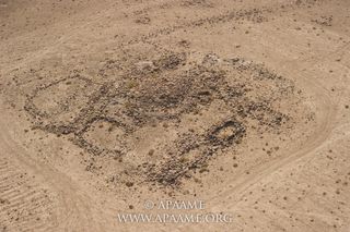
Archaeologists have found the remains of structures that they call "towers" along the Khatt Shebib. They vary between 2 meters (6.6 feet) and 4 meters (13.1 feet) in diameter. Some of them were constructed after the wall was built. Archaeologists believe that they had a variety of uses. Some could have been watch posts while others may have been places to use while hunting for animals. This photo shows one of the towers. (Credit: APAAMEG_20040527_RHB-0010 © Robert Bewley, Aerial Photographic Archive for Archaeology in the Middle East)
In parallel
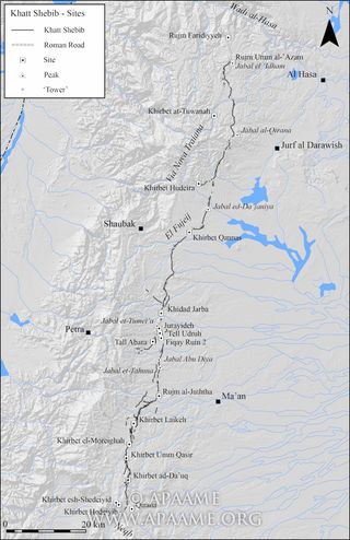
A map showing the full length of the Khatt Shebib. Several archaeological sites are located on or near the wall. At the southern end of the wall you can see sections where two walls run in parallel instead of one. (Drawing by R. Banks)
Mysteries remain
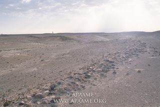
Ultimately more on-the-ground fieldwork will have to be done to solve the wall's mysteries. (Credit: APAAMEG_20040527_RHB-0012 © Robert Bewley, Aerial Photographic Archive for Archaeology in the Middle East)
Follow us @livescience, Facebook & Google+.

Owen Jarus is a regular contributor to Live Science who writes about archaeology and humans' past. He has also written for The Independent (UK), The Canadian Press (CP) and The Associated Press (AP), among others. Owen has a bachelor of arts degree from the University of Toronto and a journalism degree from Ryerson University.
