In Images: Maps of Alaska Help Track Climate Change
Colorful maps
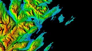
The Arctic digital elevation model (DEMs) images clearly depict elevation transitions smoothly from blue (low elevations) to green (medium to higher elevations) to red (peaks). This image centers of Kodiak Benny Benson State Airport, and highlights the vegetation, buildings, coastal features and the drainage network of the area. [Read full story about Alaska's elevation maps]
Coastal erosion
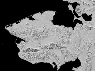
The city of Kotzebue is located in the Northwest Arctic Borough right above the Arctic Circle, and was visited by President Obama last year. At only about 10 feet above sea level, there is not a lot of elevation to map for Kotzebue and the Seward Peninsula. However, the DEMs will help monitor coastal erosion due to rising sea levels and climate change.
Shrinking glaciers
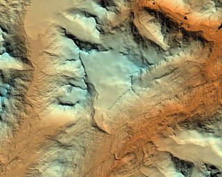
A valley glacier in the coastal mountains of south-central Alaska, Wolverine Glacier's terrain can now be seen in unprecedented detail. The shrinking of glaciers can now be seen more clearly due to the precise and frequent image collection of the project.
Wildest and most remote
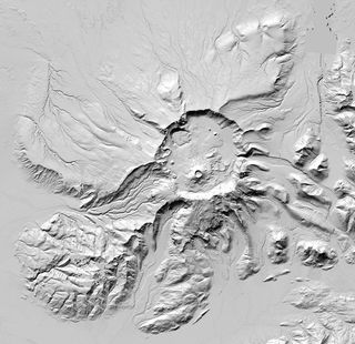
The Aniakchak National Monument and Preserve in the Aleutian Range of Alaska is one of the wildest and least visited places in the National Park System. This image of Mount Aniakchak, a volcanic caldera, along with the rest of the DEMs enables the public to view and explore such remote regions.
Arctic landscape in focus
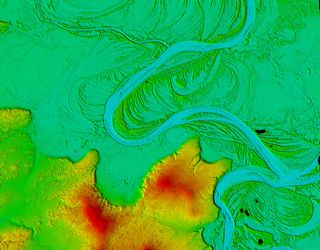
This DEM shows the boreal forest vegetation patterns that surround the winding Koyukuk River in western Alaska, a 425-mile-long tributary of the Yukon River. The DEMs help bring the unique Arctic landscape into focus.
Unprecedented detail
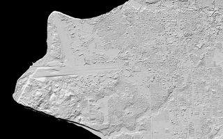
The higher resolution DEM allows for an incredible level of detail. For instance, this elevation map of Anchorage is so defined that planes can be seen parked at Ted Stevens Anchorage International Airport.
Sign up for the Live Science daily newsletter now
Get the world’s most fascinating discoveries delivered straight to your inbox.

