Puerto Rico's Massive Power Outage Seen from Space

A NASA satellite has captured dramatic photos of Puerto Rico before and after a massive blackout during which almost 1.5 million homes lost power late Wednesday (Sept. 21), according to NASA's Earth Observatory.
Puerto Rico plunged into darkness after a fire at the Aguirre power plant, a substation in the southern part of the island, triggered a cascade of problems across Puerto Rico's aging electrical grid.
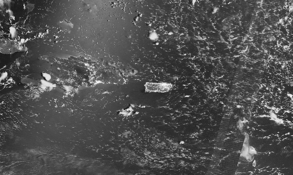
The power outage was so stark that NASA's satellites could "see" it from space. The Visible Infrared Imaging Radiometer Suite (VIIRS) aboard the Suomi NPP satellite took photos before and after the blackout. The first, taken at 2:50 a.m. local time (AST) on Sept. 21 show Puerto Rico bathed in light. [Earth from Above: 101 Stunning Images from Orbit]
The second, acquired the following day at 2:31 a.m. local time, depicts an island almost as dark as the sea surrounding it.
In fact, because the moonlight hits the waves of the ocean at different angles, varying degrees of moonlight are visible in the ocean parts of the photos, according to the Earth Observatory.VIIRS used its "day-night band" to capture both images. This band detects light in wavelengths ranging from green to near infrared, and relies on filtering techniques to indicate signals such as gas flares, city lights and reflected moonlight.
The electrical outage affected most of Puerto Rico, including Ponce, Humacao, Aguadilla, Arecibo and Mayagüez. But the capital and largest city, San Juan, still had some power, the photo shows.
The fire began after a switch overheated and caused a 2,000-gallon (about 8,000 liters) mineral oil tank to explode, NASA said in a statement. This explosion triggered a fire across a 3-acre (1 hectare) area, which led to massive losses of water and air conditioning, as well as traffic jams and business and school closures, NASA said.
Sign up for the Live Science daily newsletter now
Get the world’s most fascinating discoveries delivered straight to your inbox.
"With something of this scale, we're not just seeing an outage. We are seeing a complete stoppage in the rhythms of daily life," Miguel Román, a scientist at NASA Goddard Space Flight Center and a member of the Suomi NPP science team, said in the statement.
"These nighttime satellite images help bring a level of situational awareness so we can clearly identify the extent of the impacts into key lifelines of a city's infrastructure," added David Green, the program manager for NASA's Disaster Response Program. "We hope that power, civil and health authorities can use imagery and data like this to map the extent of affected areas and prioritize their personnel and resources to restore critical infrastructure."
As of Thursday night (Sept. 22), power had been restored to about 375,000 homesacross Puerto Rico, Gov. Alejandro García Padilla said at a news conference, according to New York's PIX 11 News.
Original article on Live Science.

Laura is the archaeology and Life's Little Mysteries editor at Live Science. She also reports on general science, including paleontology. Her work has appeared in The New York Times, Scholastic, Popular Science and Spectrum, a site on autism research. She has won multiple awards from the Society of Professional Journalists and the Washington Newspaper Publishers Association for her reporting at a weekly newspaper near Seattle. Laura holds a bachelor's degree in English literature and psychology from Washington University in St. Louis and a master's degree in science writing from NYU.


