Photos: Stunning Images of Earth from GOES-16 Weather Satellite
Blue Marble
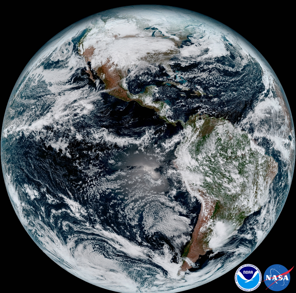
This composite color full-disk visible image was taken at 1:07 p.m. ET on Jan. 15, 2017. The image shows North America and South America and the surrounding oceans. GOES-16 observes Earth from an equatorial view, approximately 22,300 miles (35,900 kilometers) above Earth. [Read full story about the first publicly released images from GOES-16]
Storm system
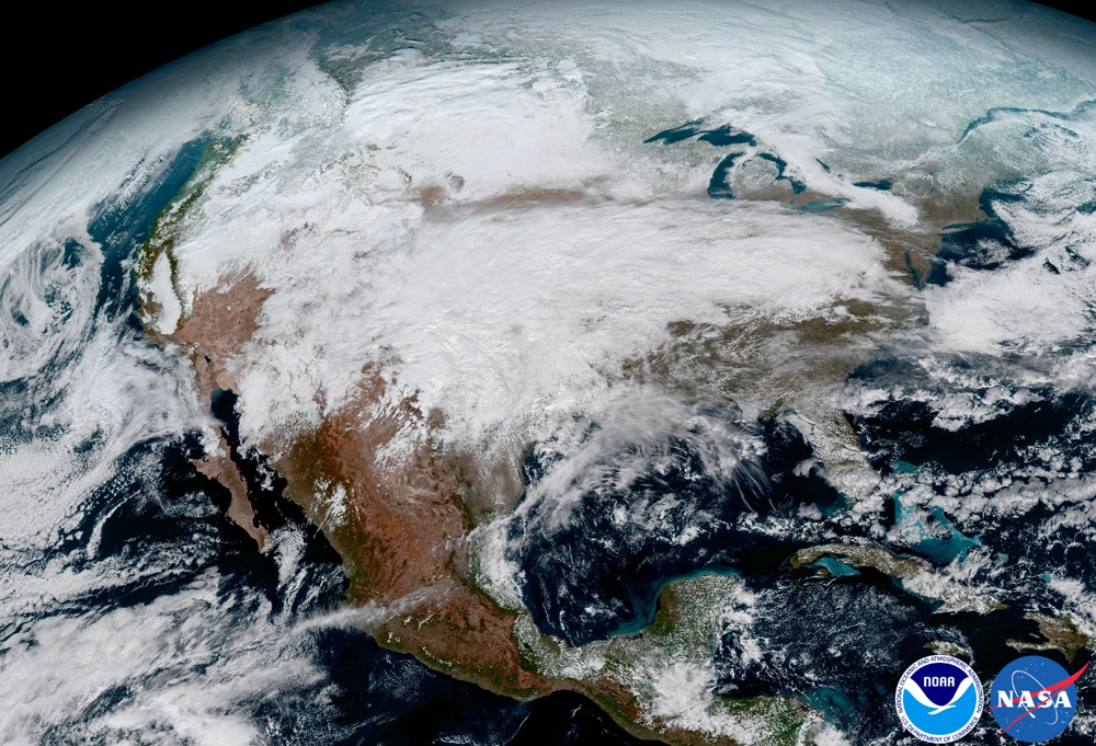
This image clearly shows a significant storm system that crossed North America, causing freezing and icy conditions across the United States on Jan. 15, 2017.
Multiple channels
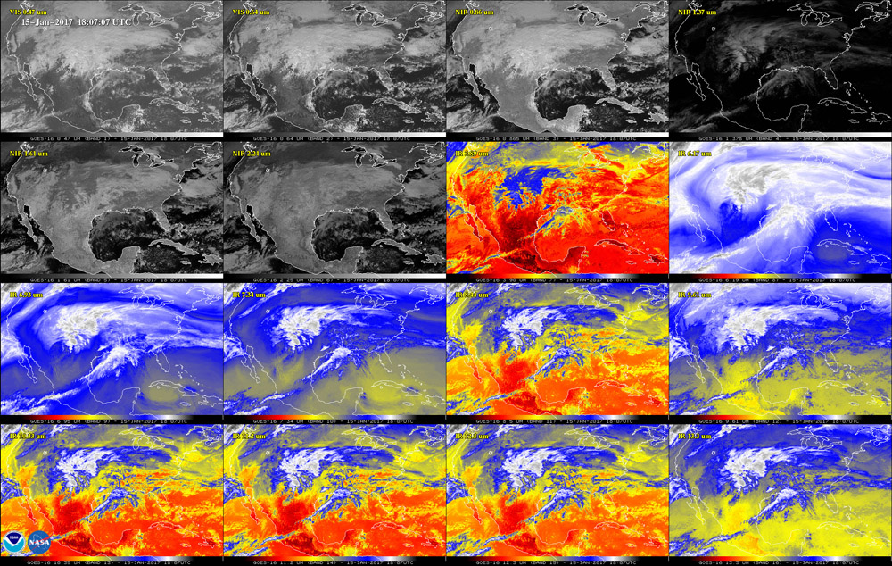
This 16-panel image shows the continental United States in the two visible, four near-infrared and 10 infrared channels on GOES-16's Advanced Baseline Imager instrument. These channels help forecasters distinguish between differences in the atmosphere like clouds, water vapor, smoke, ice and volcanic ash. GOES-16 has three times more spectral channels than earlier generations of GOES satellites, according to the National Oceanic and Atmospheric Administration (NOAA).
Dusty veil
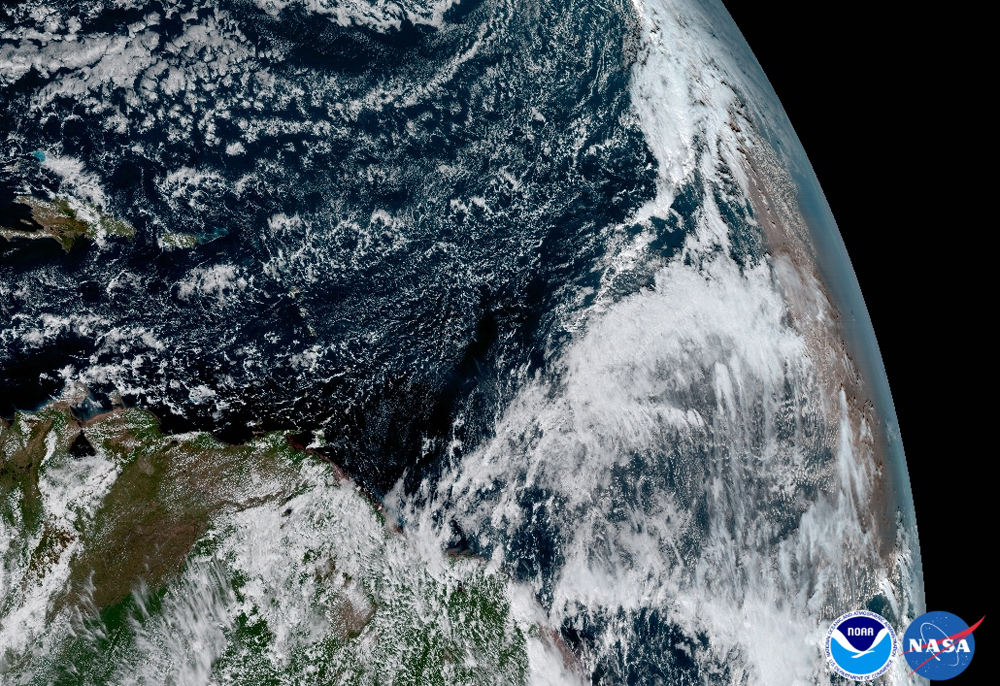
The Saharan Dust Layer can be discerned in the far right edge of this image of Earth. This dry air from the coast of Africa can have impacts on tropical cyclone intensity and formation. GOES-16's ability to observe this phenomenon with its 16 spectral channels will enable forecasters to study related hurricane intensification as storms approach North America, according to NOAA. These additional channels will also enable forecasters to differentiate between clouds from dust, or snow from clouds.
The Caribbean
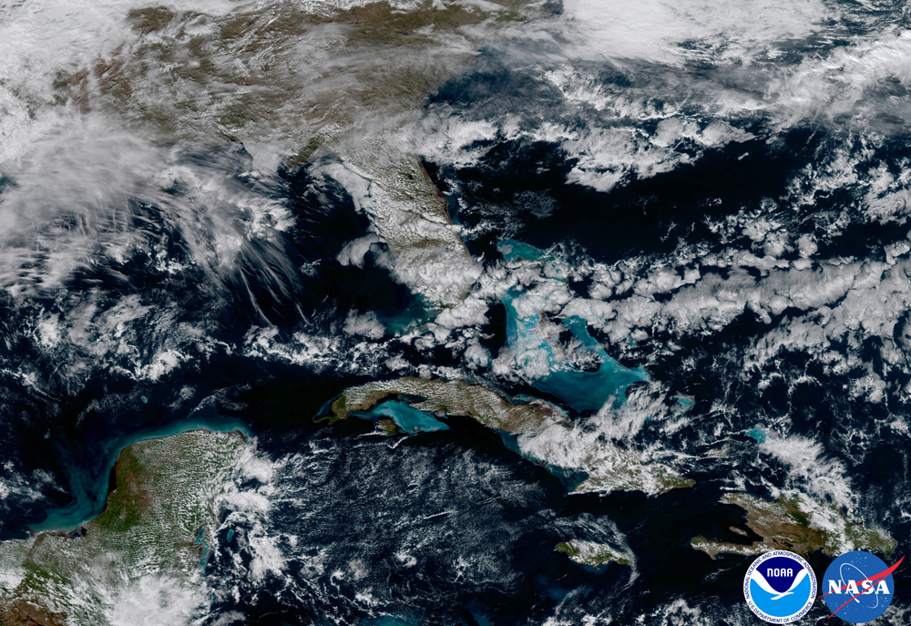
The satellite captured this image of the Caribbean and Florida. Here, the satellite captures the shallows waters of the Caribbean.
Argentina
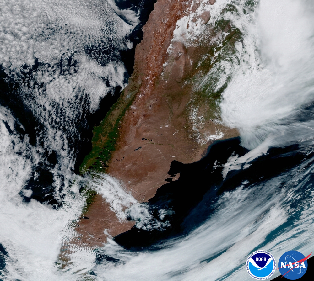
This view captures the entire Western Hemisphere, including Argentina in South America. Storms are evident in the northeast and mountain wave clouds can be seen in the southwest.
California
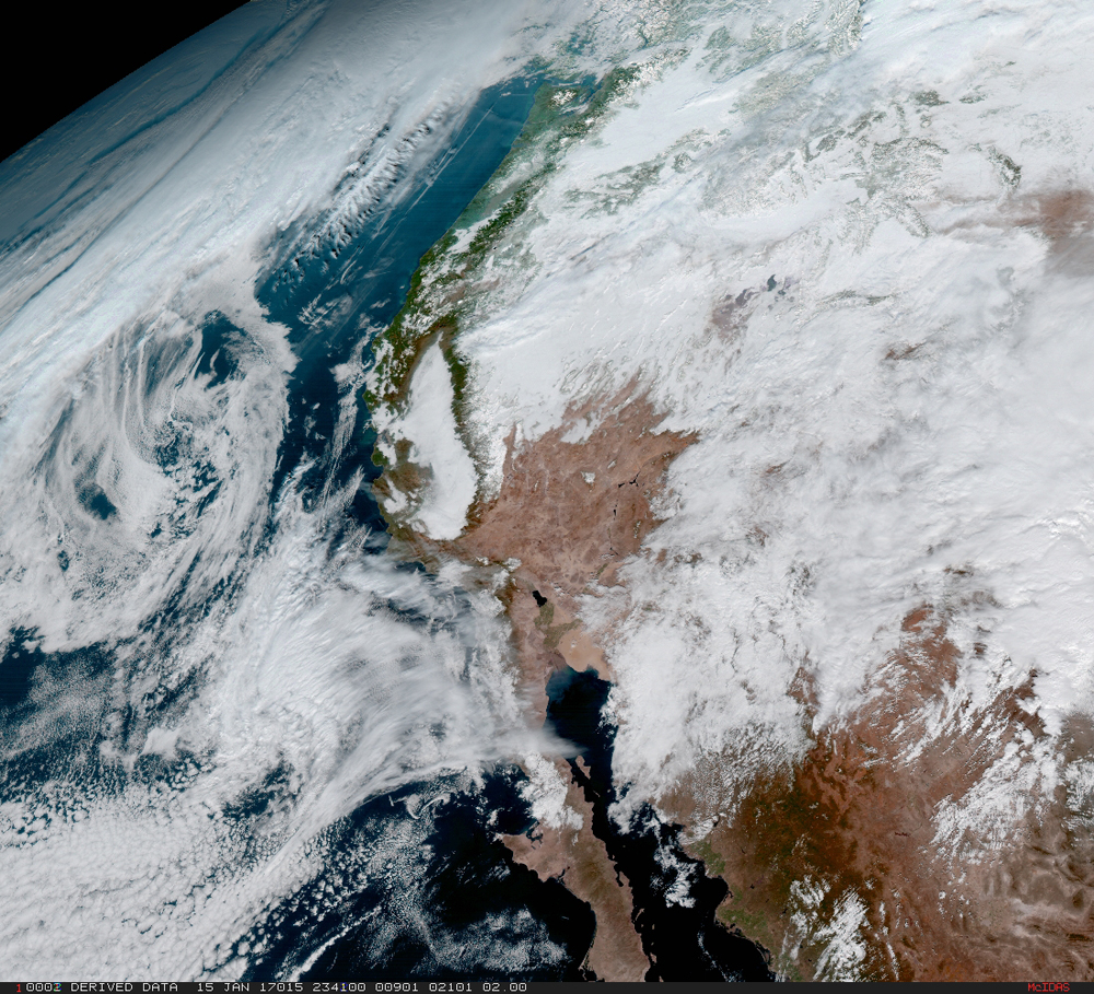
From its central location, GOES-16 captured this image of the west coast of the United States and the Baja Peninsula in Mexico.
Sign up for the Live Science daily newsletter now
Get the world’s most fascinating discoveries delivered straight to your inbox.
Northeast
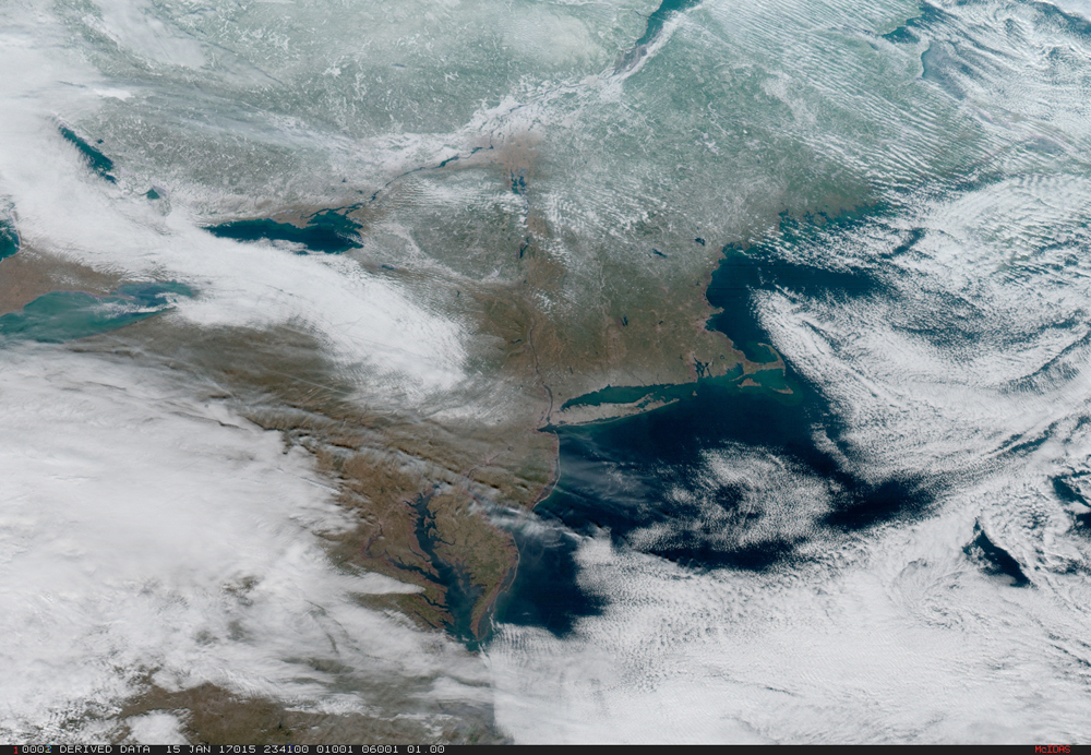
On Jan. 15, severe weather moved across the central United States before passing through the Northeast on Jan. 16th and 17th, where it resulted in wet and wintry weather for travelers across the region.
Yucatan peninsula
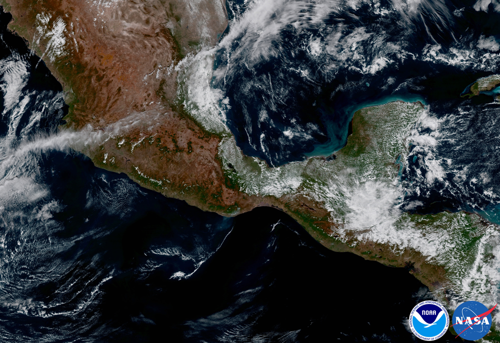
This area of Mexico and Central America is seen from GOES-16 with a largely cloud-free view. A fire and its associated smoke are evident over southern Mexico near the coast.
Moon views
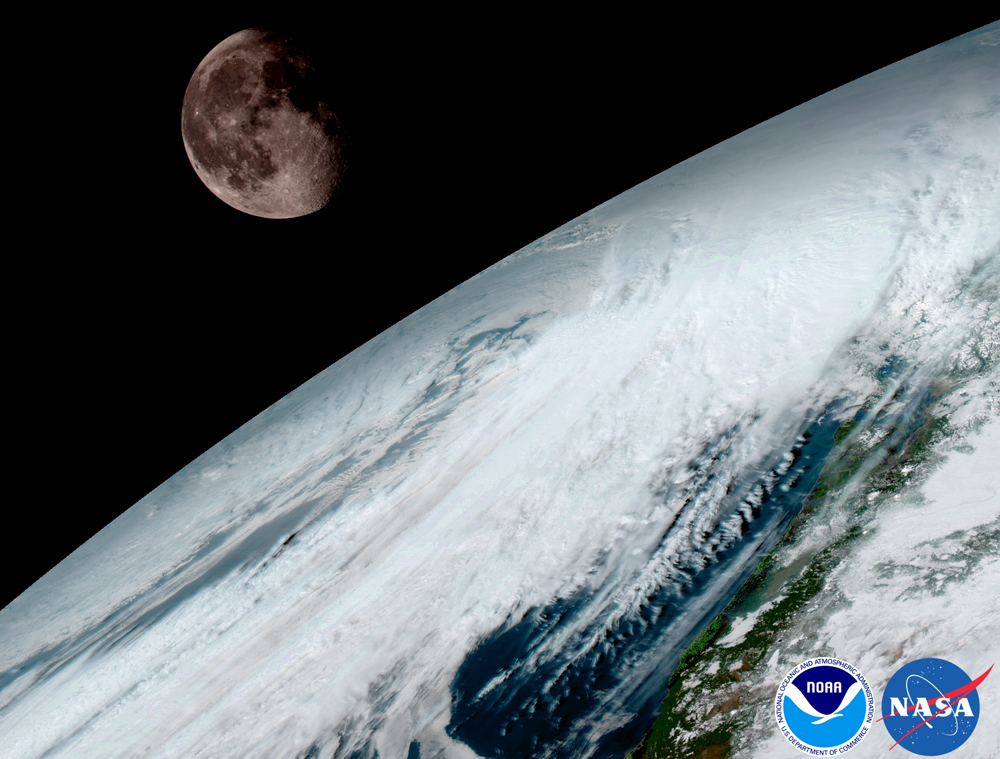
GOES-16 captured this view of the moon as it looked across the surface of the Earth on Jan. 15, 2017. Like earlier GOES satellites, GOES-16 will use the moon for calibration, according to NOAA.

