Cracks appear
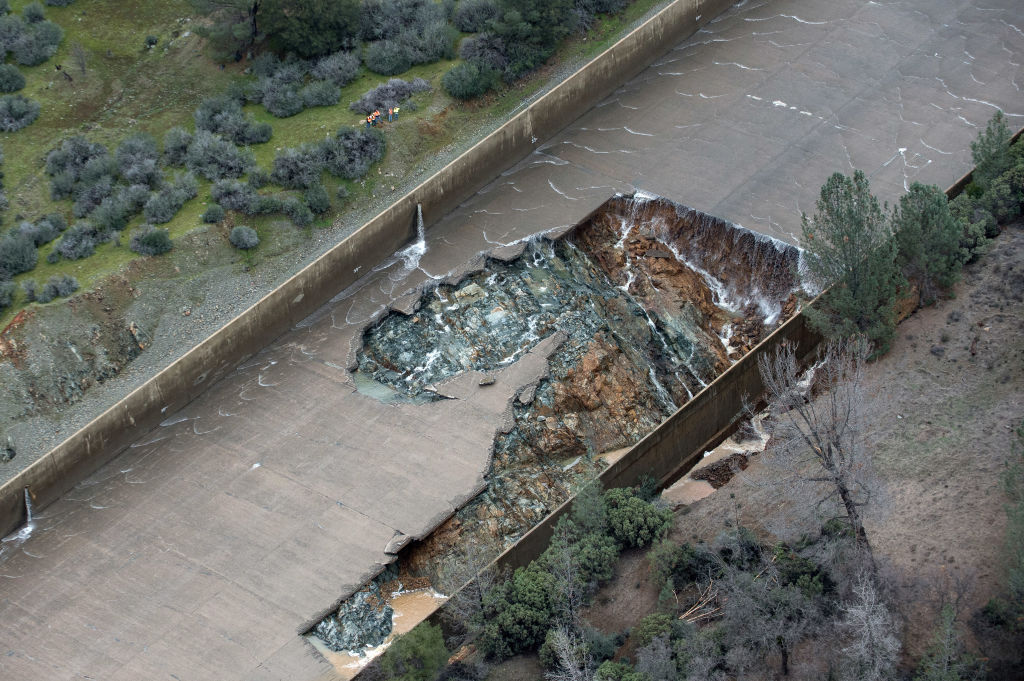
On Feb. 7, a small hole appeared in the Oroville spillway, which is meant to provide overflow relief for the Oroville Dam in Northern California.
First hole
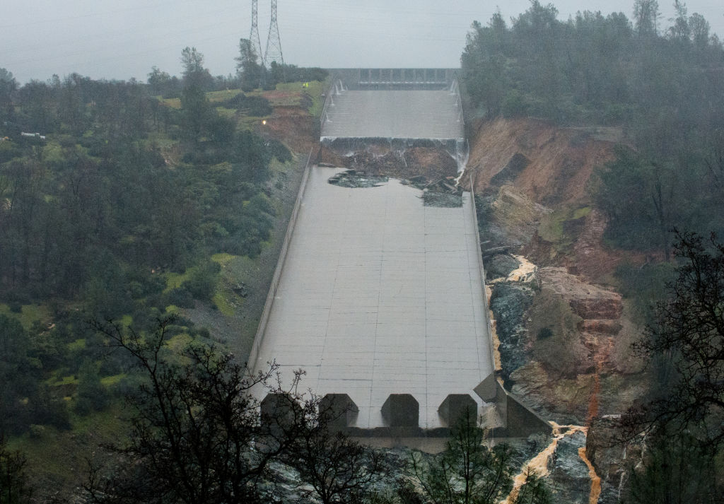
The hole, shown here on Feb. 7 triggered an evacuation of nearly 200,000 people. Ultimately, however, with more rains coming, water-department officials decided they needed to use the damaged spillway to continue lowering the water levels in Lake Oroville, so that water didn't overtop the dam and cause truly catastrophic devastation.
Rushing waters
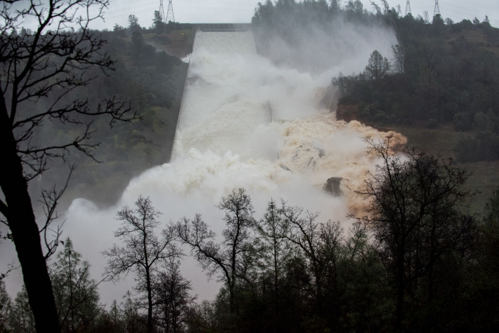
On Feb. 9, the Lake Oroville spillway flows late Thursday afternoon as 35,000 cubic feet per second (cfs) of water was released over the damaged spillway February 9, 2017 in Oroville, California.
No choices
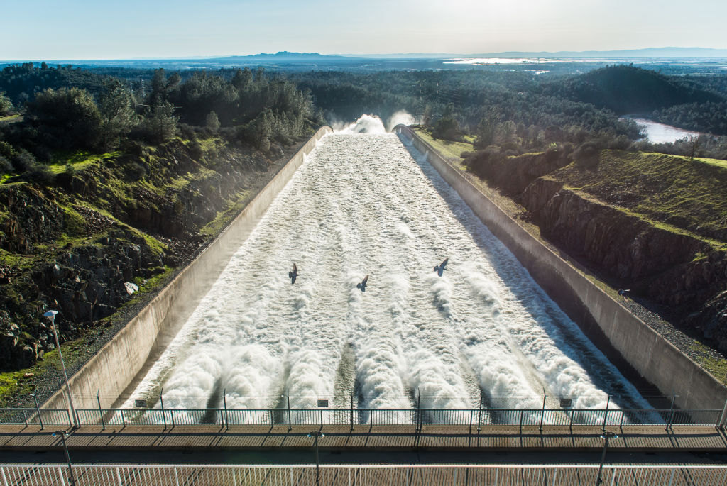
Water flows down the Oroville Dam main spillway at 55,000 cubic feet per second (cfs) February 11, 2017 in Oroville, California.
Huge erosion
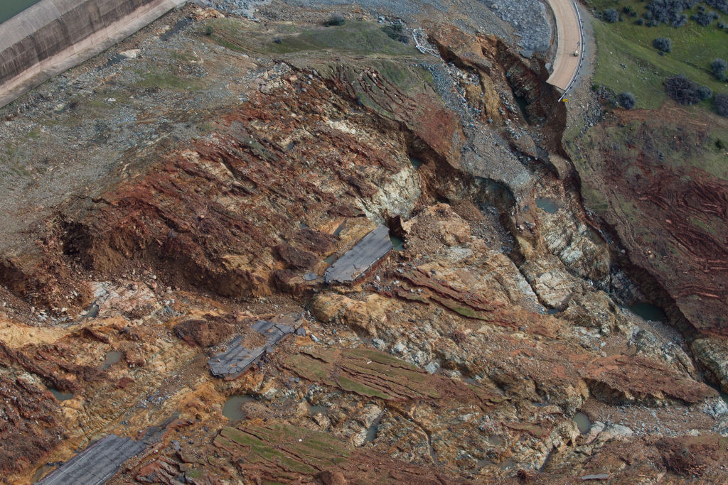
The scale of the damage and erosion at the Oroville Spillway can already be seen on Feb. 13.
Scale of erosion
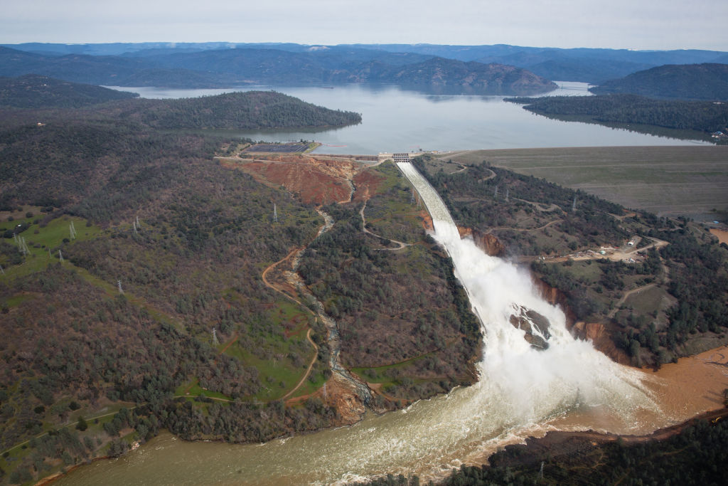
On Feb. 13, water flowed down the Oroville Spillway. The huge area covered by the water's outlet gives a hint of the scale of erosion below.
Pounding waterfall
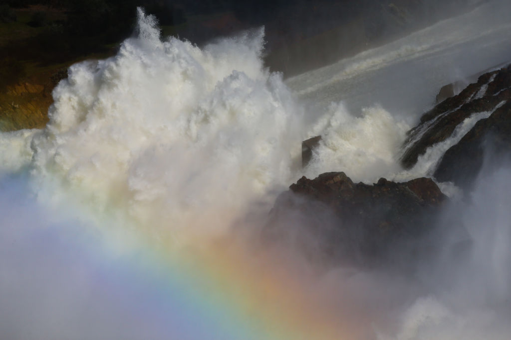
On Feb. 14, sprays from the pounding waterfall cascading over the Oroville Spillway created a rainbow. The pounding whitewater was causing extensive damage to the spillway and mountainside beneath it.
Sign up for the Live Science daily newsletter now
Get the world’s most fascinating discoveries delivered straight to your inbox.
Extensive damage
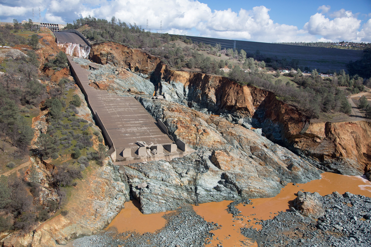
An aerial view of the damaged Oroville Dam spillway site with a huge debris field in the diversion pool area just below the spillway on February 27, 2017 in Oroville, California.
Swept away
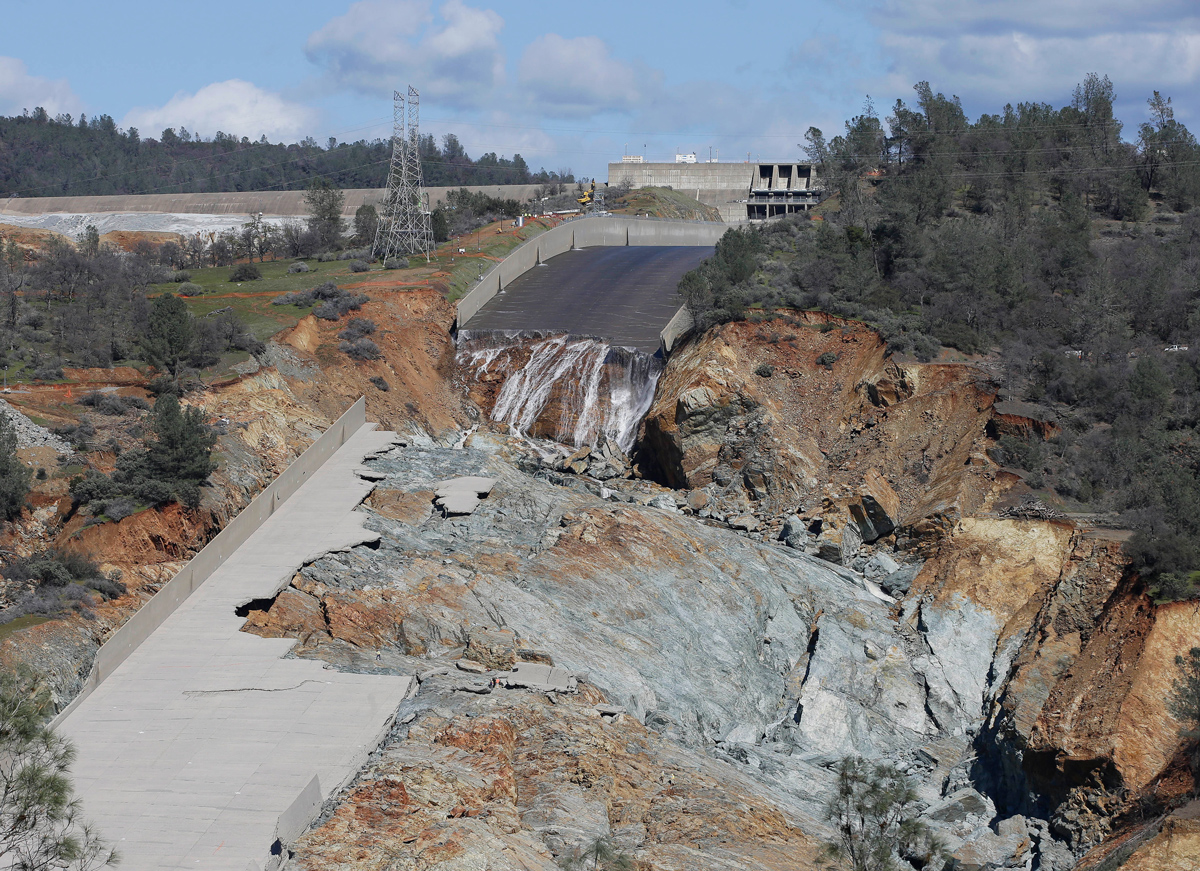
A small flow of water goes down Oroville Dam's crippled spillway Tuesday, Feb. 28, 2017, in Oroville, California.
Dramatic difference
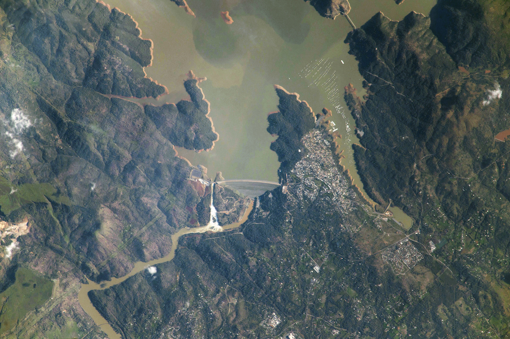
The erosion in the Oroville Spillway can be seen from space on Feb. 22 in this image taken by a member of the Expedition 50 crew on the International Space Station. The outlet flow appears markedly wider halfway down the spillway.
oroville-massive-erosion
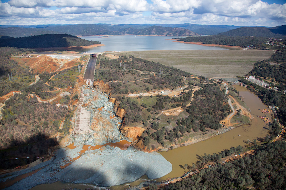
The massive amount of erosion can be seen from above in the diversion pool just below the spillway in this photo taken Feb. 27.

Tia is the managing editor and was previously a senior writer for Live Science. Her work has appeared in Scientific American, Wired.com and other outlets. She holds a master's degree in bioengineering from the University of Washington, a graduate certificate in science writing from UC Santa Cruz and a bachelor's degree in mechanical engineering from the University of Texas at Austin. Tia was part of a team at the Milwaukee Journal Sentinel that published the Empty Cradles series on preterm births, which won multiple awards, including the 2012 Casey Medal for Meritorious Journalism.
