The Beautiful Aftermath of Tropical Storm Ida

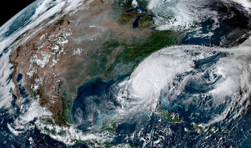
One of the dramatic and often unseen effects of tropical storms and hurricanes is the muck they churn up from the ocean floor as they come ashore.
These clouds of sediment in the Gulf of Mexico were spotted Nov. 10, after Tropical Storm Ida made landfall and then moved on.
The image was made from data collected by NASA’s Aqua satellite.
The tan-green sediment-colored water transitions to clearer dark blue water near the edge of the continental shelf where the water becomes deeper. The ocean turbulence that brought the sediment to the surface is seen in the textured waves and eddies within the tan and green waters.
In addition to Ida's effects, a second source of sediment is visible along the shore, NASA explained in a statement. Many rivers, including the Mississippi River, drain into the Gulf of Mexico in this region. The river plumes are dark brown that fade to tan and green as the sediment dissipates.
October 2009 was the wettest October in the 115-year weather record for the south-central United States, which includes the area shown in this image, according to the National Climate Data Center. Rivers throughout the region ran high, likely carrying more sediment than usual into the Gulf.
The rivers also carry nutrients like iron from soil and nitrogen from fertilizers. These nutrients fuel the growth of phytoplankton, tiny, plant-like organisms that grow in the ocean surface waters. Phytoplankton blooms color the ocean blue and green and may be contributing to the color seen here.
Sign up for the Live Science daily newsletter now
Get the world’s most fascinating discoveries delivered straight to your inbox.
- Gallery: Art Meets Science in Amazing Images
- The Science of Hurricanes
- Gallery: Hurricanes From Above


