North Korea: A Hermit Country from Above (Photos)
A divided peninsula
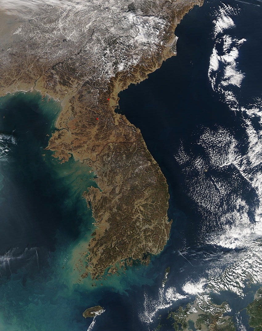
In this image taken by the MODIS instrument on NASA's Aqua satellite, the Korean peninsula's differences disappear. This view of both North and South Korea shows two small fires burning in the North (red dots).
China and North Korea
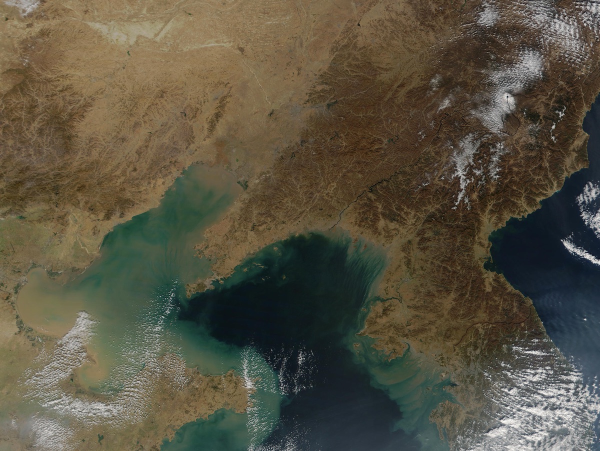
Phytoplankton blooms turn the water psychedelic in this November 2001 image captured by the MODIS instrument on NASA's Terra satellite. The Bohai Sea is seen at the far left, with its three bays: Liaodong, Bohai and Laizhoid (from top, counterclockwise). The Korea Sea, part of the Yellow Sea, is visible as the darker region butting up against the Chinese and North Korean coastlines. According to NASA's Visible Earth, the murky sediments seen in the Bohai Sea are full of nutrients feeding the vivid blue plankton blooms.
Peering into Pyongyang
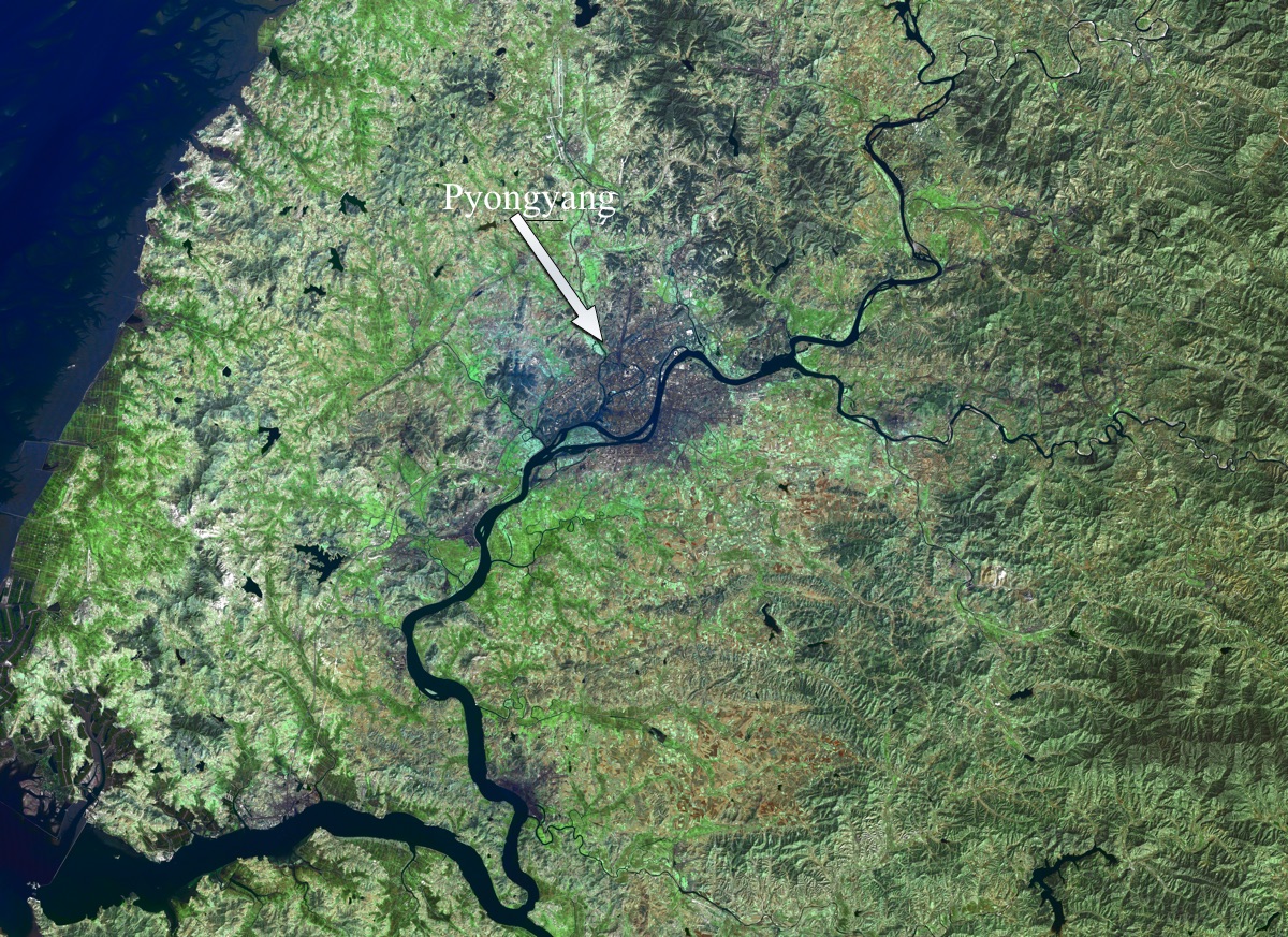
Pyongyang is North Korea's capital city and the home of most of the country's elites. It sits along the banks of the Taedong River and is home to approximately 3.2 million people, according to North Korea's 2008 census. A 2014 GoPro camera tour of the city — approved by the country's government — shows broad boulevards and Soviet-style architecture. Foreign reporters and visitors are rarely allowed outside of Pyongyang.
Snow over North Korea
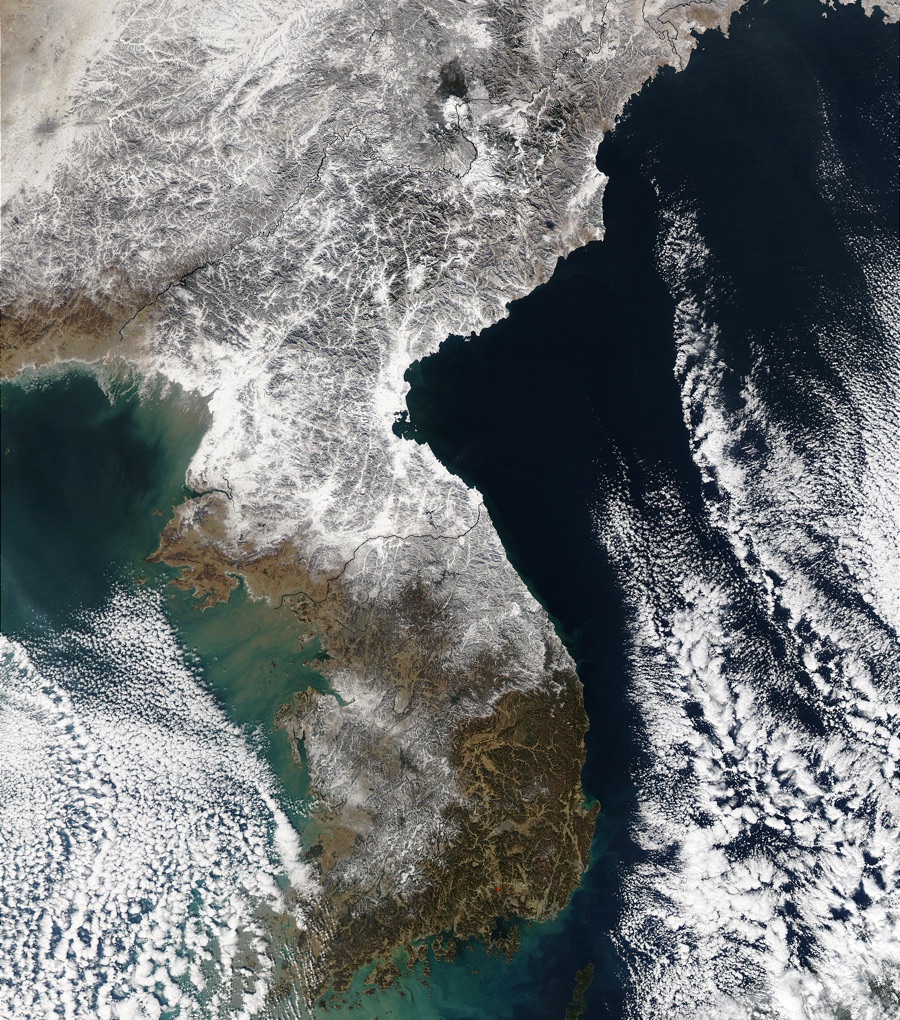
A blanket of white snow covers North Korea, dipping across the Demilitarized Zone into South Korea. This image from December 2002 was taken by MODIS aboard NASA's Aqua satellite. North Korea's winters are long, as the CIA World Factbook puts it, "bitter." According to Weather-and-Climate.com, average temperatures in January hover around 26 degrees Fahrenheit (minus 3 degrees Celsius), and there are 37 snowfall days on average in the winter months.
Dust plume
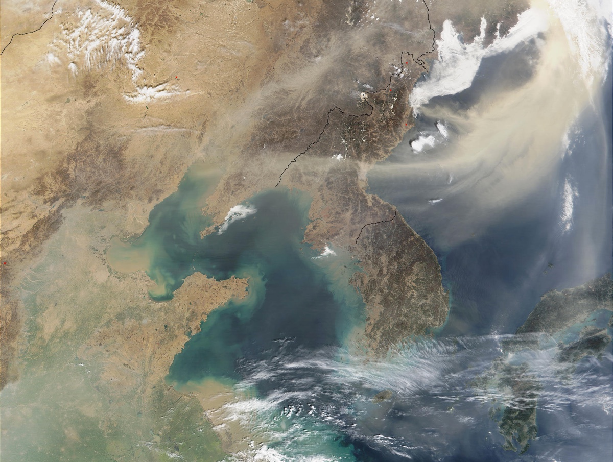
A tail of dust swirls over North Korea in this image taken by the MODIS instrument aboard NASA's Terra Satellite in April 2002. The dust was blowing from East Asia toward the Sea of Japan.
Typhoon Rusa
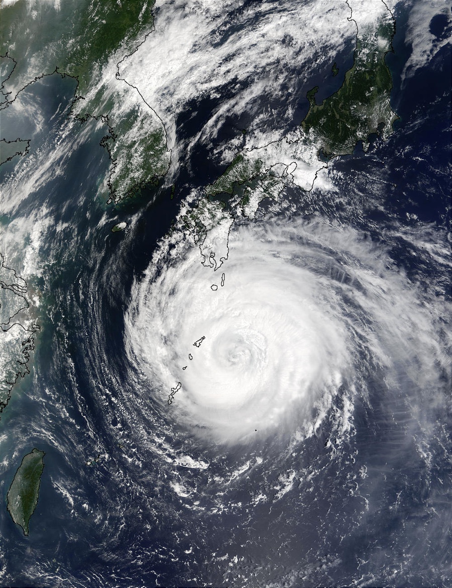
Typhoon Rusa, one of the strongest to hit the Korean Peninsula in recorded history, made landfall at Goheung in South Korea in August 2002. Its expanse, however, affected the entire peninsula, as this image made with data from the MODIS instruments aboard NASA's Terra and Aqua satellites show. More than 200 people in South Korea died and thousands were left homeless in North Korea, according to the United Nations Office for the Coordination of Humanitarian Efforts.
Dense fog
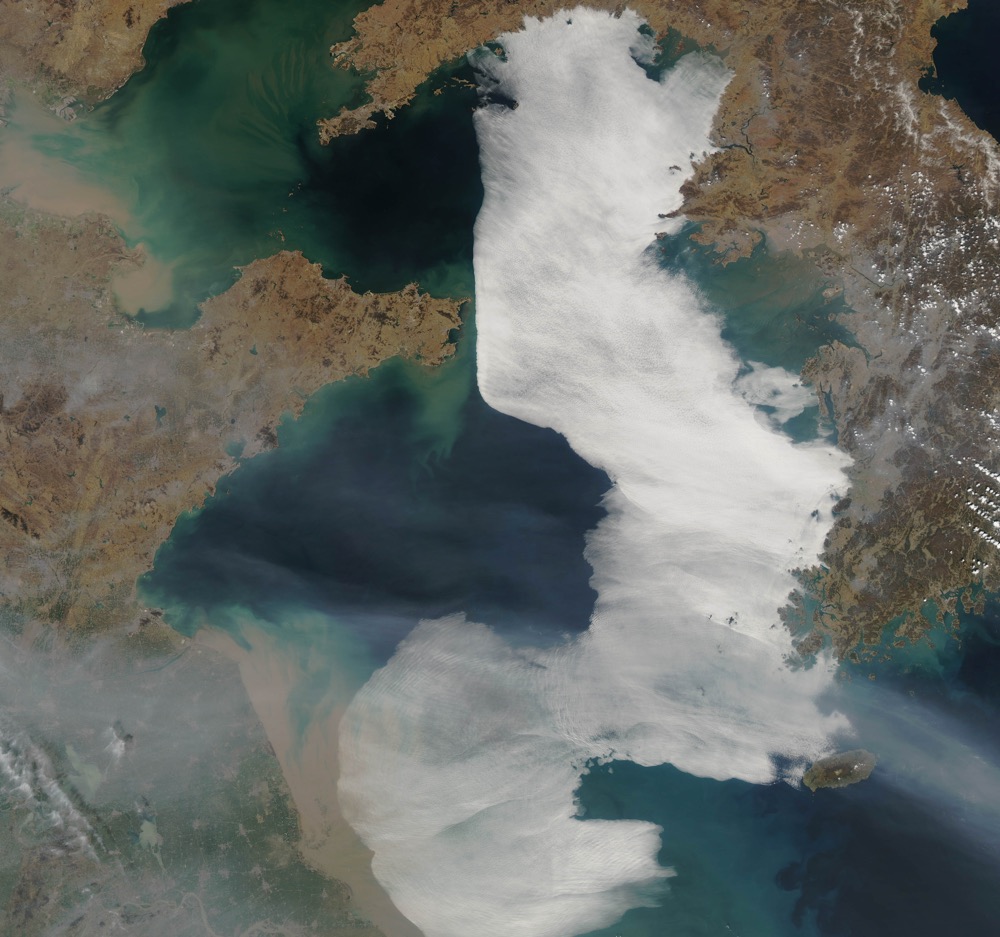
A dense blanket of fog curls against the North Korean coast and across the Yellow Sea in a satellite image captured on March 28, 2012. Foggy days are common over the Yellow Sea, according to NASA's Visible Earth. In this case, NASA scientists found that the fog was likely the result of northeasterly winds pushing moist air over the cool sea surface, causing the moisture to condense. Pyongyang is faintly visible as a grey spot in the upper lefthand corner of the image.
Get the world’s most fascinating discoveries delivered straight to your inbox.
A colorful region
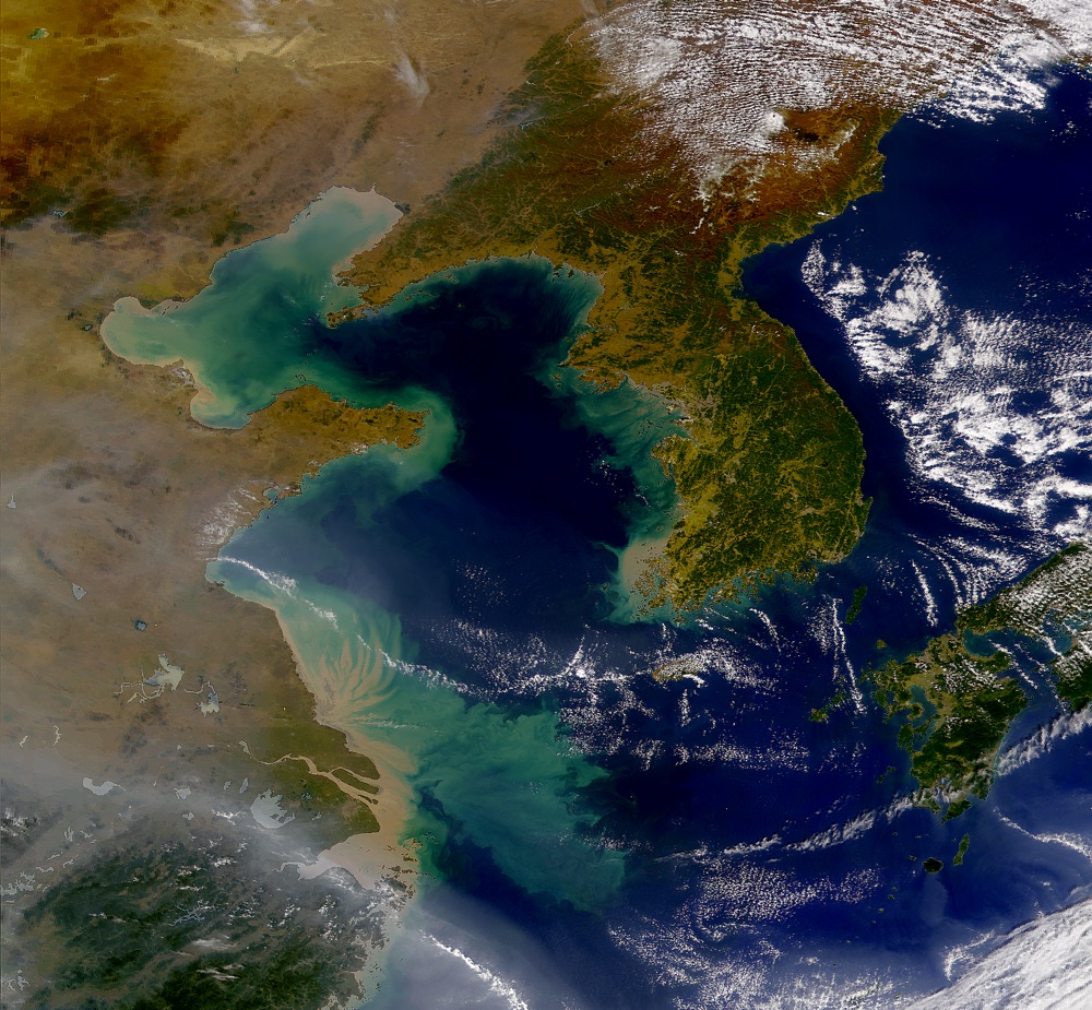
This zoomed-out view of North Korea, South Korea and the eastern portion of China shows the interaction of sea and land in the region. To the lower left, China's Yangtze river pushes a plume of sediment into the East China Sea. This image was taken by the Sea-Viewing Wide Field-of-View Sensor (SeaWiFS) aboard GeoEye's OrbView-2 satellite, which collected data between 1997 and 2010. This shot was taken soon after the satellite's launch in 1997.
Chilly weather
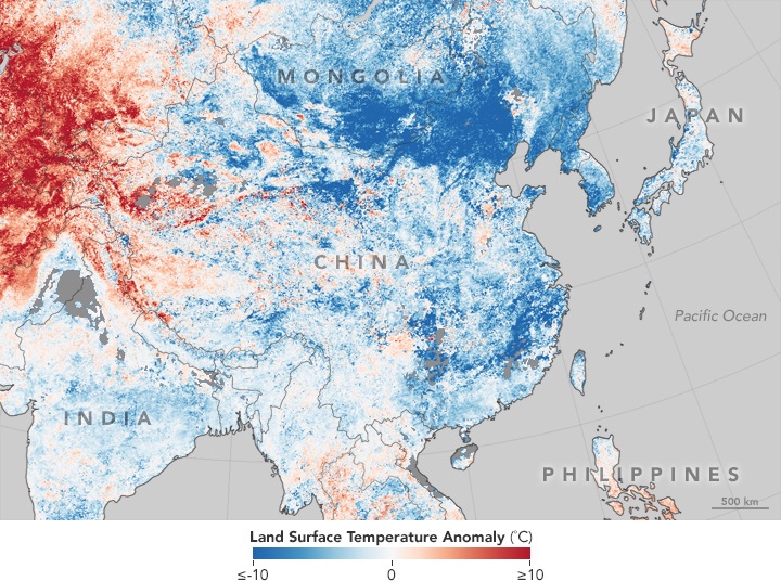
Record cold temperatures hit Asia as a "polar vortex" dipped southward in January 2016 and were captured by the MODIS instrument on NASA's Terra satellite. This map, made from land surface temperature data collected by that instrument, shows temperatures between Jan. 17 and 24, 2016, compared with averages for that period between 2001 and 2010. The darker the blue, the farther below average the temperature in the 2016 cold snap.

Stephanie Pappas is a contributing writer for Live Science, covering topics ranging from geoscience to archaeology to the human brain and behavior. She was previously a senior writer for Live Science but is now a freelancer based in Denver, Colorado, and regularly contributes to Scientific American and The Monitor, the monthly magazine of the American Psychological Association. Stephanie received a bachelor's degree in psychology from the University of South Carolina and a graduate certificate in science communication from the University of California, Santa Cruz.


