Photos: Artistic Views of Earth from Above

A Study in Color
earth as art

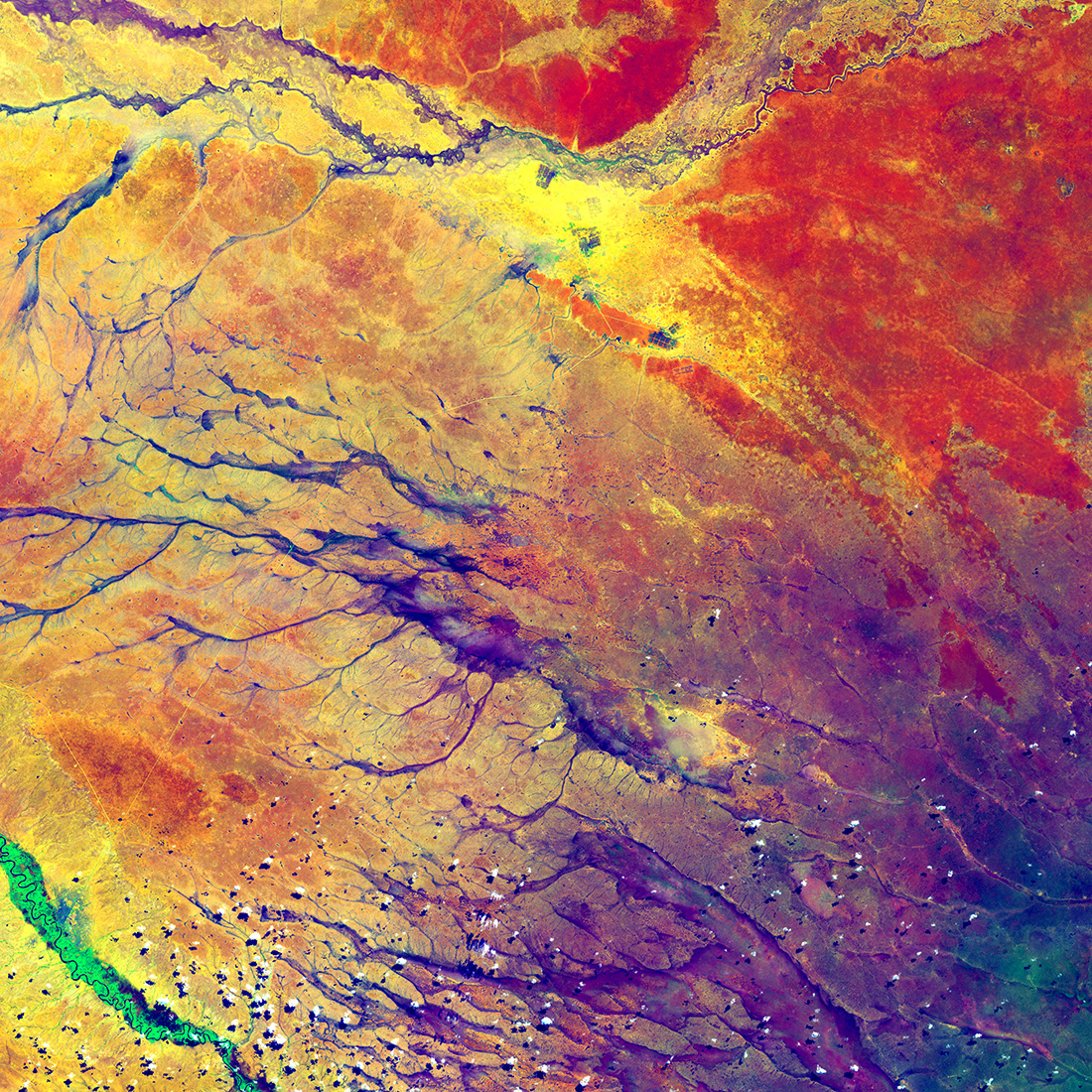
The Deep purple in the lower right spreads out into a few channel before fading into a miltitude of colors. These channels are remnant of an ancient drainage network in Kenya. The beauty of the colors actually hides a start reality for hundreds of thousands of people. the dark spots at the top center of the image are refugee camps. (Image credit: U.S. Geological Survey)

In this image, acquired on July 15, 2014 by the Landsat 8 satellite, the deep purple in the lower right spreads out into a few channels before fading into a multitude of colors. These channels are remnants of an ancient drainage network in Kenya. The beauty of the colors actually hides a stark reality for hundreds of thousands of people: The dark spots at the top center of the image are refugee camps.

Earth Selfie
earth as art

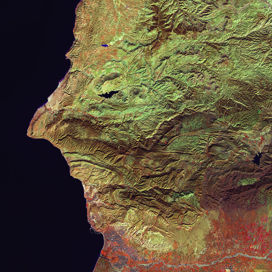
The tendency to recognize human faces in things that are not human is common. Can you see the eye, nose, and mouth in this satellite image of Morocco? The face captured in this 'Earth Selfie' appears to be quietly watching over the waters just off its coast. The city of Agadir is underneath the chin, and the irrigated farms of the Souss Valley appear in red. (Image credit: U.S. Geological Survey)

Can you see the eye, hooked nose and mouth in this satellite image of Morocco? Seeing faces (or other images) in random things is called pareidolia. This Earth selfie was captured on Jan. 26, 2015 by Landsat 8. The face is looking over the waters just off Morocco's coast, with the city of Agadir underneath the chin. The irrigated farms of the Souss Valley are colored red.

Eerie Cloud Shadows
earth as art

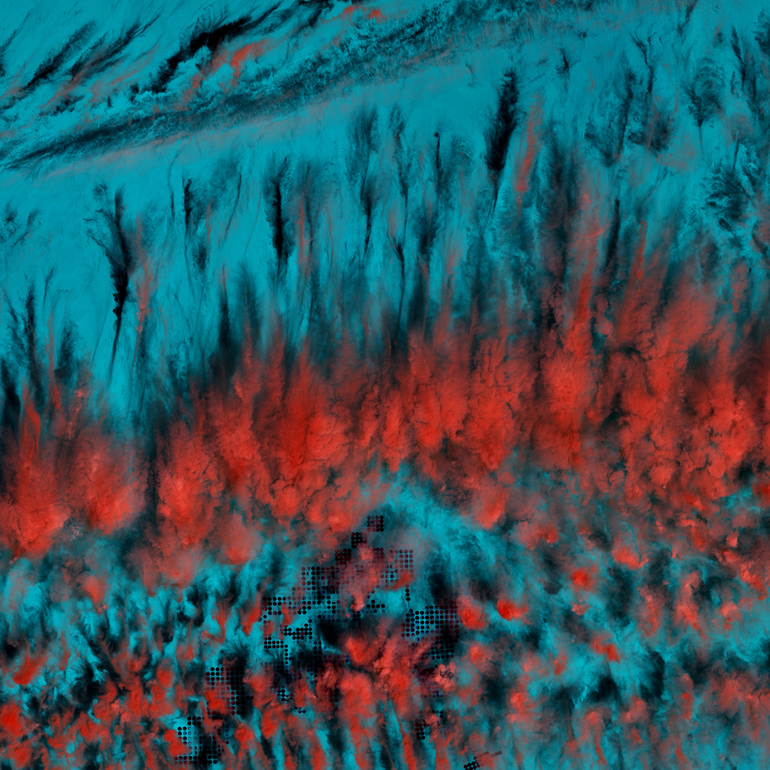
These cloud patterns cast eerie shadows on the landscape of southern Egypt. The clouds appear red and the desert below hazy blue in this infrared rendition. (Image credit: U.S. Geological Survey)

These cloud patterns cast eerie shadows on the landscape of southern Egypt in the Landsat-8 satellite image captured on March 22, 2014. In this infrared image, the clouds appear red and the desert a hazy blue.

Geometric Desert
earth as art

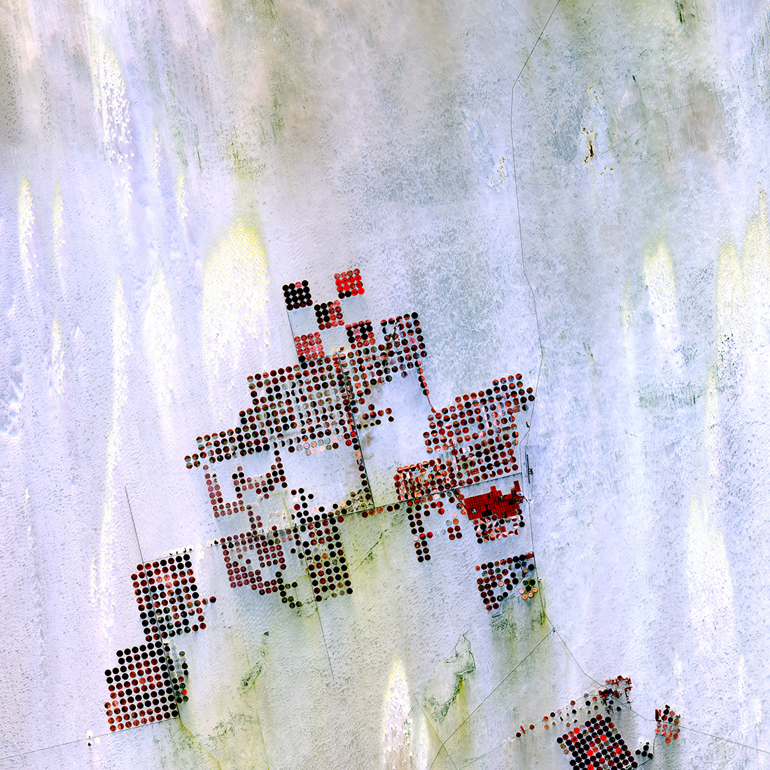
Geometric shapes lie across the emptiness of the Sahara Desert in southern Egypt. Each point is a center pivot irrigation field a little less than 1 kilometer (0.6 mile) across. With no surface water in this region, wells pump underground water to rotating sprinklers from the huge Nubian Sandstone aquifer, which lies underneath the desert. (Image credit: U.S. Geological Survey)

Irrigation becomes art in this Landsat-8 satellite image of the Sahara Desert in southern Egypt, shown on May 22, 2013. There is no surface water in this region; instead, wells pump underground water from the Nubian Sandstone aquifer to rotating sprinklers on the surface. Each point represents a center pivot irrigation field just under 0.6 miles (1 kilometer) across, according to the U.S. Geological Survey.

Land of Terror
earth as art

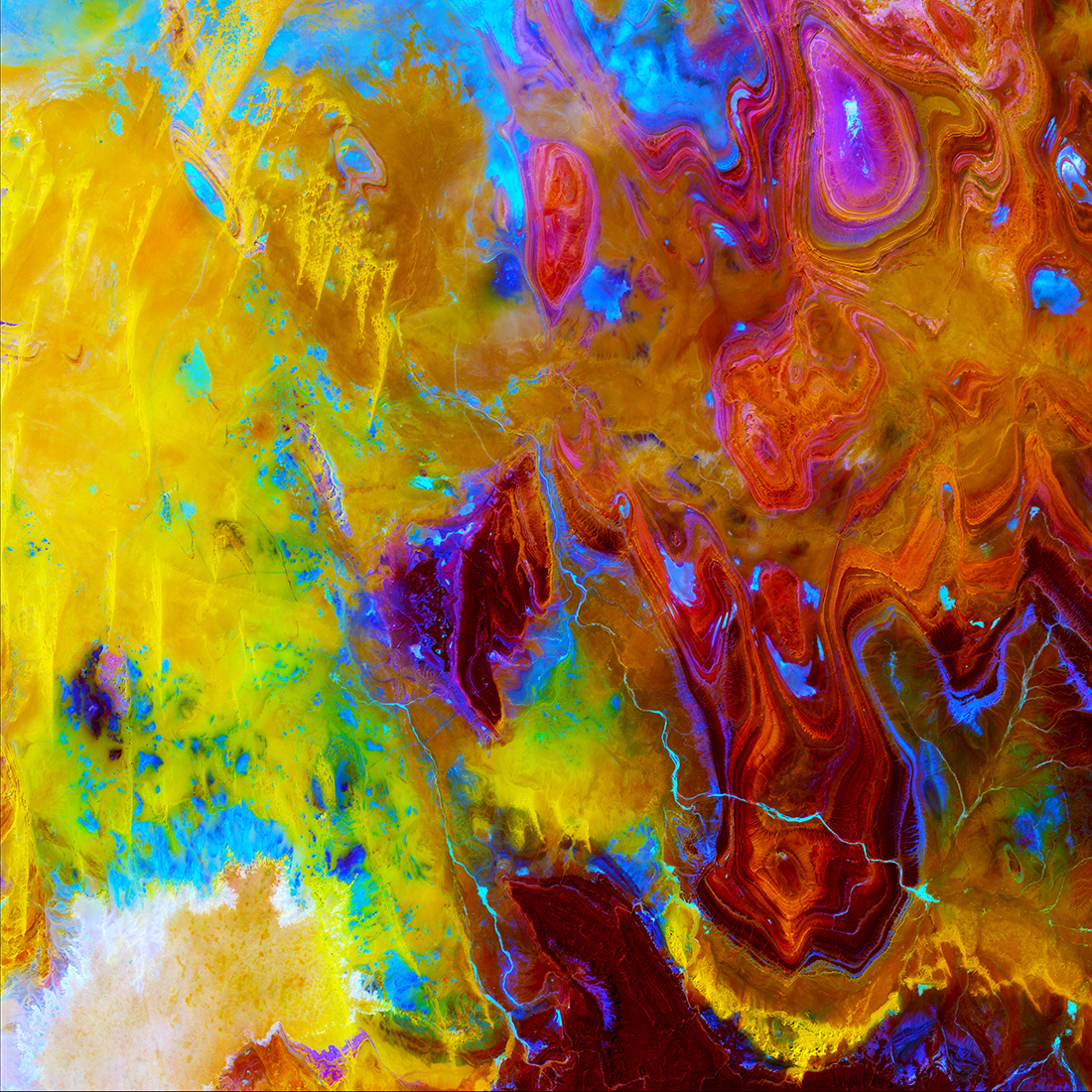
No water. No vegetation. No oases. Known as the 'Land of Terror,' the Tanezrouft Basin in Algeria is one of the most desolate parts of the Sahara Desert. Sand dunes, which appear in yellow, streak down the left side of the image, and sandstone formations carved by relentless wind erosion make concentric loops, much like the grain seen in a piece of wood. (Image credit: U.S. Geological Survey)

Known as the Land of Terror, the Tanezrouft Basin in Algeria is one of the most desolate parts of the Sahara Desert, according to the USGS. The yellow streaks down the left side of the image are sand dunes, while the concentric loops are sandstone formations carved into the ground by the hand of erosion. This image was captured on Oct. 14, 2014 by the Landsat-8 satellite.

Lava Field
earth as art

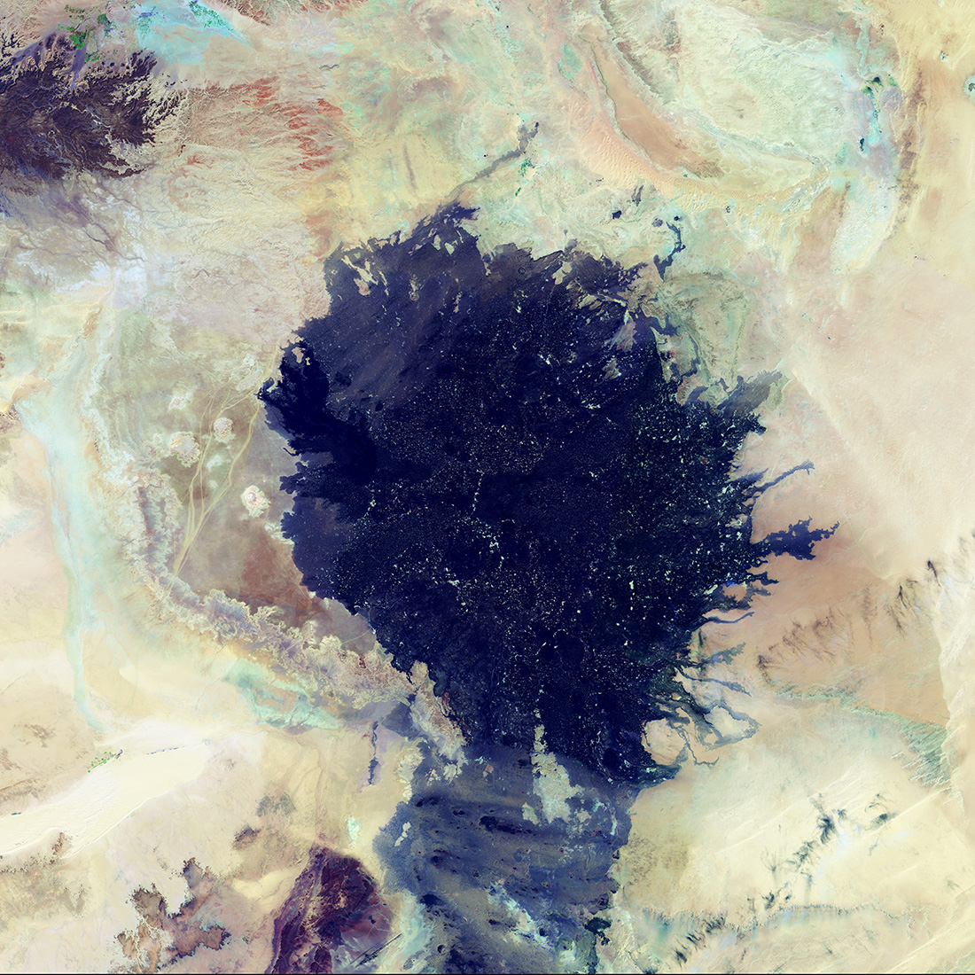
The Haruj Volcanic Field in central Libya was created from basaltic lava flows that erupted over time from multiple volcanoes. The volcanic craters and lava flows are evidence of a previous active eruption period. Many of the bright spots within the darker colored basalt flows are depressions covered with silt and fine sand. The lava field measures about 185 kilometers (115 miles) across. (Image credit: U.S. Geological Survey)

Several volcanic eruptions that spewed out basaltic lava created the Haruj Volcanic Field in central Libya, seen here in a mosaic of 2015 images from Landsat 8. The lava field is about 115 miles (185 kilometers) across, according to the USGS. "Many of the bright spots within the darker colored basalt flows are depressions covered with silt and fine sand," the USGS said.

Life along the Nile
earth as art

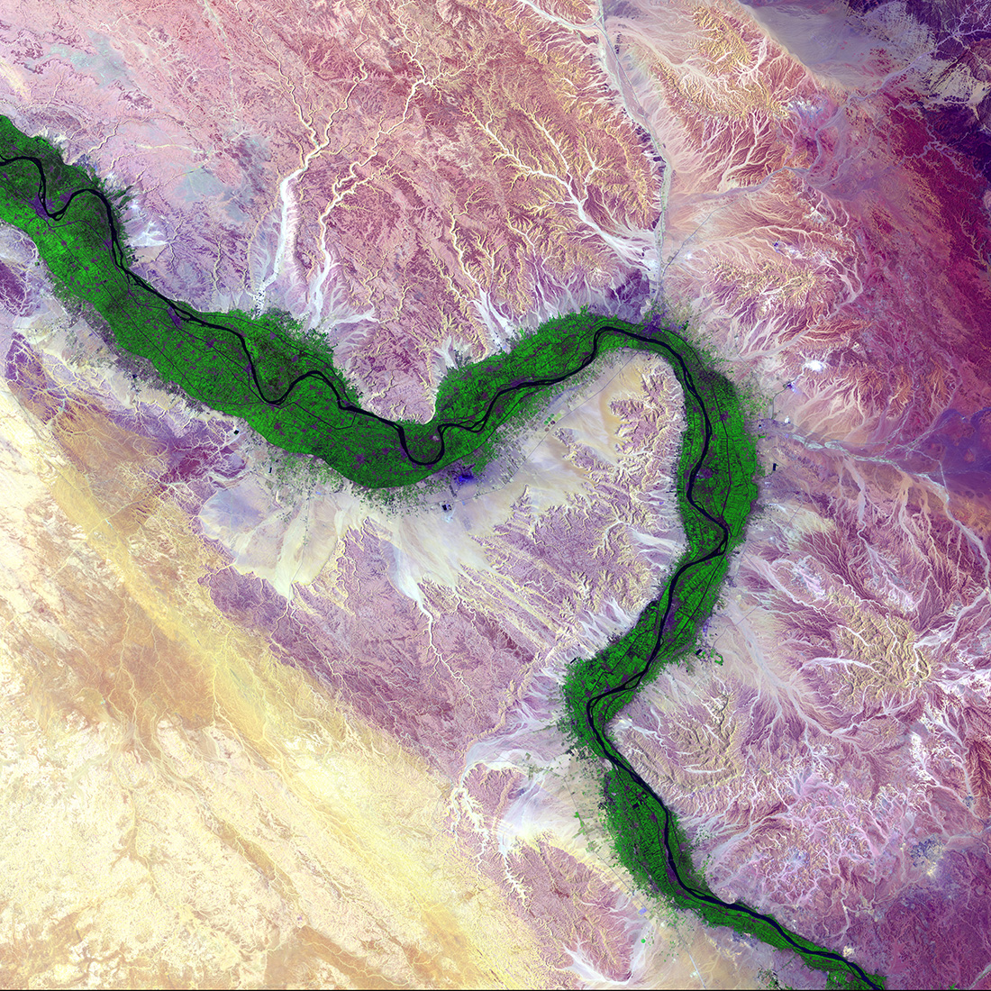
It is easy to see from this image why people have been drawn to the Nile River in Egypt for thousands of years. Green farmland marks a distinct boundary between the Nile floodplain and the surrounding harsh desert. (Image credit: U.S. Geological Survey)

In this image, captured by Landsat 8 on Aug. 15, 2014, green farmland forms a distinct boundary between the Nile River floodplain and the surrounding desert.

Mulanje Massif
earth as art

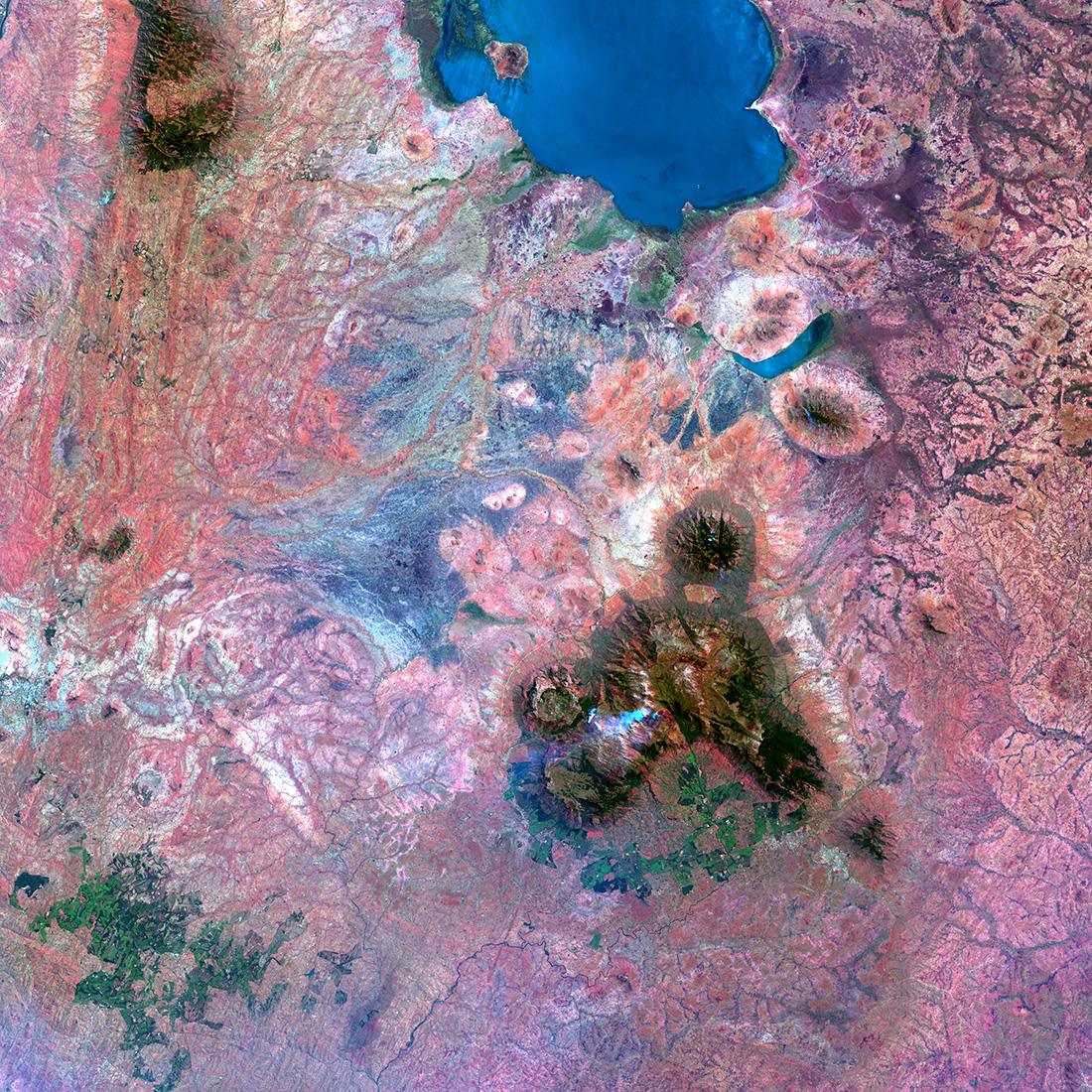
In southern Malawi, the erosion-resistant rock of Mulanje Massif, a large mountain mass, rises dramatically above the landscape near Lake Chilwa, a shallow, saline lake. The upper slopes of the massif are protected forest. The deep green color south of the massif is tea and macadamia farms. (Image credit: U.S. Geological Survey)

"In southern Malawi, the erosion-resistant rock of Mulanje Massif, a large mountain mass, rises dramatically above the landscape near Lake Chilwa, a shallow, saline lake. The upper slopes of the massif are protected forest. The deep green color south of the massif is tea and macadamia farms," the USGS said. This image was captured on Oct. 10, 2014 from Landsat 8.

The Lorian Swamp
earth as art

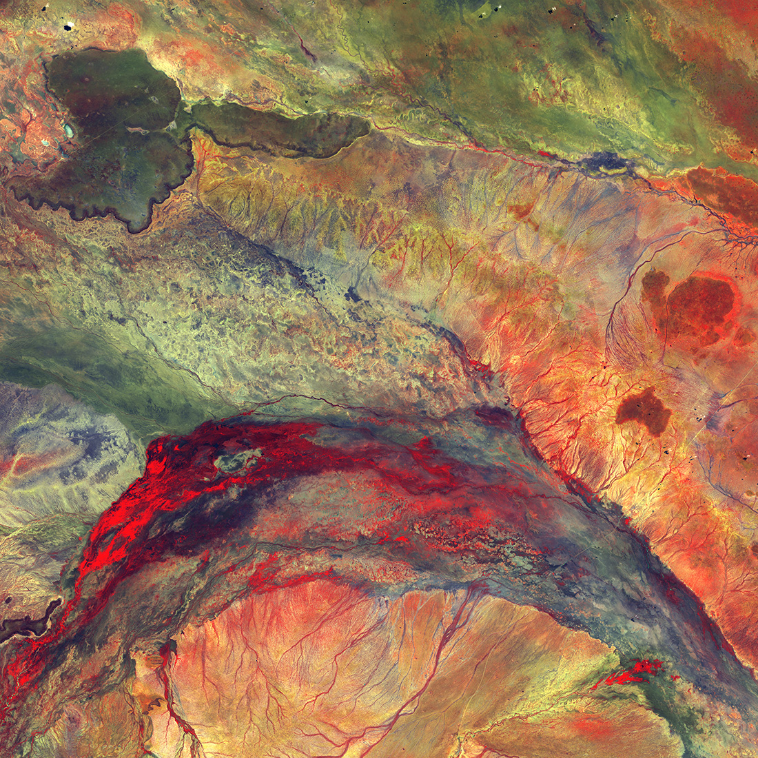
Water flowing out of this inland delta rarely reaches the ocean; instead, it seeps into the semiarid plains of northeastern Kenya. The dark feature in the upper left, which looks like a black eye, is hard basaltic rock from an ancient lava flow. (Image credit: U.S. Geological Survey)

Water flowing out of this inland delta seeps into the semiarid plains of northeastern Kenya. The dark feature in the upper left of this image, from May 3, 2014, is basaltic rock from an ancient lava flow.

Koettlitz Glacier
earth as art

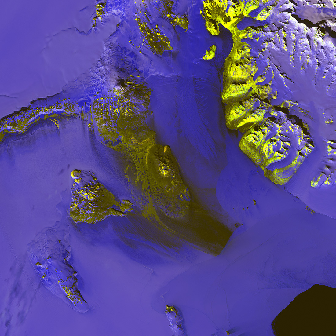
Landsat 8 helps reveal the hidden complexities of the Antarctic landscape. In this image, ice takes on different levels of blue with exposed rock and dirt appearing in yellow tones. The dynamic Koettlitz Glacier flows between Brown Peninsula and the rugged mainland. (Image credit: U.S. Geological Survey)

In this Landsat-8 satellite image, taken on Nov. 18, 2013, the ice of Antarctica takes on different shades of blue with exposed rock and dirt appearing in yellow tones. The Koettlitz Glacier flows between Brown Peninsula and the rugged mainland.

Slessor Glacier
earth as art

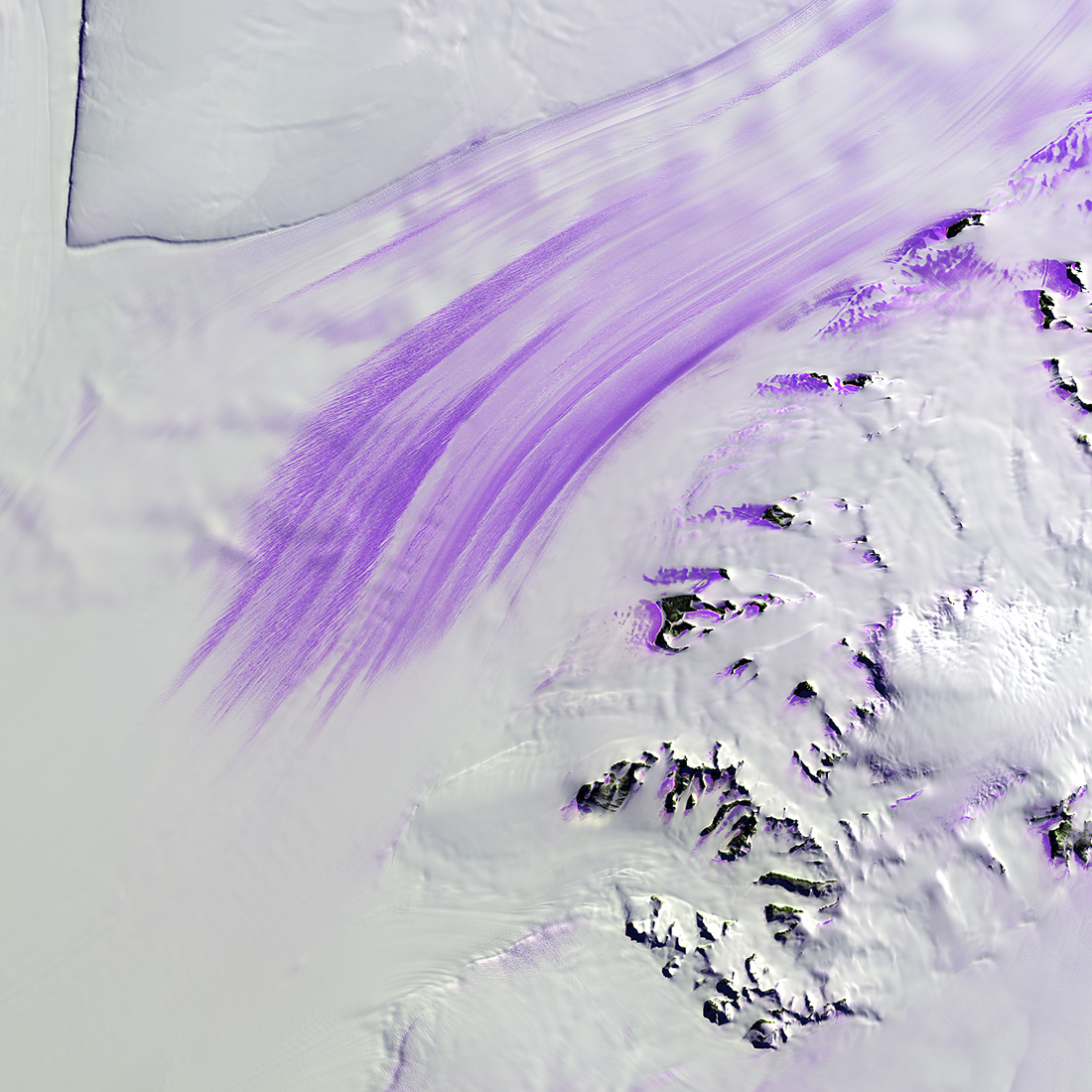
Slessor Glacier in Antarctica flows between the angular promontory Parry Point on the top left of the image and the Shackleton Range on the lower right. The purple highlights are exposed ice. Strong winds blow away the snow cover and expose lines that indicate the glacier flow direction. Rock outcrops next to the glacier also exhibit some of this bare ice. (Image credit: U.S. Geological Survey)

Slessor Glacier in Antarctica, shown here on Nov. 14, 2014, flows between Parry Point on the top left and the Shackleton Range on the lower right. "Strong winds blow away the snow cover and expose lines that indicate the glacier flow direction. Rock outcrops next to the glacier also exhibit some of this bare ice," the USGS said.

TOPICS
Live Science Staff
For the science geek in everyone, Live Science offers a fascinating window into the natural and technological world, delivering comprehensive and compelling news and analysis on everything from dinosaur discoveries, archaeological finds and amazing animals to health, innovation and wearable technology. We aim to empower and inspire our readers with the tools needed to understand the world and appreciate its everyday awe.