Photos: Artistic Views of Earth from Above

Nature's Patterns
earth as art

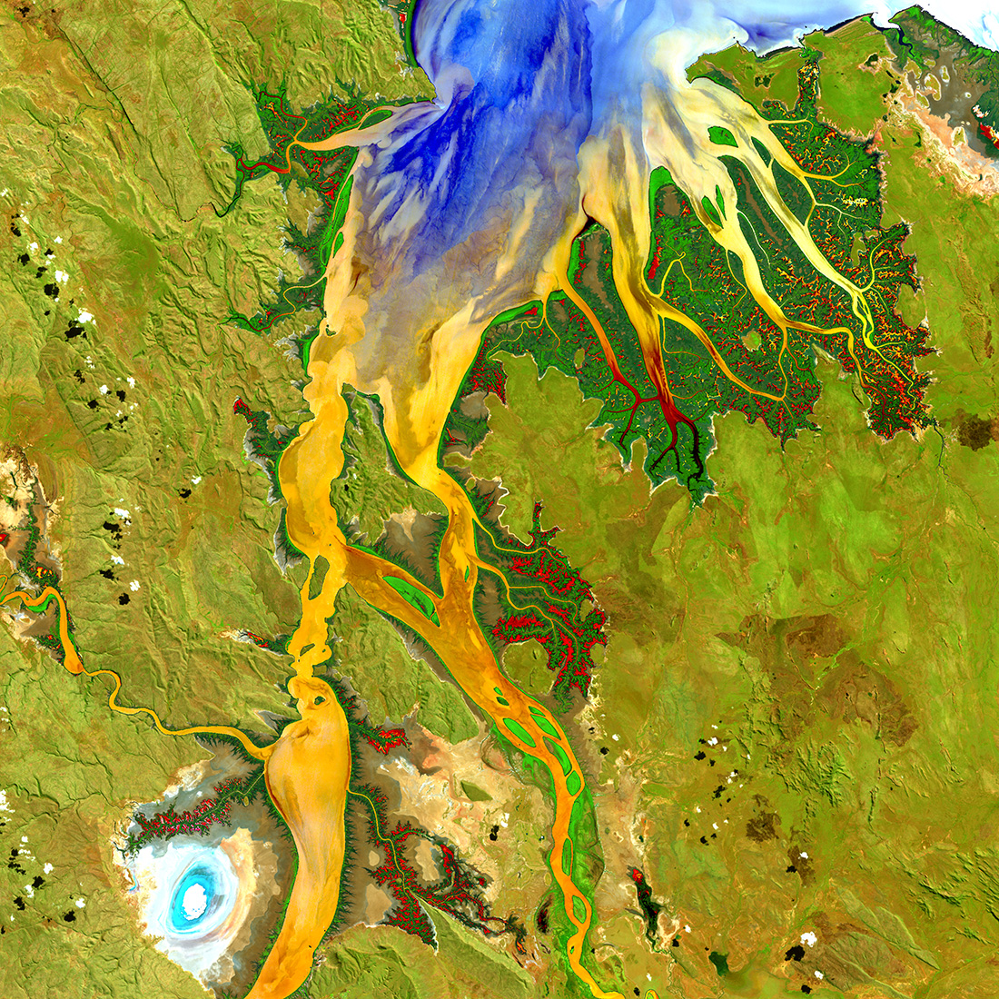
The biologically complex conditions of mangroves are shown in dark green along the fingers of the Ord River in Australia. Yellow, orange, and blue represent the impressive flow patterns of sediment and nutrients in this tropical estuary. The bright spot at the lower left is an area of mudflats, which is home to saltwater crocodiles. (Image credit: U.S. Geological Survey)

Mangroves stand out as dark-green shading along the fingers of the Ord River in Australia in this satellite image. Captured on May 12, 2013, the image shows flowing sediment and nutrients in this tropical estuary, and even an area of mudflats (bright spot at the lower left) inhabited by saltwater crocodiles, according to the USGS.

Putrid Sea
earth as art

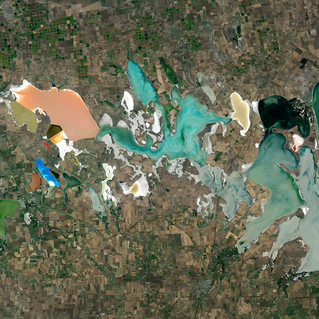
Varied types of microalgae flourish in this colorful network of shallow, salty lagoons at the neck of the Crimean Peninsula between the Black Sea and the Sea of Azov. This natural color image portrays the unnaturally strange colors of the area known as Sivash, which is nicknamed the 'putrid sea' because the algae in some of the lagoons produce a rotten smell. (Image credit: U.S. Geological Survey)

Putrid? Well, looks can be deceiving. Microalgae sprout up in Sivash — a network of lagoons formed at the neck of the Crimean Peninsula between the Black Sea and the Sea of Azov, according to the USGS. Not only do the microalgae create a colorful scene, they also produce a rotten smell in some of the lagoons; hence, Sivash got the nickname of "putrid sea." The Landsat-8 image of the putrid sea was captured on Sept. 5, 2014.

Canyonlands
earth as art

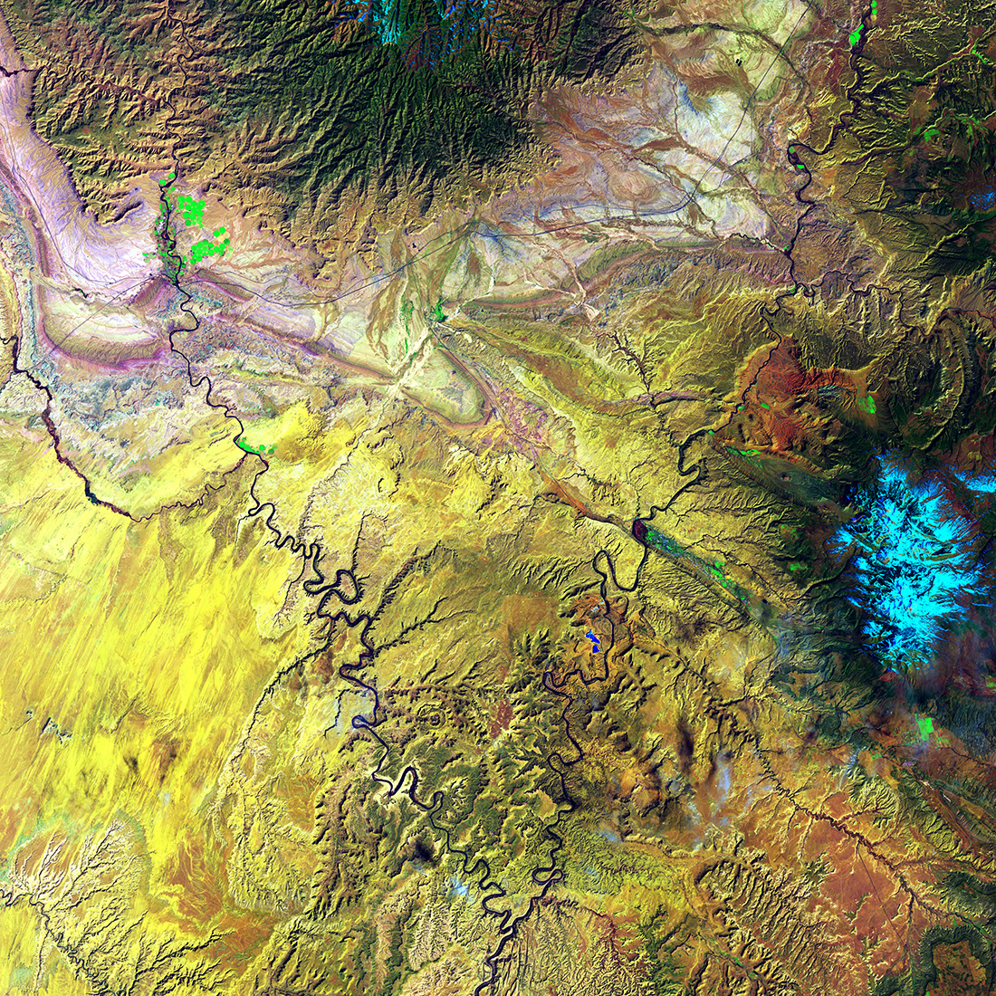
The Green River and the Colorado River meet within Canyonlands National Park in Utah. Snow-covered Mount Waas, shown in light blue on the right side of the image, overlooks the arches, canyons, and bizarre rock formations that prevail throughout this region. (Image credit: U.S. Geological Survey)

The Green River and the Colorado River meet in Canyonlands National Park in Utah. The Colorado River carved out the dramatic desert scape in Canyonlands, which is full of diverse features like canyons, arches and odd rock formations, according to the USGS. On the right side of this image, taken on March 29, 2015, Mount Waas can be seen in light blue.

Eye of Quebec
earth as art

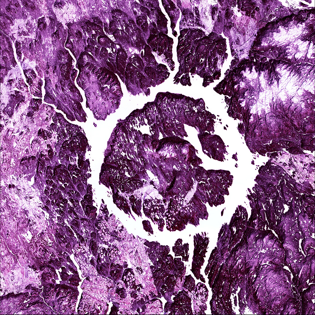
Lake Manicouagan, Canada, is one of the Earth's largest and oldest known impact craters. The crater is 65 kilometers (40 miles) wide and is estimated to be about 214 million years old. The lake and island are clearly seen from space and are sometimes called the 'Eye of Quebec.' (Image credit: U.S. Geological Survey)

At 40 miles (65 km) across and an age of 214 million years, Lake Manicouagan, Canada, is one of the Earth's largest and oldest known impact craters. Sometimes called the Eye of Quebec, the lake and island can be seen clearly from space on March 28, 2015, USGS reported.

Cloud Lightning

earth as art

What looks like lightning arcing through an ominous cloud is actually a dry landscape of rocky buttes in southern Utah and northeastern Arizona. River channels flow north from Arizona into the San Juan River. The light vertical feature at the top of the image is referred to as Comb Ridge, a jagged fold in the Earth's crust called a monocline. (Image credit: U.S. Geological Survey)

This isn't an image of lightning, though it looks to be. Rather, a dry landscape of rocky buttes in southern Utah and northeastern Arizona creates the electric view. Comb Ridge, a monocline or "a jagged fold in Earth's crust," can be seen at the top of the image, which was captured on Oct. 4, 2014.

Contrails
earth as art

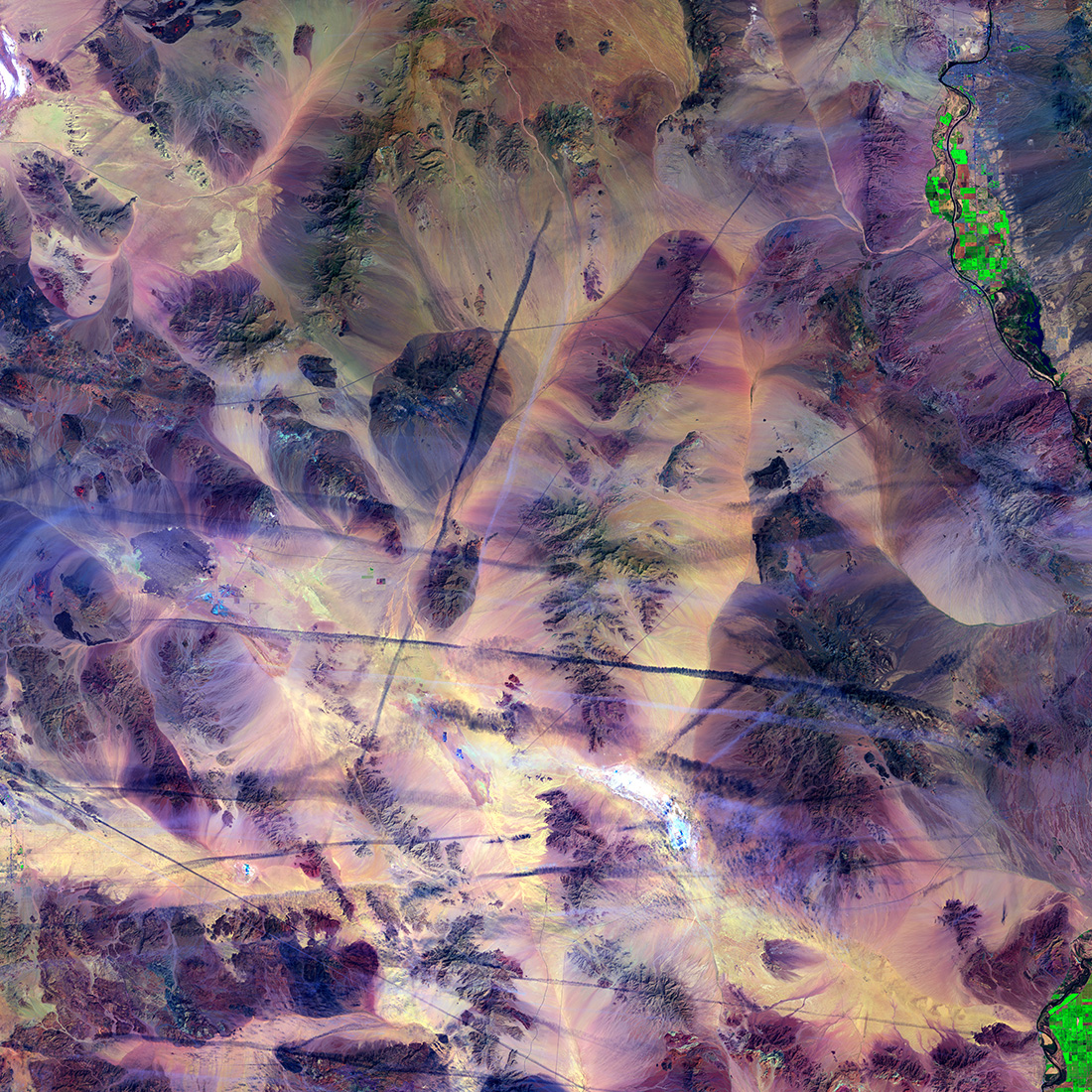
Like scratches on a marble table, airplane contrails cut across the southern California Mojave Desert. The shadows from the contrails cast dark lines across the ground. Contrails form when cold, dry air mixes with warmer aircraft (Image credit: U.S. Geological Survey)

Airplane contrails cut across the southern California Mojave Desert on April 3, 2015. Contrails form when water vapor condenses and freezes around small particles in the aircraft exhaust, according to NASA. In this image, shadows from the contrails cast dark lines on the ground.

Earth's Aquarium
earth as art

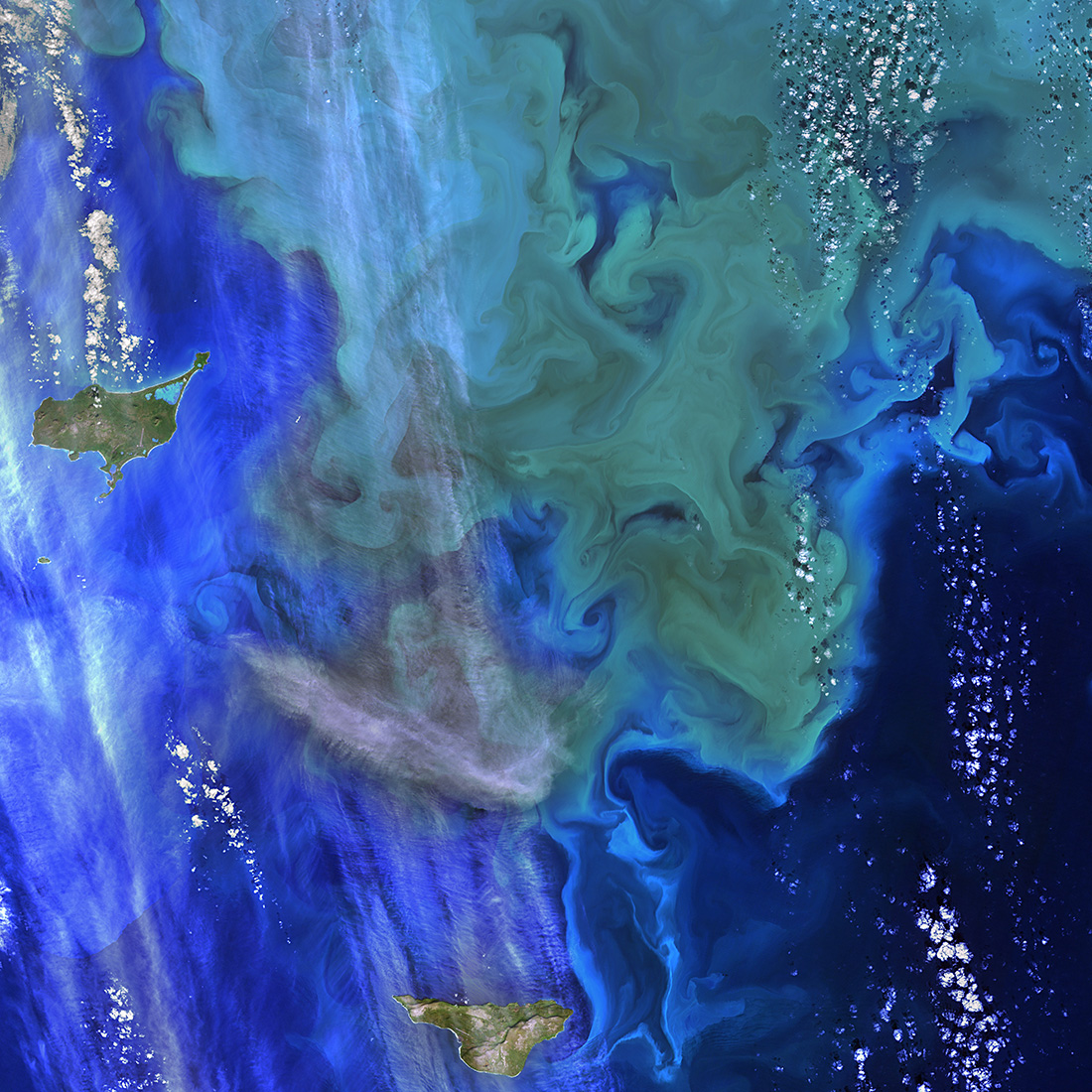
These green and blue swirls in the Bering Sea reveal the bottom of the food chain in the ocean. Microscopic organisms called phytoplankton, which are important to fish populations, may be too small to be seen individually, but in vast numbers they are visible from space. The white clouds in the image look like bubbles in an aquarium. (Image credit: U.S. Geological Survey)

When tiny organisms called phytoplankton gather in large numbers, the result can be beautiful, as was the case on Sept. 22, 2014 in the Bering Sea. When the gathering gets big enough, the resulting green and blue swirls are visible from space. White clouds also appear as bubbles in this image.

Cellular Ice

earth as art

The ice surrounding the northern Canadian Spicer Islands, shown in bright red, resembles a cell, complete with ribosomes, mitochondria, and a nucleus. Even though the image was captured shortly after the first day of summer in the Northern Hemisphere, the islands are locked in ice. (Image credit: U.S. Geological Survey)

"The ice surrounding the northern Canadian Spicer Islands, shown in bright red, resembles a cell, complete with ribosomes, mitochondria and a nucleus. Even though the image was captured shortly after the first day of summer in the Northern Hemisphere, the islands are locked in ice," the USGS said. The image was captured on June 24, 2014.

Mexico's Biosphere
earth as art

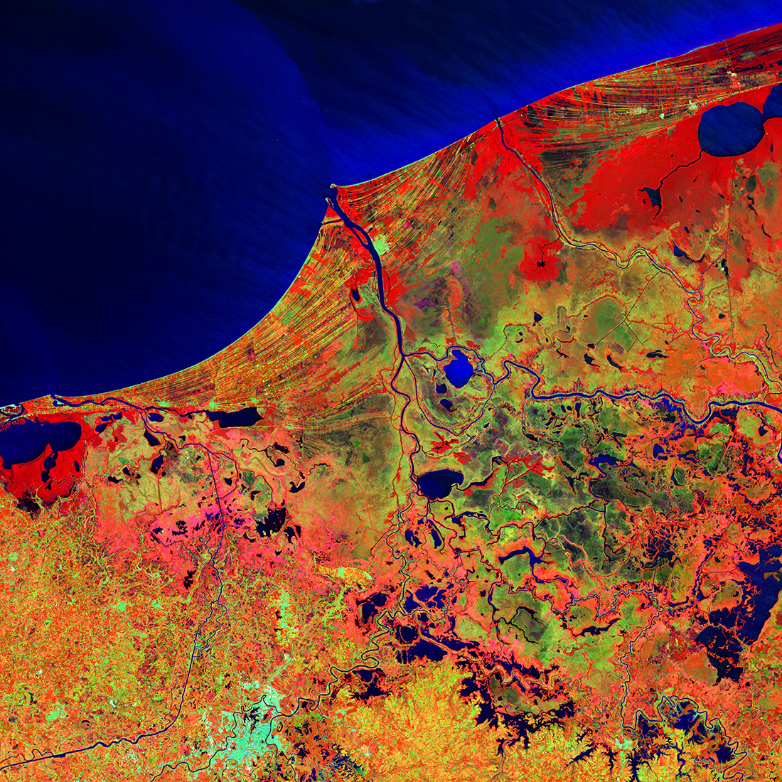
Much of this image consists of the Reserva de la Biosfera Pantanos de Centla, a biosphere reserve in southern Mexico that protects wetlands in the area. The water bodies, mangroves, and forests are a sanctuary for a great variety of wildlife. Sediment carried away by the Grijalva River appears as a sweeping light blue brushstroke flowing into the Gulf of Mexico at the top of the image. (Image credit: U.S. Geological Survey)

The Reserva de la Biosfera Pantanos de Centla, a biosphere reserve in southern Mexico can be seen in this satellite image taken on Feb. 20, 2014. A light-blue brushstroke at the top of the image is the sediment carried by the Grijalva River flowing into the Gulf of Mexico.

Petermann Glacier
earth as art

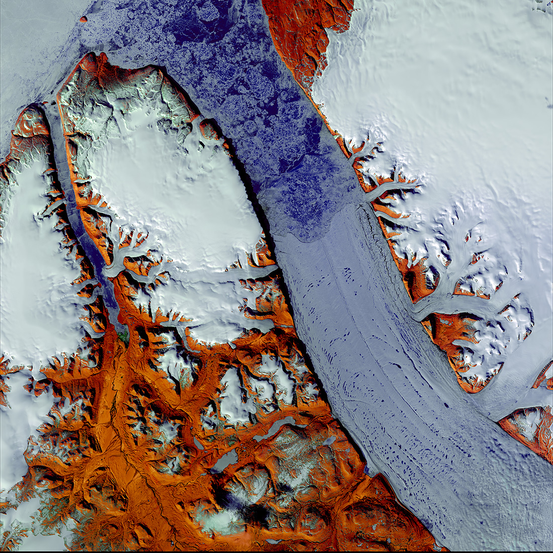
Located on the northwestern coast of Greenland, Petermann Glacier covers 1,295 square kilometers (500 square miles). The glacier's floating tongue of ice extends from the lower right corner of the image toward the top center. At 15–20 kilometers (9–12 miles) wide and 70 kilometers (43 miles) long, it is the longest floating glacier in the Northern Hemisphere. Infrared wavelengths reveal bare ground shown in red-brown tones in this summer image. (Image credit: U.S. Geological Survey)

Petermann Glacier, on the coast of Greenland, covers an area of 500 square miles (1,295 square kilometers). The glacier's floating tongue extends from the lower-right corner of the image toward the top center. The red-brown hues indicate bare ground. The image was taken on June 24, 2014.

TOPICS
Live Science Staff
For the science geek in everyone, Live Science offers a fascinating window into the natural and technological world, delivering comprehensive and compelling news and analysis on everything from dinosaur discoveries, archaeological finds and amazing animals to health, innovation and wearable technology. We aim to empower and inspire our readers with the tools needed to understand the world and appreciate its everyday awe.