In Photos: Hurricane Harvey Takes Aim at Texas
Eye of the storm
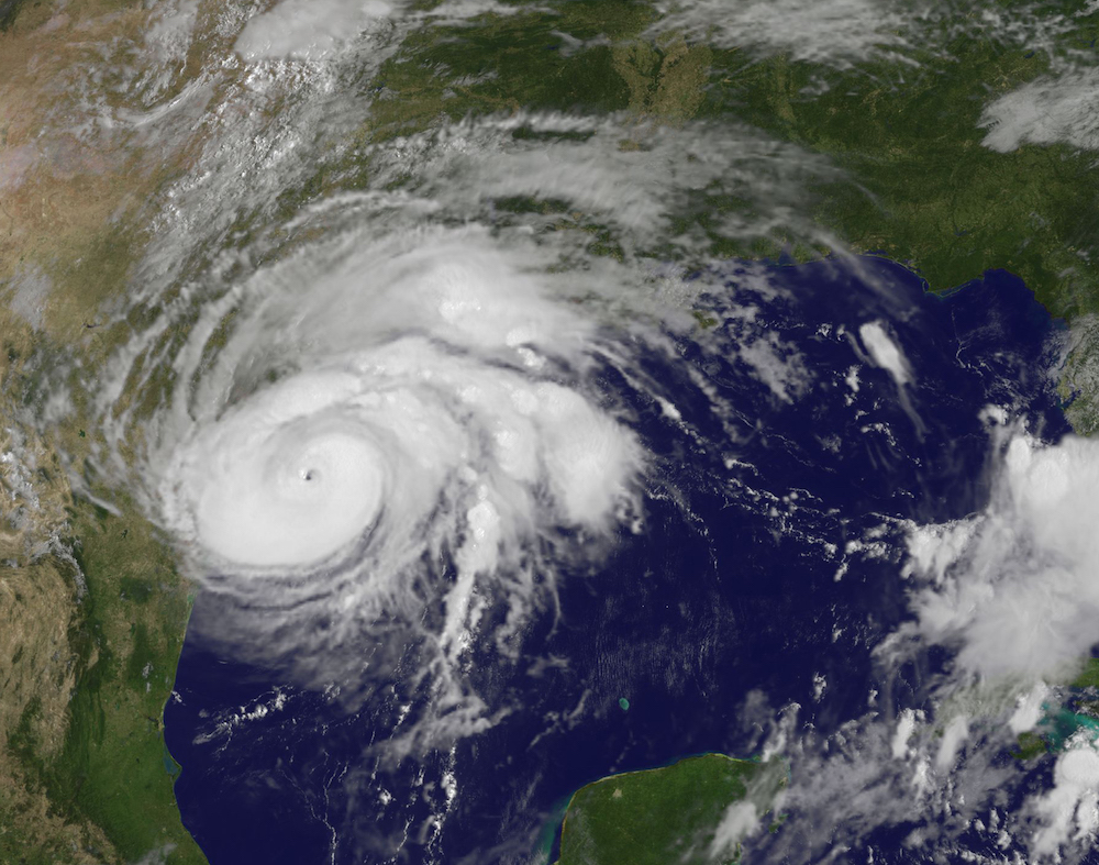
Hurricane Harvey is taking aim at Texas, with cities from Houston to Corpus Christi bracing for what's expected to be a major storm with strong winds and heavy rain. Harvey became a hurricane on Aug. 24 and is expected to make landfall Friday night (Aug. 25). Hurricane Harvey is a category 4 storm on the Saffir-Simpson scale, with winds near 130 miles per hour (215 km/h). After making landfall, Harvey is "likely to meander near or just inland of the middle Texas coast through the weekend," according to the National Hurricane Center. This means the storm could dump 15 to 30 inches (38 to 76 centimeters) of rain over a widespread area of coastal and inland Texas. [Read more about how Hurricane Harvey formed]
This visible image of Hurricane Harvey taken from NOAA’s GOES East satellite on Aug. 25 at 10:07 a.m. EDT (1407 GMT) clearly showed the storm’s eye as the storm nears landfall in the southeastern coast of Texas. [Hurricane Season 2017 Guide]
Unspeakable damage
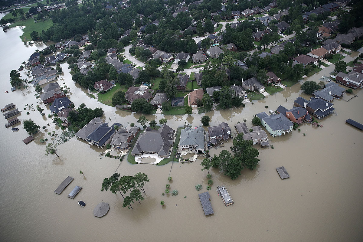
Remarkable amounts of rainfall from Tropical Storm Harvey, which made landfall in Texas as a hurricane, have left unimaginable destruction in the Houston area.
Handy tools
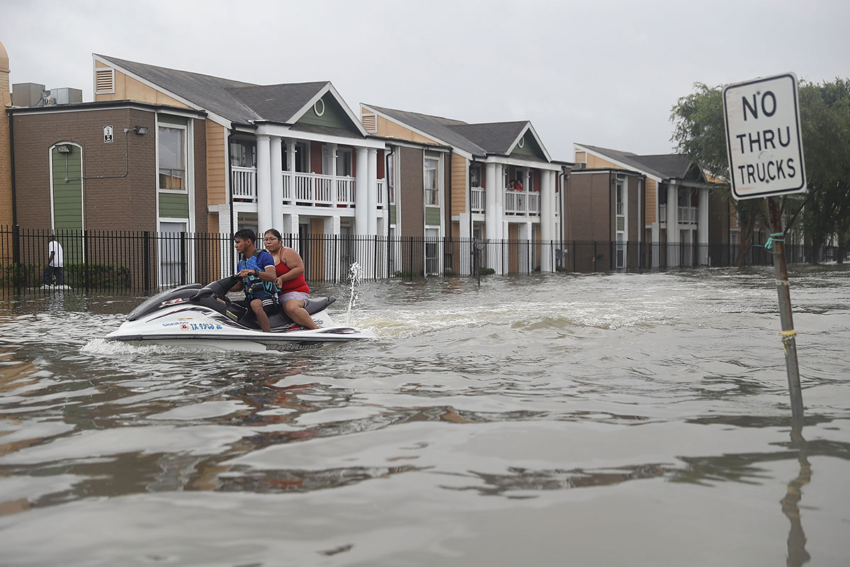
During rescues, even a jetski was used to get people from their homes in Houston. Harvey made landfall north of Corpus Christ late on Aug. 25, 2017.
Flooded homes
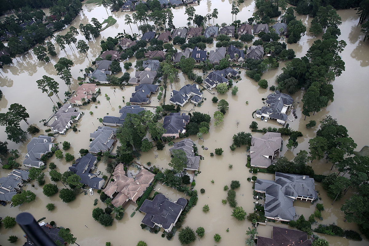
Near Lake Houston, severe flooding from Harvey is affecting this entire neighborhood. Historic levels of rainfall have increased flooding in the region, though the storm has since moved out of the area.
City underwater
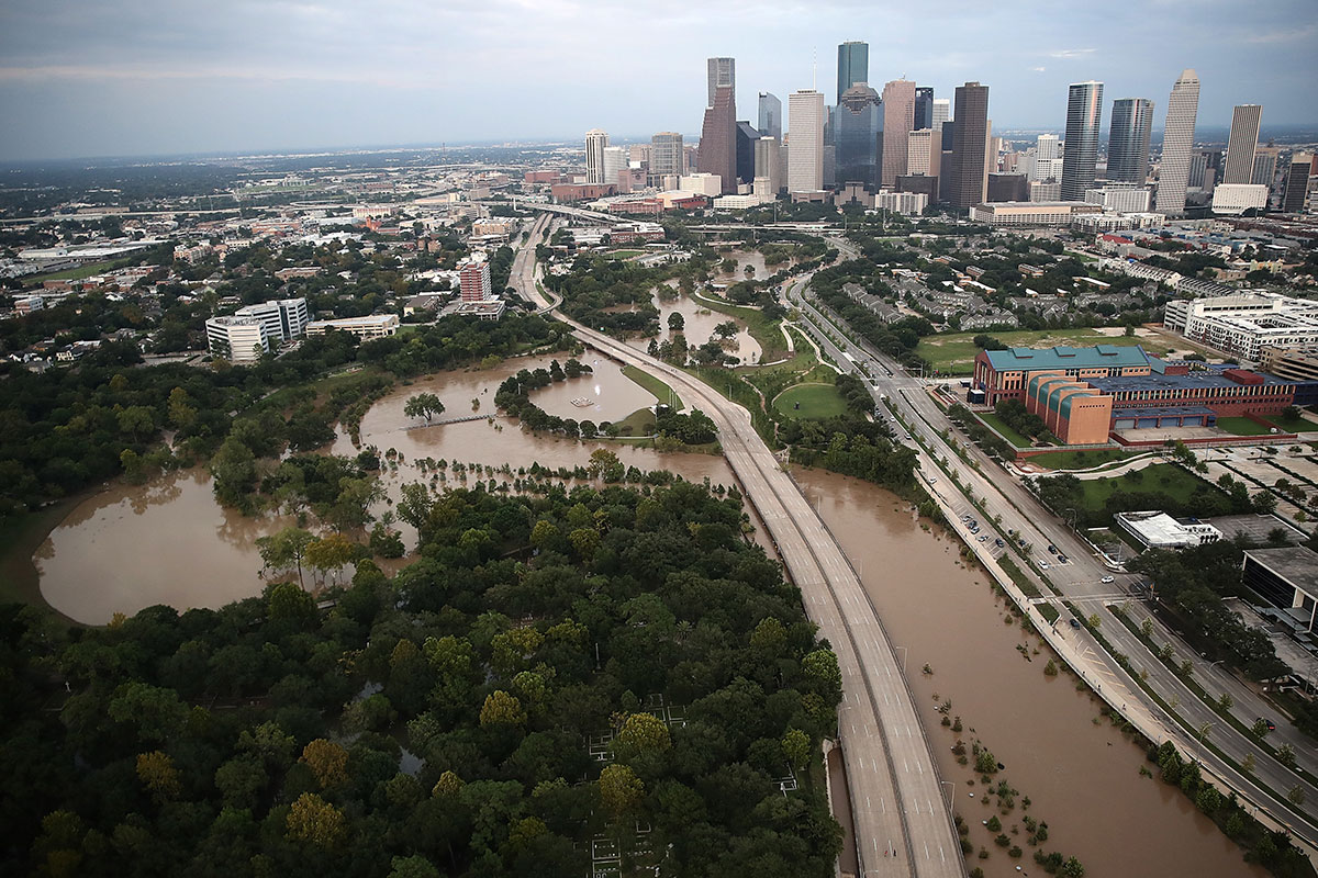
Downtown Houston experienced significant and severe flooding from Tropical Storm Harvey's unprecedented rainfall.
Looking for survivors
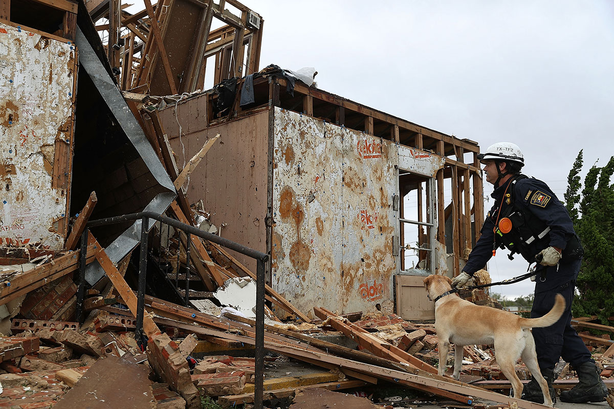
Texas Task Force 2 members Robert Grant and Rocky explore a destroyed apartment complex on a search-and-rescue mission in the aftermath of the Category 4 Hurricane Harvey.
Rescue in action
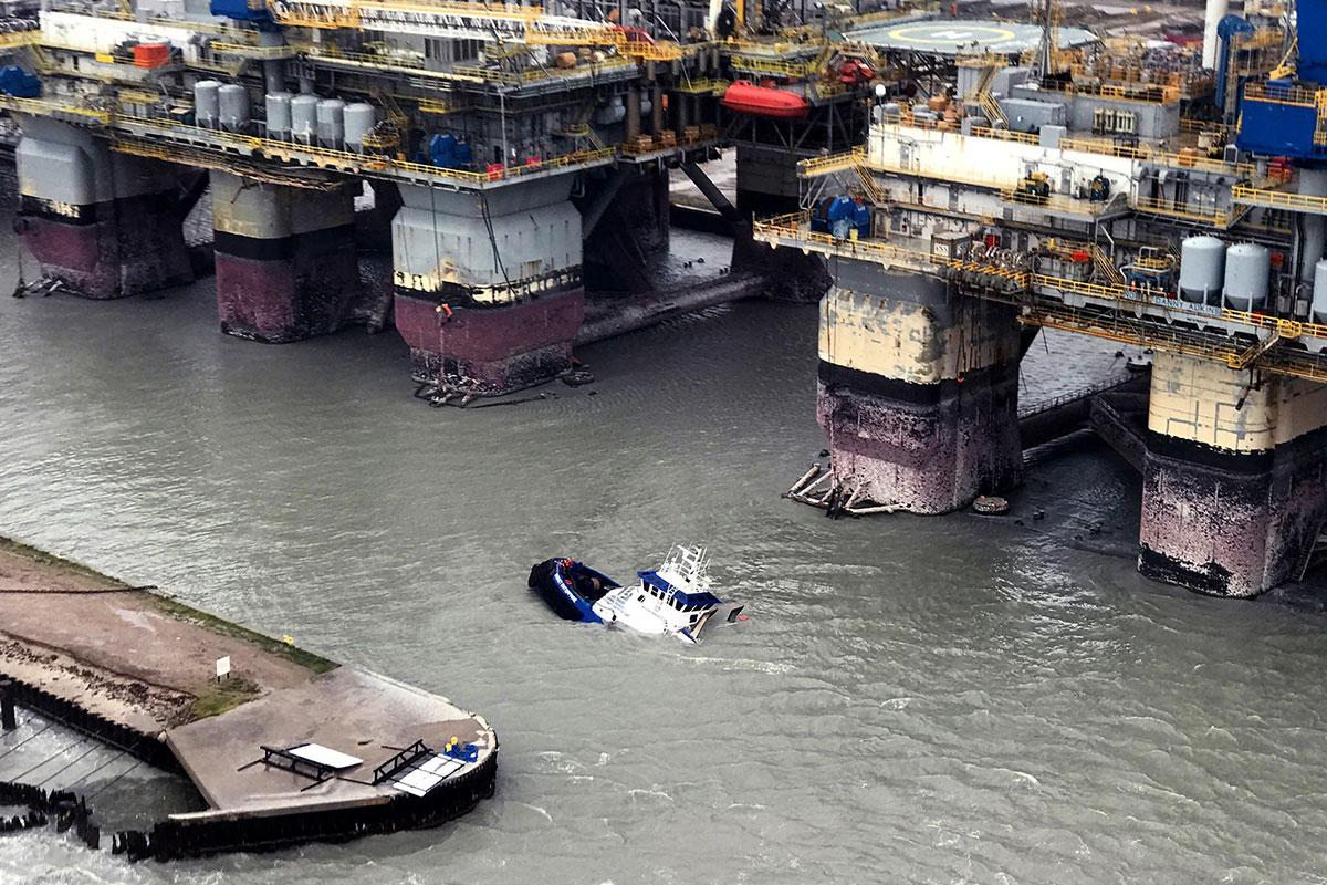
The U.S. Coast Guard aids people aboard the sinking Signet Express near Port Aransas.
Evident flooding
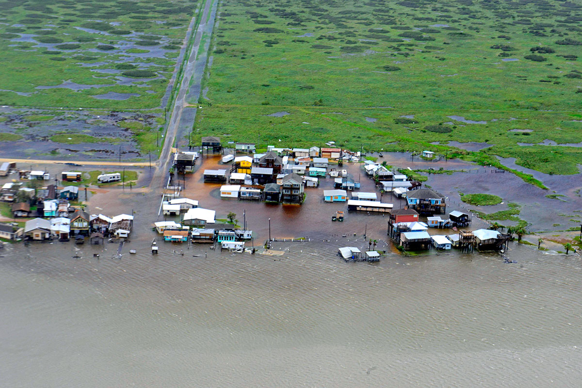
Just south of Port O'Connor, the U.S. Coast Guard photographed this encampment site during a flyover to assess damage and offer search and rescue services.
Floodwaters
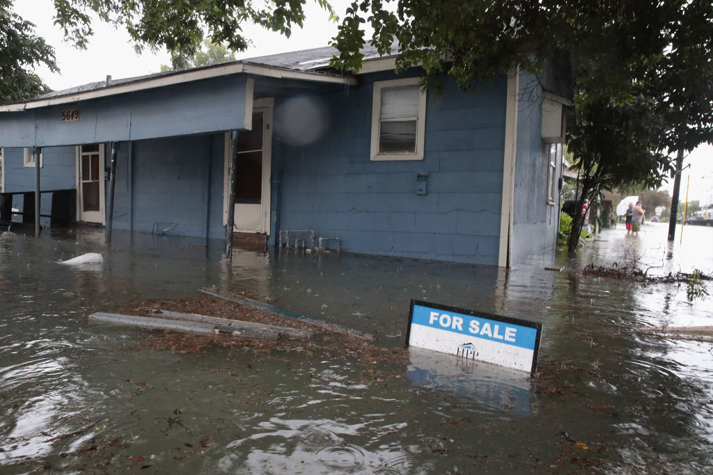
Rain from Hurricane Harvey inundates the Cottage Grove neighborhood on Aug. 27 in Houston, Texas.
Airport destruction
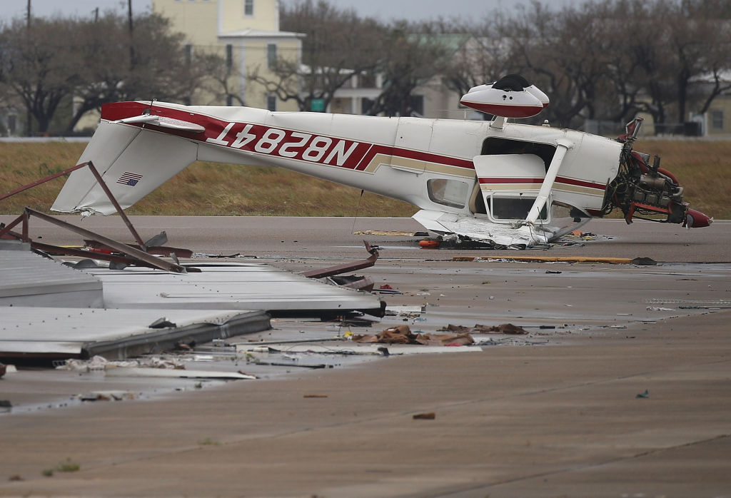
An airplane is seen flipped on its roof at the Aransas County Airport after Hurricane Harvey passed through Rockport, Texas, on Aug. 26, 2017.
Navigating the flood
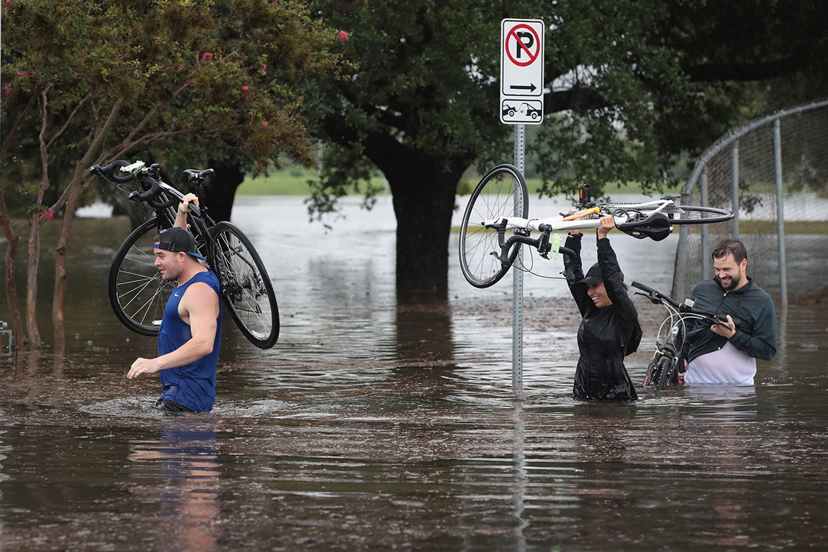
Hurricane Harvey is the strongest to hit the United States in 12 years. Residents wade through waist-high water carrying bicycles.
Sign up for the Live Science daily newsletter now
Get the world’s most fascinating discoveries delivered straight to your inbox.
