Hurricane Harvey Before and After: Satellite Images Show Storm's Destruction
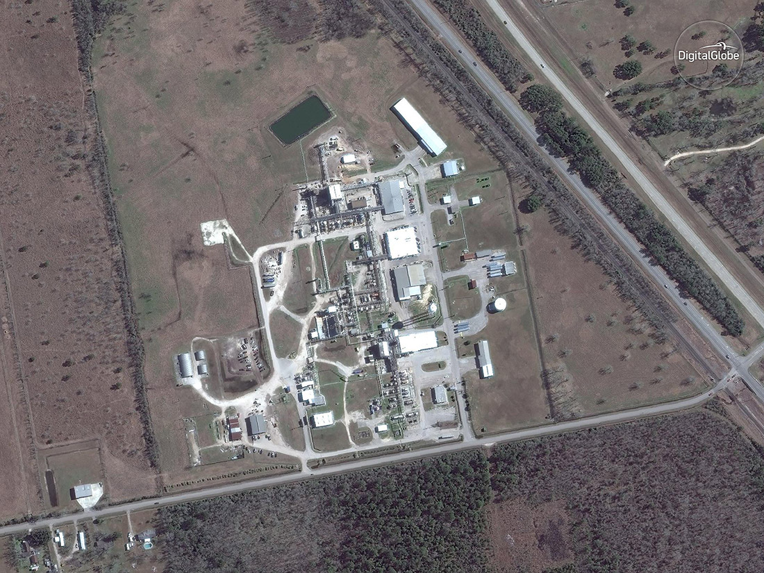
Crosby - Jan. 29, 2017
Hurricane Harvey hit Texas, north of Corpus Christi, as a Category 4 storm on Aug. 25, 2017. It was the first major hurricane to make landfall in the U.S. since Hurricane Wilma in 2005. Harvey was also the first hurricane to hit the Texas coast since Hurricane Ike in 2008. After making landfall, Harvey weakened into a tropical storm, but stalled over the Texas coast, dumping huge amounts of rain over Houston and the surrounding area. In fact, scientists say flooding from Harvey was unprecedented, at levels expected to be seen just once every 500,000 years, in some areas of Southeast Texas.
Here are some before-and-after satellite images of Texas that show the devastation caused by Harvey.
In this image, the Arkema plant in Crosby, Texas, is seen on Jan. 29, 2017.
Crosby - Aug. 31, 2017
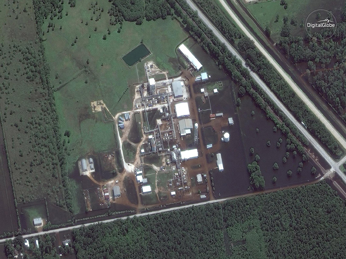
Flooding from Harvey knocked out power at the Arkema facility, and on Aug. 31, fire broke out at the chemical plant. Arkema said two explosions were reported at the plant, which is located northeast of Houston, but local emergency officials later said there had been no explosion at the plant.
Channelview - April 6, 2017
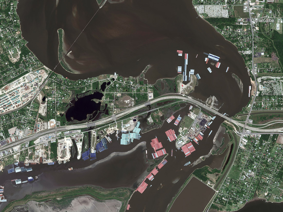
The city of Channelview is located about 15 miles (24 km) east of downtown Houston.
Channelview - Aug. 31, 2017
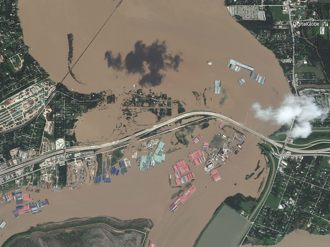
Channelview, like other places in and around Houston, experienced catastrophic flooding from Harvey.
Highlands - April 6, 2017
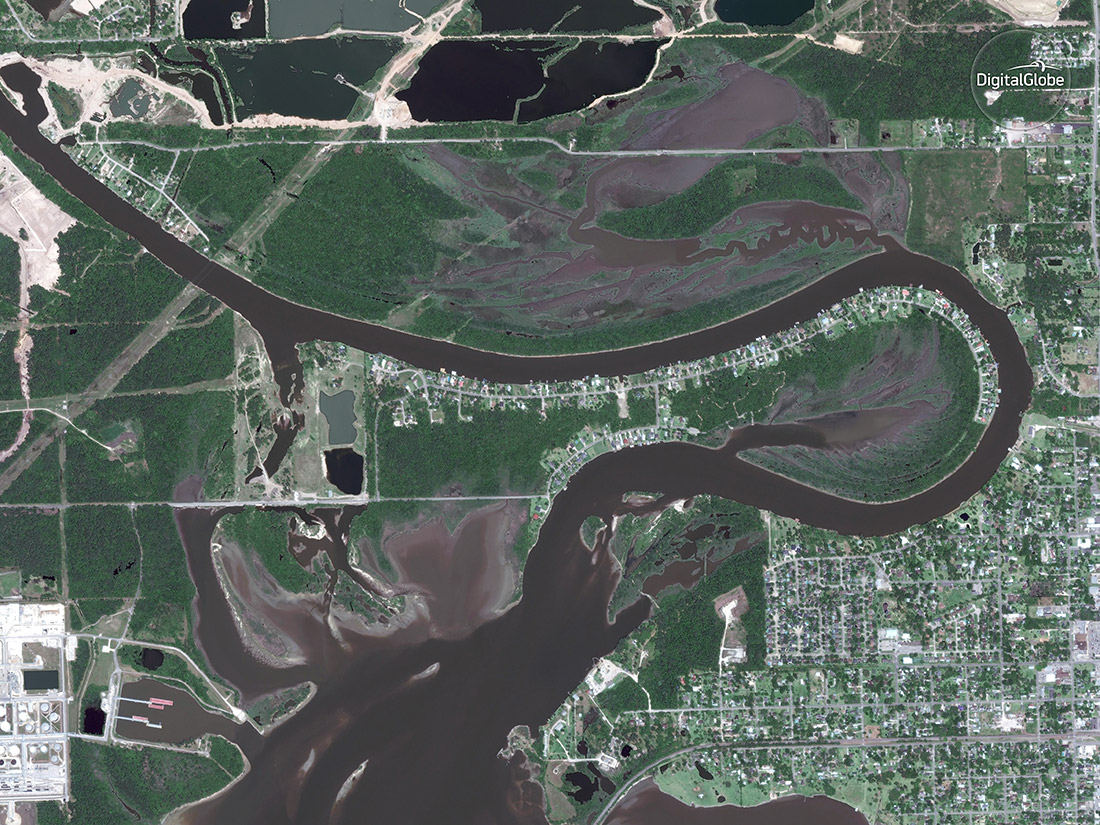
Highlands is located north of Interstate 10, along the east bank of the San Jacinto River.
Highlands - Aug. 31, 2017
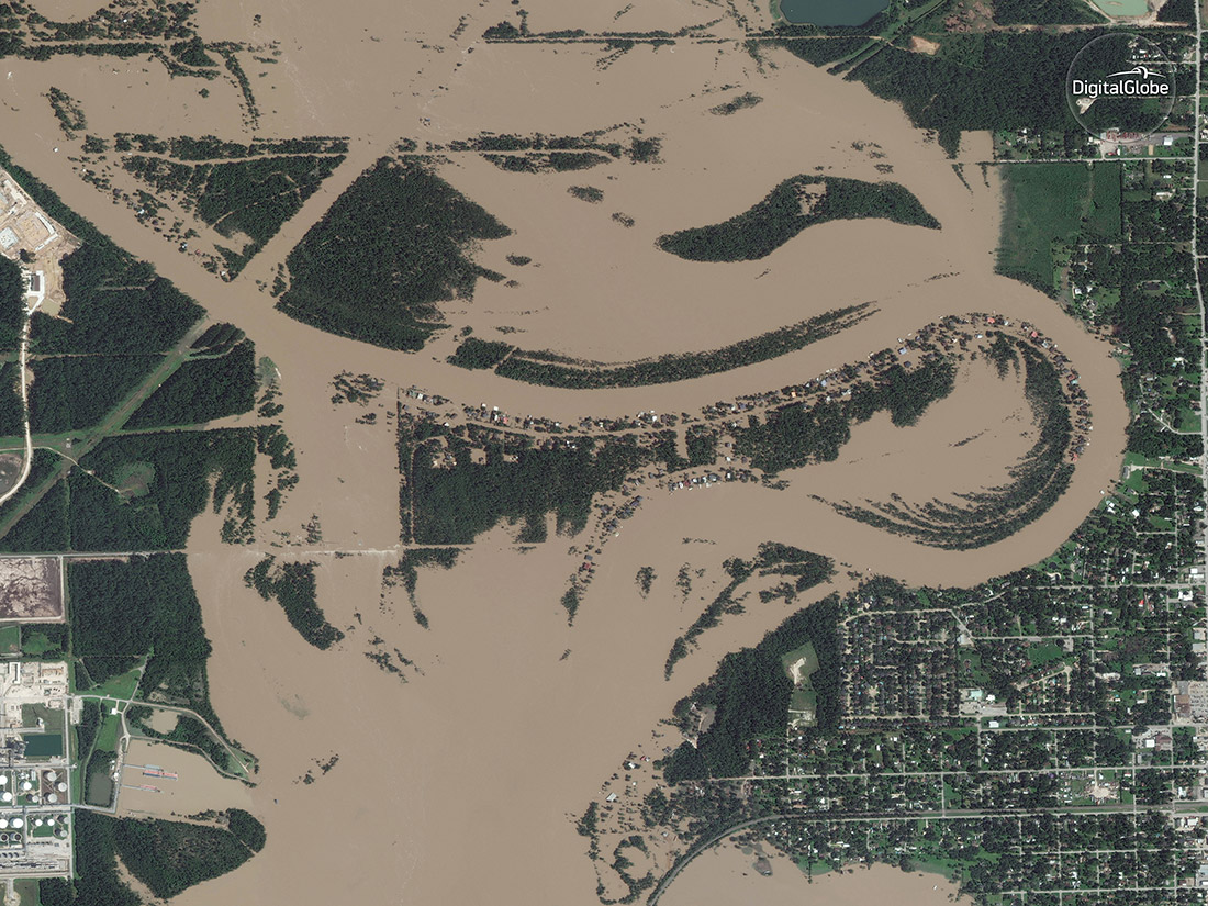
Satellites spied this jaw-dropping view of the flooding in Highlands, Texas, on Aug. 31, 2017.
Brookshire - Nov 20, 2016
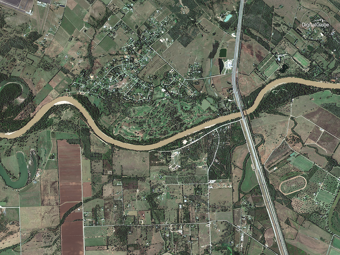
The city of Brookshire is located about 34 miles (55 kilometers) west of downtown Houston.
Sign up for the Live Science daily newsletter now
Get the world’s most fascinating discoveries delivered straight to your inbox.
Brookshire - Aug. 30, 2017
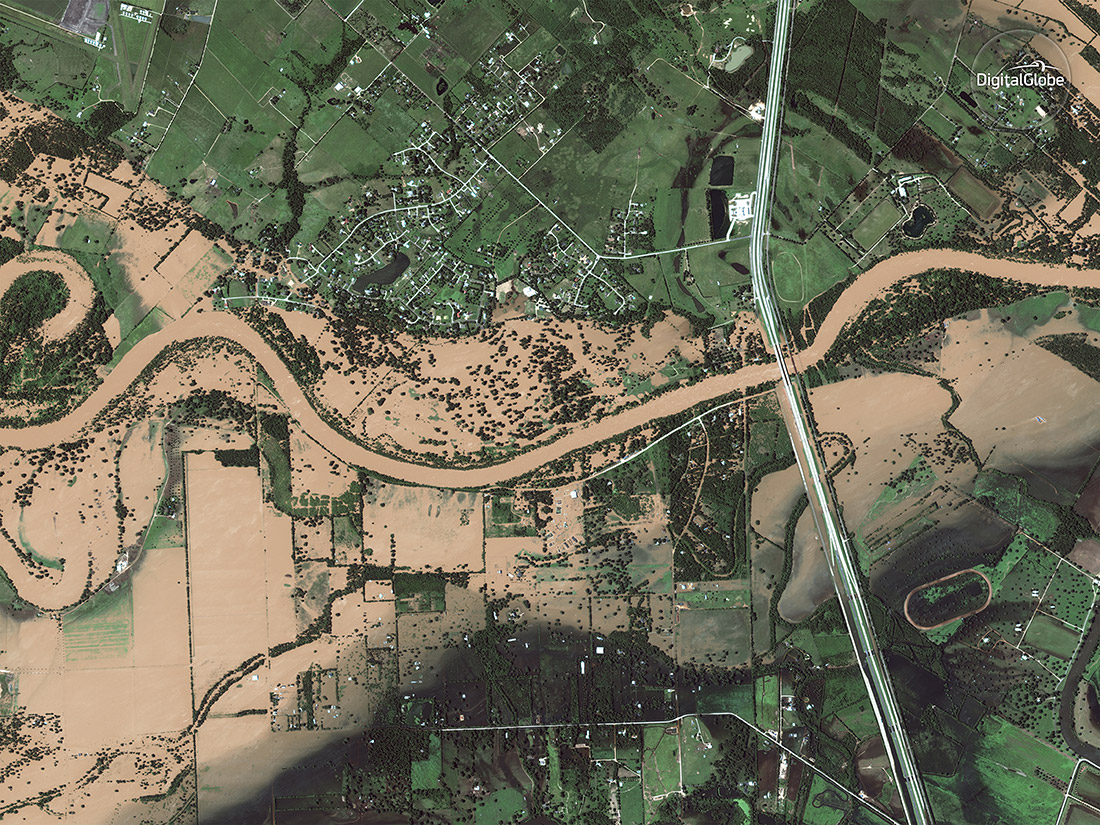
This satellite photo, taken as Harvey was inundating the area with heavy rains, shows the extensive flooding caused by the storm.
Simonton - Nov. 20, 2016
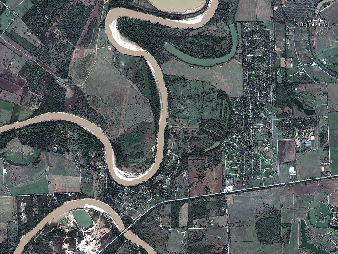
The city of Simonton is located about 40 miles (64 km) outside of downtown Houston.
Simonton - Aug. 30, 2017
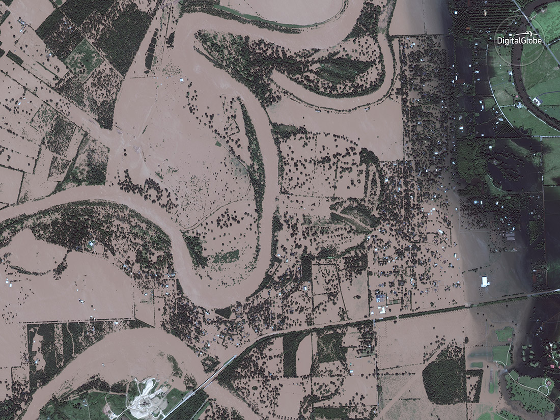
Simonton was one of the cities that suffered heavy flooding from Harvey.
Holiday Lakes - April 3, 2017
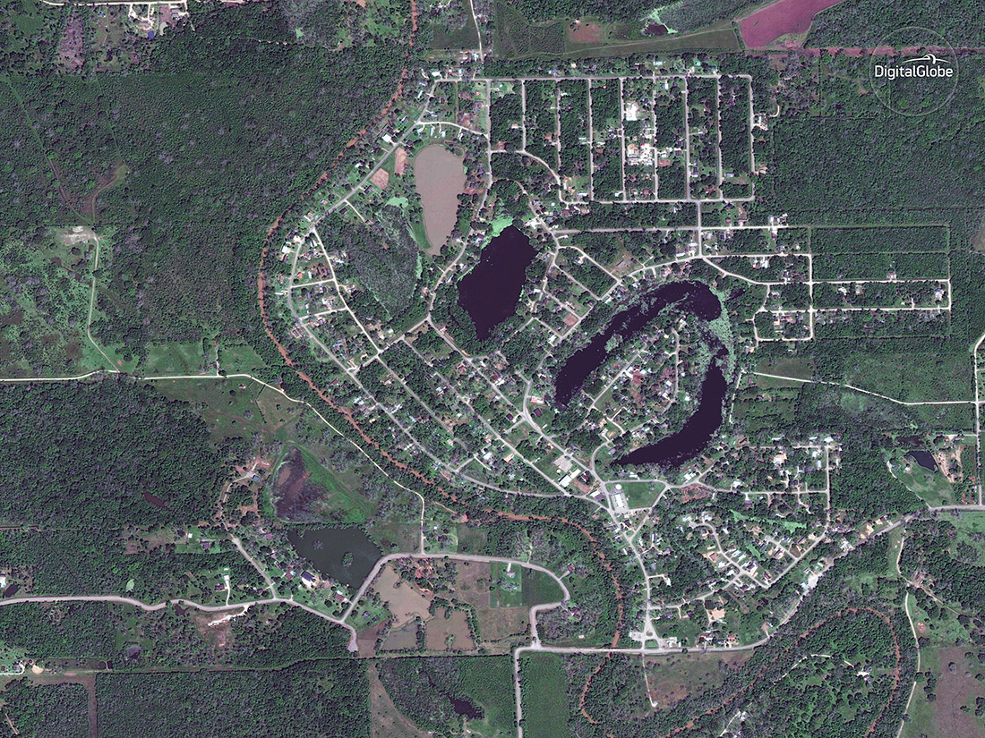
The town of Holiday Lakes is located about 7 miles (11 km) north of Angleton.

Denise Chow was the assistant managing editor at Live Science before moving to NBC News as a science reporter, where she focuses on general science and climate change. Before joining the Live Science team in 2013, she spent two years as a staff writer for Space.com, writing about rocket launches and covering NASA's final three space shuttle missions. A Canadian transplant, Denise has a bachelor's degree from the University of Toronto, and a master's degree in journalism from New York University.


