In Photos: Hurricane Maria Seen from Space
Hurricane Maria's Raging Intensity
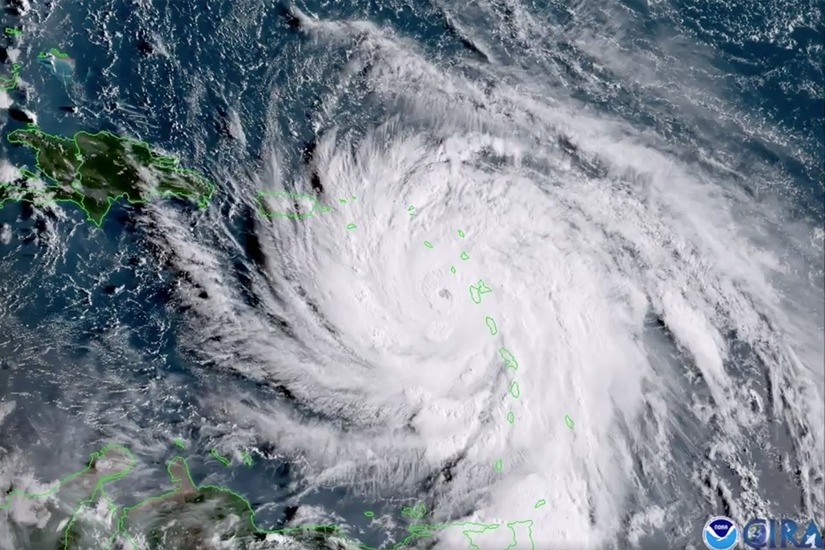
Hurricane Maria developed into a Category 5 storm for a second time on Sept. 19, the morning after it made landfall over the Caribbean island of Dominica. The storm weakened to a Category 4 after making landfall but quickly regained strength once it moved back over the warm ocean water. This view of the hurricane was acquired by the GOES-16 satellite, which is operated by NASA and the National Oceanic and Atmospheric Administration (NOAA).
Frigid Cloud Tops
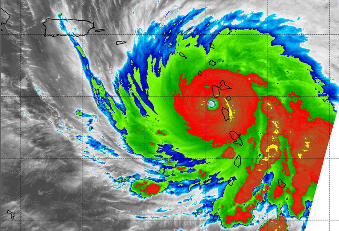
On Sept. 19 at 2:15 a.m. EDT (0615 UTC), the Moderate Resolution Imaging Spectroradiometer (MODIS) instrument aboard NASA's Aqua satellite measured the temperatures of Hurricane Maria's cloud tops. The data showed temperatures consistent with strong thunderstorms in Maria's eyewall at about minus 80 degrees Fahrenheit (minus 62.2 Celsius).
Hurricane Maria
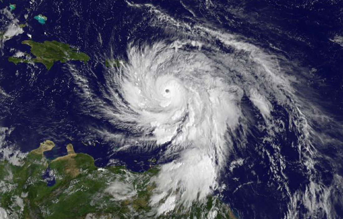
The massive Category 5 storm boiled across the Caribbean Sea on Sept. 19. NOAA's GOES East satellite captured this visible-light image at 11 a.m. EDT (1500 GMT).
Warnings
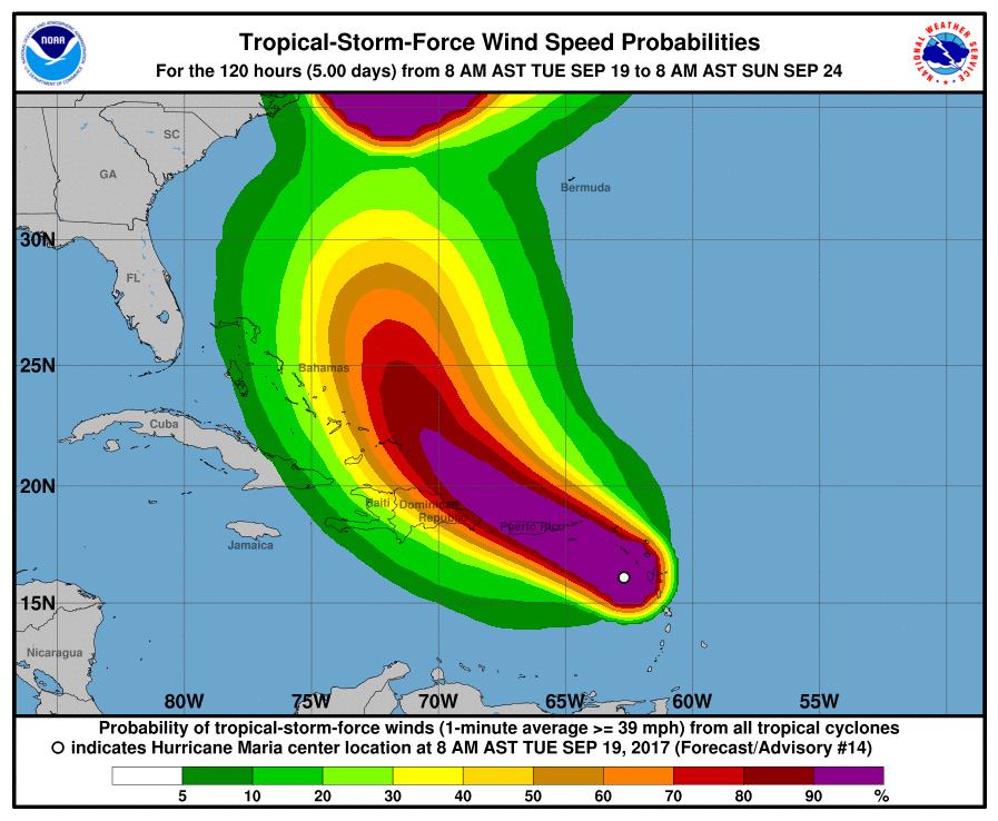
On Sept. 19, the NOAA issued a tropical-storm-force wind advisory that would remain in effect through Sept. 24.
Another Season
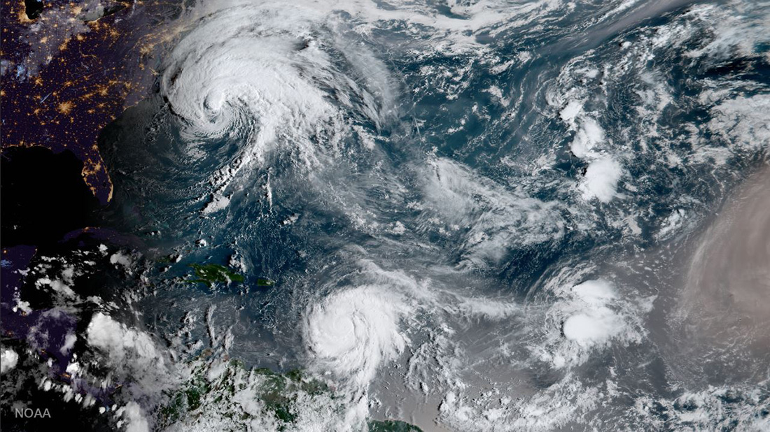
NOAA's GOES-16 captured this geocolor image of Hurricanes Jose and Maria and Tropical Depression Lee simultaneously churning through the Atlantic Ocean on Sept. 18.
Maria Approaches the Caribbean
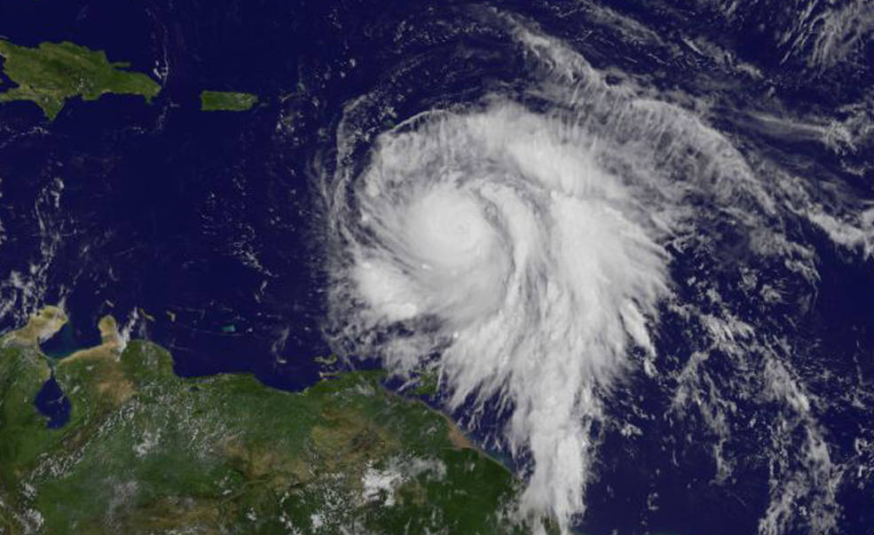
This image of Hurricane Maria was taken by NOAA's GOES East satellite on Sept. 18 at 10:45 a.m. EDT (1445 GMT) as it strengthened to a Category 3 hurricane just east of the Leeward Islands. Hurricane Maria made landfall on the Caribbean island of Dominica as a Category 5 storm later that day at 9:15 p.m. EDT (0115 GMT on Sept. 19).
Maria's Projected Path
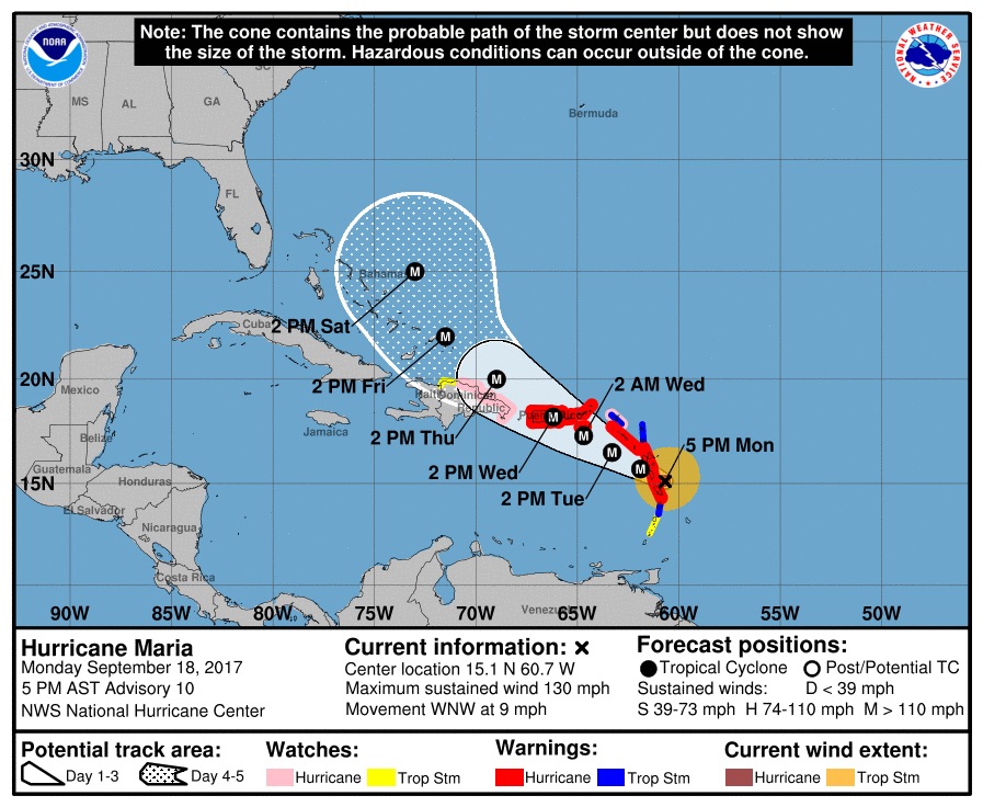
This graphic shows areas affected by Hurricane Maria, and the expected dates and times when the storm will arrive at those locations. The NOAA released this forecast on Sept. 18 at 5 p.m. EDT (2100 GMT).
Sign up for the Live Science daily newsletter now
Get the world’s most fascinating discoveries delivered straight to your inbox.
Stormy Seas
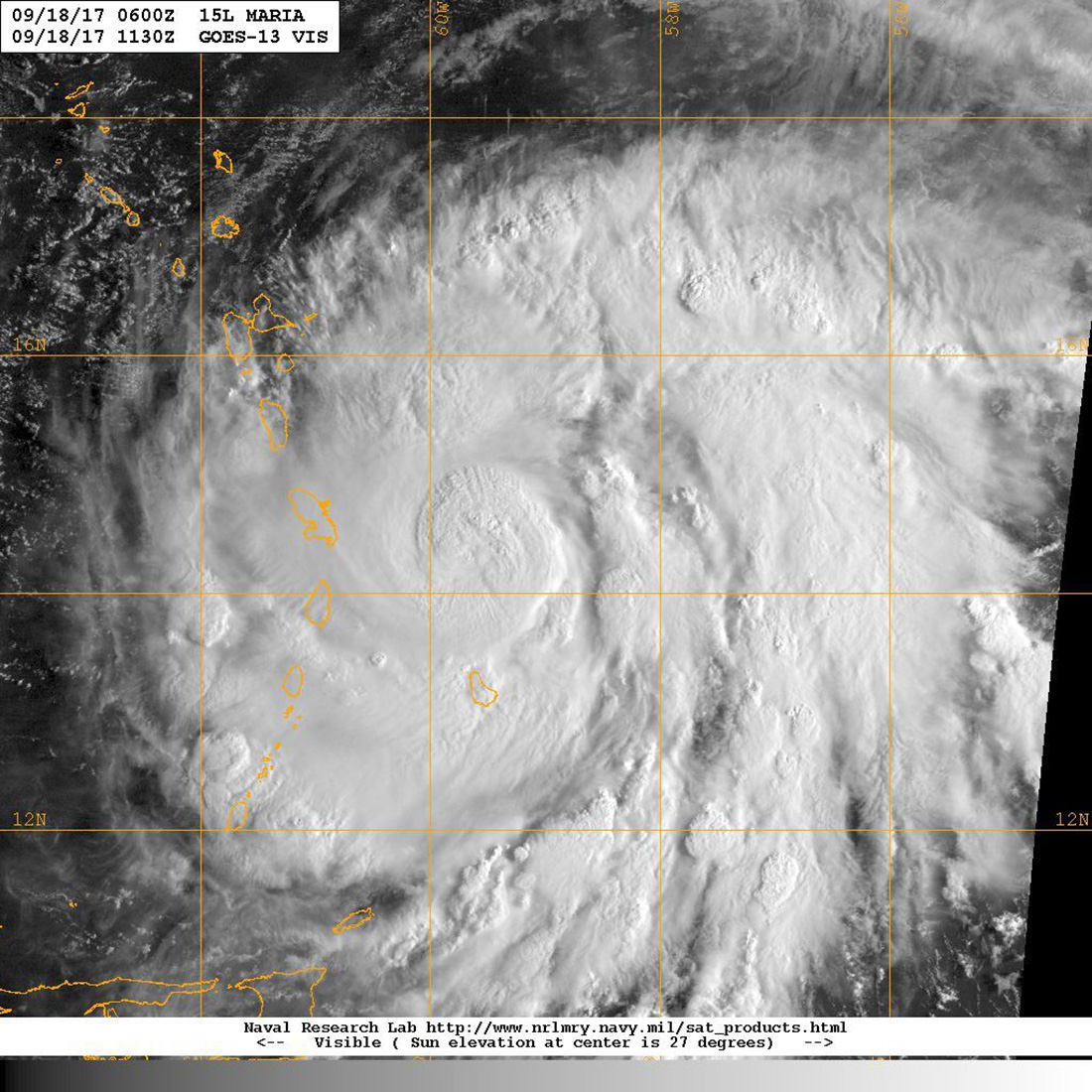
At a Category 1 storm, Hurricane Maria trekked across the Caribbean Sea toward the Leeward Islands in this GOES satellite image taken on Sept. 18.
Impressive Height
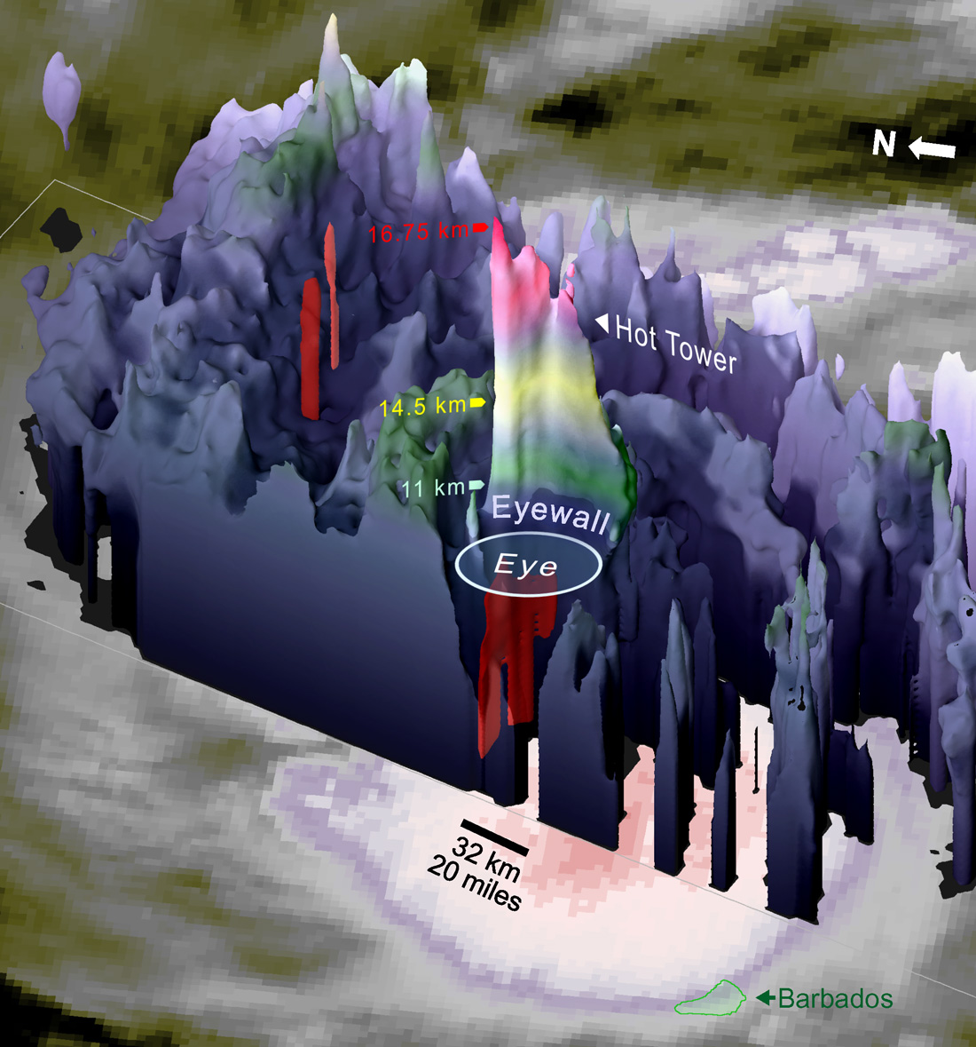
On Sept. 18, NASA's Global Precipitation Measurement (GPM) satellite measured Hurricane Maria's cell at an imposing 10.41 miles (16.75 kilometers) altitude, stretching into the lower stratosphere.
A View from GOES-13
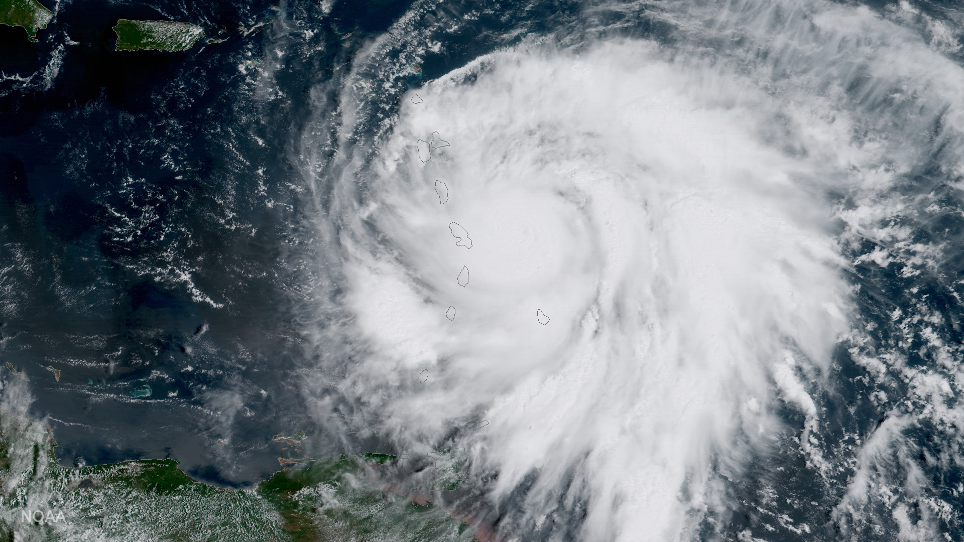
Hurricane Maria is seen by NOAA's GOES-13 satellite (also known as GOES East) as the storm was located about 60 miles east of Martinique and moving toward the west-northwest near 10 mph on Sept. 18 at 11 a.m. EDT. At the time, Maria was a Category 3 hurricane. It later strengthened to a Category 5.
Gaining Strength
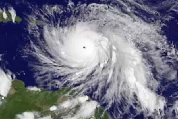
NASA's GOES-East satellite captured this view of Hurricane Maria on Sept. 18 as the Category 3 storm quickly evolved into a Category 5.

