Chaco Canyon Photos: Amazing Ruins from an Ancient World
Ancient civilization
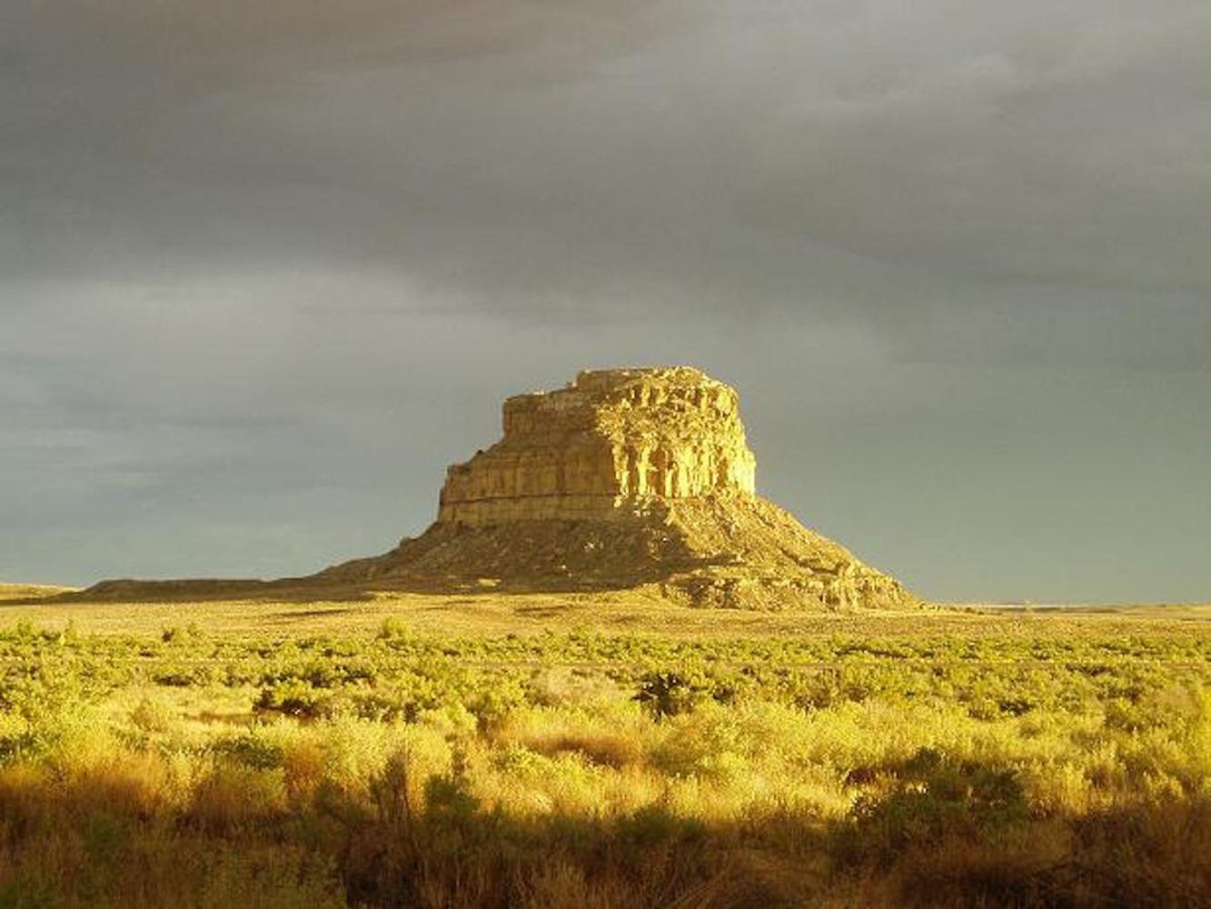
In the great desolation and emptiness of northwestern New Mexico, the ruins of an advanced Pre-Columbian civilization is preserved today within a 53-square-mile (137 square kilometers) national historic park. Here, the Chacoan people from the mid-9th to early 13th centuries created along Chaco Canyon the largest, most architecturally advanced (and most archaeoastronomically aligned) series of roads, villages and solar stone structures found in North America, and arguably anywhere in the world. Fajada Butte within Chaco Culture National Historic Park is shown here. [Read more about Chaco Canyon]
Historic park
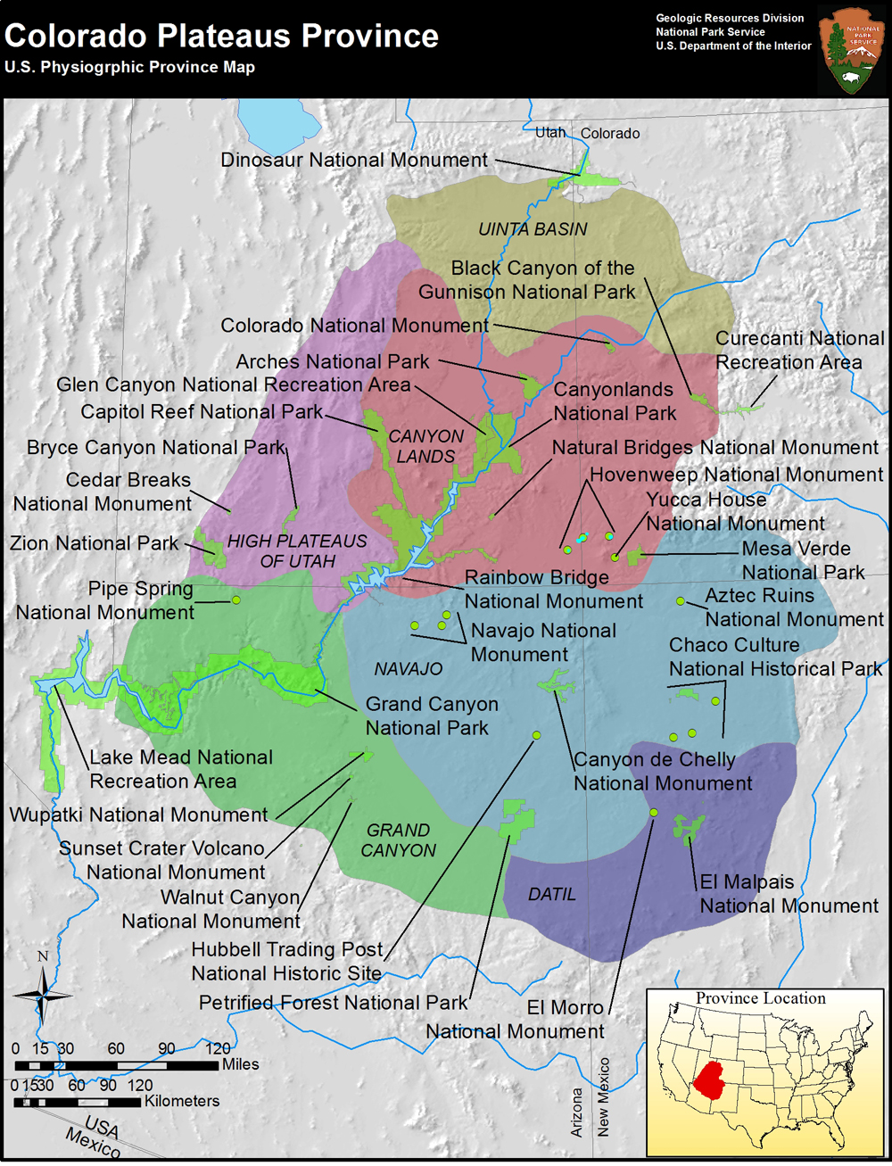
Chaco Culture National Historic Park is located in the southeastern portion of the Colorado Plateau, some 88 miles (142 km) as the crow flies from the Four Corners region. Chaco Canyon is one of hundreds of Ancestral Puebloan sites found across the 130,000-square-mile (337,000 square km) plateau. These ancient indigenous people created large population centers across the Colorado Plateau that show evidence of a very rich culture of art, trade, religion and the celestialsciences. Many suggest that Chaco Canyon was the epicenter of the Ancestral Puebloans' world.
Geological wonder
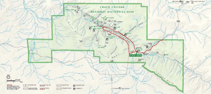
The park is situated totally within the San Juan Basin. This high scrubland desert canyon, with an average elevation of 6,175 feet (1,882 meters), has a general northwest-to-southeast alignment. It is surrounded by ancient dune fields, ridges and three mountain ranges: the Chuska Mountains to the west, the San Pedro Mountains to the east and the San Juan Mountains to the north. Chaco Canyon was carved over time by the Chaco Wash, a seasonal stream. The layout of the 10 Ancestral Puebloan pueblos scattered along 9 miles (14 km) of the Chaco Wash are considered to be the most significant of all ancient Colorado Plateau pueblo communities.
Preserving culture
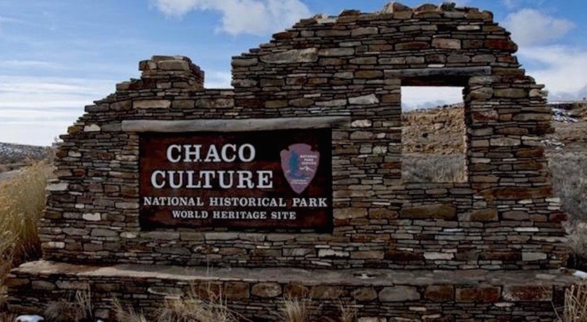
Some archeologists have long contended that the ruins of Chaco Canyon are the most significant ancient ruins in North America and even across the world. President Theodore Roosevelt recognized these alluring ruins in 1907 when he designated Chaco Canyon a national monument. The ruins were placed on the National Register of Historic Places in 1966.
In 1980, the boundary of the national monument was enlarged by 20 square miles (52 square kilometers) and the monument became the Chaco Culture National Historical Park. Finally, because of the exceptional architecture, skillfully engineered and constructed roads, and the influence that the Chaco culture had upon the people of the Four Corners area for more than four centuries, Chaco Canyon was recognized by UNESCO as a World Heritage Site in 1987. Today, Chaco Culture National Historic Park preserves more than 4,000 cultural sites reflective of habitation by Paleo-Indians, Ancestral Puebloans, Navajo, Hopi and the Euro-American occupation.
Pueblo Bonito
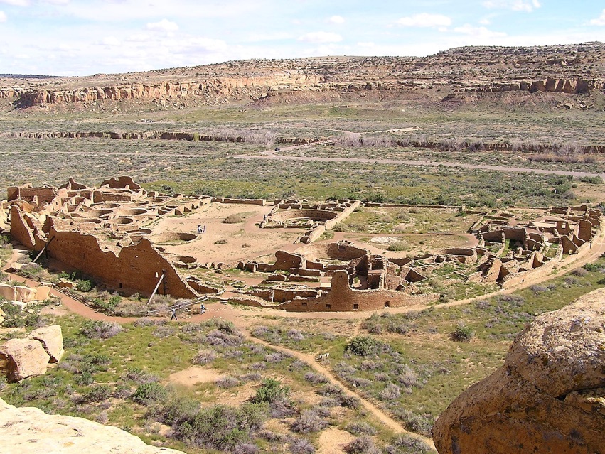
The uniquely D-shaped Pueblo Bonito (Spanish for "beautiful town") is the most famous and largest of all Chacoan great houses, hosting more than 350 ground floor rooms, three great kivas and 32 smaller kivas. At its peak, Pueblo Bonito rose some four stories along the arc of north side rooms with interior rooms from one -- three stories high. Pueblo Bonito was first occupied from the mid-850s A.D. until the early 12th century. Like all the other major structures found in Chaco Canyon, Pueblo Bonito was built with an internal geometry that aligns it to the relationships of the solar and lunar cycles. Itsnorthern back wall is built along a perfect east-west axis. In addition, Pueblo Bonito is located near the center of Chaco Canyon and plays a crucial role in the astronomical solar/lunar alignment of 10 other Chaco Canyon great houses.
Ceremonial role
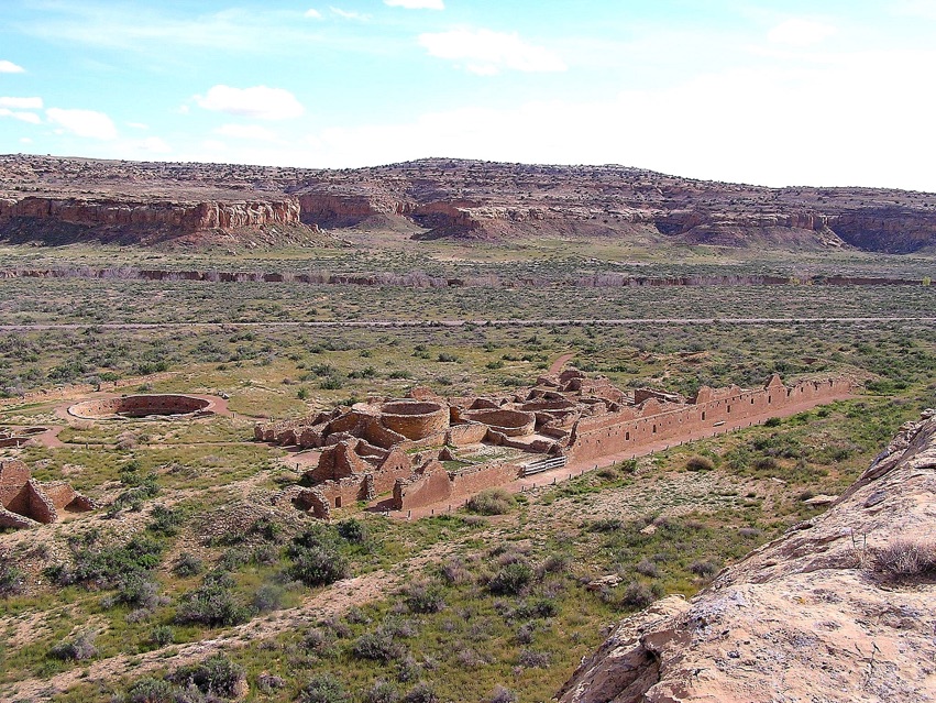
The Chaco great houses found along a 9-mile (14 km) beltof the canyon floor are astronomically aligned. Some are positioned with the 18.6-year cycle of the maximum and minimum moonrise and moonset, while others were set up cardinally. Archeologist think that many of the great houses served as temples with people throughout the region making annual pilgrimages to the Chaco kivas for ceremonial activities. Chetro Ketl, shown here, contains some 500 rooms, and a Great Kiva, also found here, illustrates how the great houses of Chaco Canyon served during this time as the spiritual, administrative and economic capital of the American Southwest.
Chacoan construction
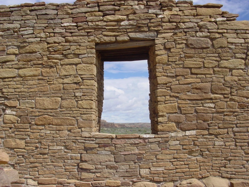
The many spectacular great houses found along Chaco Canyon remain a modern-day testament to the fact that the Chaco people were very skilled masons. Their pueblos were built in sections over hundreds of years, and archaeological architects have identified seven evolving styles. The vast majority of the great houses were built with slabs of sandstone rocks, specifically quarried and preciously stacked as if the Chacoans were following some magnificent ancient blueprint. These designs and styles allowed the people to build strong, multi-storied structures with a large number of interconnecting rooms. It is estimated that more than 240,000 ponderosa pine, Douglas fir, spruce and aspen trees were used in the construction of the floors and the roofs of the Chaco great houses. The average weight of these logs was more than 600 pounds ( 272 kilograms). Since the Chacoans had no beasts of burden (horse, oxen, mules or even cows), metal tools, nor did they know of the wheeled cart, these timbers were simply carried from forests that were upwards of 40 to 60 miles (64 to 97 km) from Chaco Canyon.
Get the world’s most fascinating discoveries delivered straight to your inbox.
Network of roads
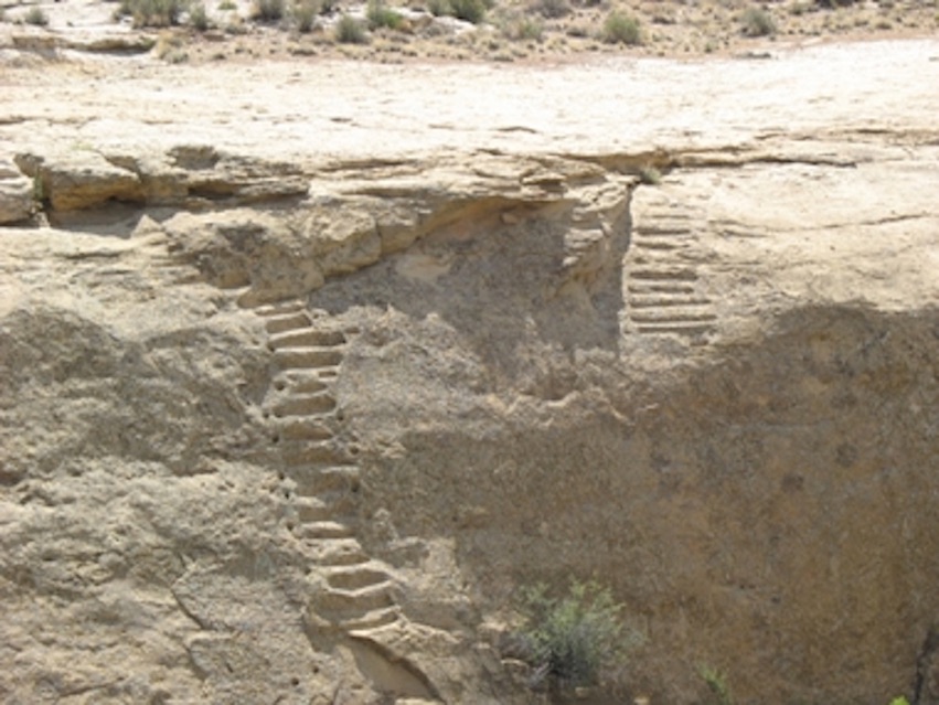
Another stunning achievement of the Chaco people was their large and carefully engineered series of roads found both within the canyon and extending from the canyon to the far outlying Chaco villages. Some 250 miles (400 km) of road were built by these industrious people. Within the canyon, the roads were about 15 feet (4.6 m) wide, while the roads leaving the canyon were nearly twice as wide. These roads are incredibly straight and when they come to a mesa or cliff face, steps (like the ones shown here) were cut, never wavering from the road's straight alignment. Why would a people with no beast of burden nor wheeled carts build such an extensive system of wide roads? Archeologist can only speculate that the roads were used for large ceremonial and religious parades, yet their actual purpose may forever be lost in the dust of history.
Cosmic connection
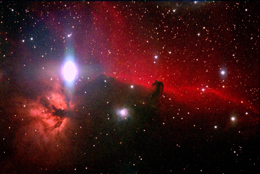
Archeologist and astronomers both agree that Chaco Canyon just might be the greatest example of an archaeoastronomy site found anywhere in the world. The scientific knowledge and mathematics needed to accurately position and then build each of their great pueblos aligned with the cosmos would take generations of astronomical observations. Some suggest the mathematics for such construction came from trade and influences of the Mayan people of the Yucatan. Whatever the origin, the ancient people of Chaco were an intelligent and creative people. Today, the Chaco Observatory continues the centuries-long tradition of watching the nighttime sky started by the ancient Chacoans. This photo, of the famous Horsehead Nebula, was taken by one of the telescopes working at the Chaco Observatory.
Dark skies
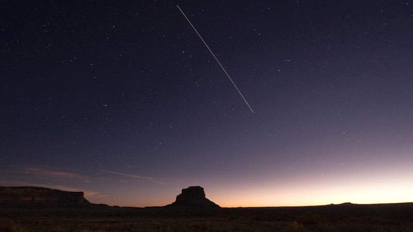
The Chaco Culture National Historic Park was designated a "gold-tier" Dark Sky Park by the International Dark-Sky Association in 2013. The park's observatory staff oversees the Chaco Night Sky Program, which aims to not only educate but also continue to advocate for the elimination of the effects of light pollution upon the park's amazing nighttime sky. Some 14,000 visitors come to the Chaco Observatory each year for the superior views of the cosmos that can be seen here. These dark skies are threatened by recent coal mining activities on nearby federal lands of the San Juan Basin.
Impressive archaeoastronomy
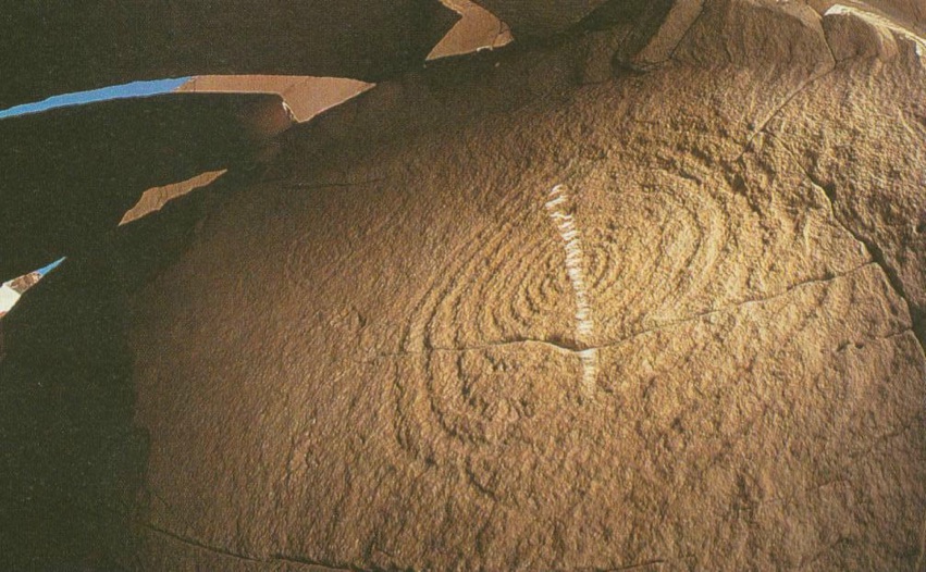
At the 480-foot (146 m) summit of Fajada Butte is found one of Chaco Canyon's most impressive archaeoastronomy sites. Here, the ancient Chacoans perfectly aligned three large slabs of sandstone for specific astronomically significant days, like the seasonal equinoxes and solstices. On these days, a narrow shaft of light falsl upon two, spiral petroglyphs. This light, shown here and known as the Chaco Sun Dagger, also tracks an 18 1/2-year lunar cycle. Such an astronomical site is found nowhere else among North American Indian cultures. But, such solar/lunar sites were once common to the Toltec and Mayan people of central and southern Mexico. For many archeologists, the Chaco Sun Dagger, along with the copper bells, mother-of-pearl and macaw feathers found among Chaco ruins, confirms the theory that Chaco Canyon was once the terminus of the great Toltec trade route.


