NASA Satellite Reveals Source of El Niño-Fueled Carbon Dioxide Spike
For every ton of carbon dioxide emitted by a power plant's smokestack or a car's exhaust pipe, some portion will stay in the Earth's atmosphere, raising global temperatures, while the rest is absorbed by the oceans or ecosystems on land.
But which parts of the ocean or biosphere act as net sources of carbon dioxide (CO2) and which take up more than they emit into the atmosphere, has been an open question. Figuring that out, as well as understanding what mechanisms govern that interplay and how they might change along with the climate, has been an open question and one that is key to understanding how global warming will progress.
The 2014 launch of the Orbiting Carbon Observatory-2 satellite was aimed at beginning to piece together some answers by monitoring the comings and goings of CO2 from the atmosphere with unprecedented precision and over large regions. [The Reality of Climate Change: 10 Myths Busted]
So far, the mission has done that and has turned up some surprises along the way. The mission serendipitously coincided with one of the strongest El Niños (an ocean and atmosphere cycle that impacts global weather) on record, allowing scientists to see how the carbon cycle responded and pinpoint exactly where the resulting record pulse of CO2 that entered the atmosphere came from. The satellite's instruments also unexpectedly proved capable of distinguishing the relatively small CO2 signatures of cities and even volcano plumes.
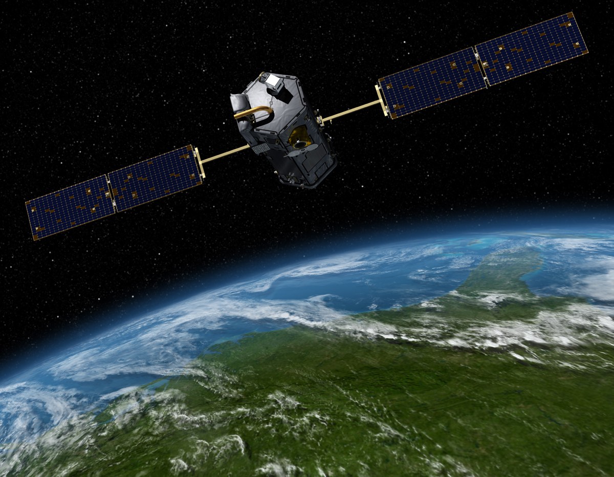
"We're very, very happy with these results," deputy project scientist Annmarie Eldering, of NASA's Jet Propulsion Laboratory, told Live Science.
But the findings, described in series of five papers in the Oct. 13 issue of the journal Science, are just the first steps at getting a better handle on the carbon cycle (how carbon flows through land and sea ecosystems and the atmosphere), as OCO-2 heads into an expected extended mission and other space-based projects are scheduled to follow in its wake.
Luck and surprises
Carbon dioxide is added to and removed from the atmosphere by a range of competing processes. On land, for example, the photosynthesis of plants takes up CO2, while the decay of plant matter and wildfires release it back into the atmosphere. [Here's How Carbon Dioxide Warms the Planet]
Sign up for the Live Science daily newsletter now
Get the world’s most fascinating discoveries delivered straight to your inbox.
Scientists knew that El Niños were another factor that caused more CO2 to build up in the Earth's atmosphere, and from the 1997-1998 major El Niño, they had some suspicions on why that was. For one thing, El Niño tends to lead to drying in parts of the tropics, resulting in less photosynthesis and less uptake of carbon dioxide.
What project scientists couldn't know when the satellite rocketed into space on July 2, 2014, was that it would be perfectly poised to observe how one of the strongest El Niños in the books affected the carbon cycle.
"Sometimes you get really lucky," said Galen McKinley, a carbon cycle scientist at Columbia University's Lamont Doherty Earth Observatory.
These effects were in evidence during the 2015-2016 event, which caused the biggest year-over-year jump in global CO2 concentrations on record, according to the National Oceanic and Atmospheric Administration. But OCO-2 revealed, as is so often the case in science, that the picture was more complicated than previously thought. [CO2 Satellite: NASA's Orbiting Carbon Observatory-2 Mission in Photos]
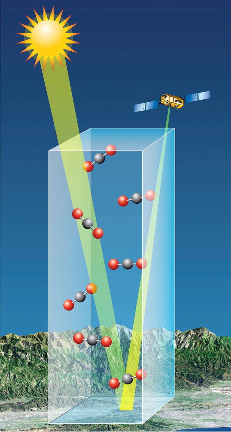
The satellite's observations let project scientists piece together the sequence of events of the carbon cycle's response as the El Niño geared up and then reached its peak. They saw that at first there was a tiny dip in carbon dioxide levels over the tropical Pacific because of changes in the structure of the underlying ocean that meant waters gave off less CO2. But that slight decrease was quickly overtaken by the much larger response from terrestrial biomass as drought, heat and wildfires took a toll and caused less CO2 to be absorbed and more to be released. [Top 10 Deadliest Natural Disasters in History]
The ocean signal "was really a big surprise to us," said Abhishek Chatterjee, a scientist with University Space Research Association working at NASA's Goddard Spaceflight Center. The response had been inferred before, "but it was never observed to the degree that we could" with OCO-2, he said.
The team was able to take the analysis a step further by using OCO-2's capability to detect a signature of photosynthesis, which is a marker of the productivity of land plants. Together, the data showed that while the tropical areas of Southeast Asia, South America and Africa all added about the same amount of CO2 into the atmosphere, they did so for different reasons. In Southeast Asia, the hot, dry conditions brought on by El Niño made the region more vulnerable to fire, which releases CO2 into the atmosphere. In South America, dry conditions tamped down plant productivity, meaning the biosphere took up less carbon dioxide, so that the region became a net source of CO2. And in Africa, while rainfall was about normal, exceptional heat increased plant respiration, which caused more CO2 emissions.
More work to do

OCO-2 sensors were also surprisingly good at picking out much smaller CO2 signatures, such as the plume of Vanuatu's Yasur volcano and the contrast between Los Angeles' relatively higher CO2 levels compared with the surrounding suburban and rural areas. [Earth from Above: 101 Stunning Images from Orbit]
The satellite could also see how the difference between the urban core and rural areas declined in the summer because plants in the region took up some of the excess.
The ability of satellites to pinpoint these signatures has implications for a wide range of applications, including monitoring emissions to make sure cities and countries are complying with their pledges to reduce CO2. Satellite CO2 measurements could also provide earlier warnings of volcanic eruptions, said Florian Schwandner, also of NASA's JPL, as CO2 emissions from volcanoes increase before an eruption.
OCO-2 has completed its initial two-year planned mission and is expected to begin a three-year extended mission once NASA officials sign off on it, said Eldering, the deputy project scientist.
Scientists are also hoping that two other planned missions go as scheduled to build on OCO-2's work. One, called OCO-3, will use leftover spare parts from OCO-2 and would be mounted on the International Space Station to allow scientists to point at features of interest. That mission has been slated to be cut by the Trump administration, though it remains to be seen whether Congress will go along with that plan.
The other, called the Geostationary Carbon Cycle Observatory, would be able to measure CO2 over continuous areas, such as the U.S., something OCO-2 can't do.
"It's very exciting science, [but] there's a lot more work to do," McKinley said.
Original article on Live Science.

Andrea Thompson is an associate editor at Scientific American, where she covers sustainability, energy and the environment. Prior to that, she was a senior writer covering climate science at Climate Central and a reporter and editor at Live Science, where she primarily covered Earth science and the environment. She holds a graduate degree in science health and environmental reporting from New York University, as well as a bachelor of science and and masters of science in atmospheric chemistry from the Georgia Institute of Technology.


