Hurricane Lane Looms Over Hawaii in These Astronaut and Satellite Photos
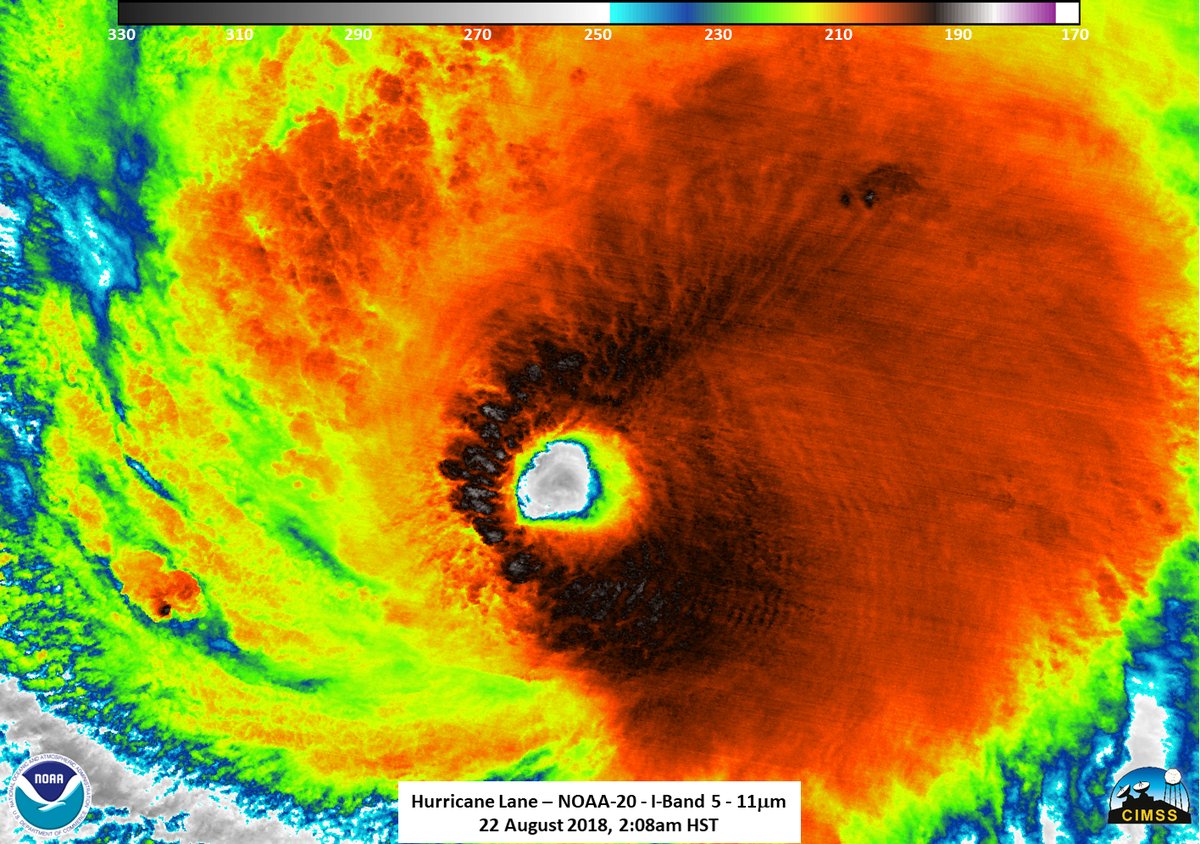
The hurricane, which is forecast to begin pummeling the islands later today (Aug. 22), has already prompted the governor of Hawaii to declare a state of emergency, and views from space offer a shocking look at just how daunting the storm is. It was briefly a Category 5 storm but has now been downgraded to a Category 4.
Today, NASA astronaut Ricky Arnold tweeted two photographs showing the view of the storm from the International Space Station and offered best wishes to people in Hawaii.
NASA's Twitter account dedicated to the space station also shared a video showing the huge size of the hurricane. The video includes two different perspectives from the space station, both of which highlight the clear eye of the storm at the heart of the giant knot of clouds.
Right now, meteorologists are expecting that the storm's center will pass uncomfortably close to the state between today and Saturday (Aug. 25).
Hawaii is expected to experience extremely powerful winds, heavy rain, storm surge and potentially even tornadoes and waterspouts as the hurricane progresses, according to a statement from the National Oceanic and Atmospheric Administration's (NOAA) National Weather Service.
A fleet of government satellites is also working to support the meteorologists watching Hurricane Lane strengthen and approach Hawaii.
Those include NASA's Terra satellite, which gathers infrared data that tells scientists how hot storm clouds are — a crucial piece of information for understanding the probability of serious thunderstorms and heavy rainfall.
Sign up for the Live Science daily newsletter now
Get the world’s most fascinating discoveries delivered straight to your inbox.
The Geostationary Operational Environment Satellite, which is operated via a partnership between NASA and NOAA, is also hard at work observing the storm using visible and infrared light and watching for flashes of lightning.
A third satellite, co-run with the Japan Aerospace Exploration Agency and called the Global Precipitation Measurement mission, can build 3D models of the storm. The models will give scientists a better understanding of the cloud structure inside the hurricane.
Taken together, this satellite data can help meteorologists better predict what the storm will do and how the residents of Hawaii can stay safe.
Email Meghan Bartels at mbartels@space.com or follow her @meghanbartels. Follow us& @Spacedotcom, Facebook and Google+. Original article on Space.com.
Meghan is a senior writer at Space.com and has more than five years' experience as a science journalist based in New York City. She joined Space.com in July 2018, with previous writing published in outlets including Newsweek and Audubon. Meghan earned an MA in science journalism from New York University and a BA in classics from Georgetown University, and in her free time she enjoys reading and visiting museums. Follow her on Twitter at @meghanbartels.

