Hurricane Lane Bears Down on Hawaii
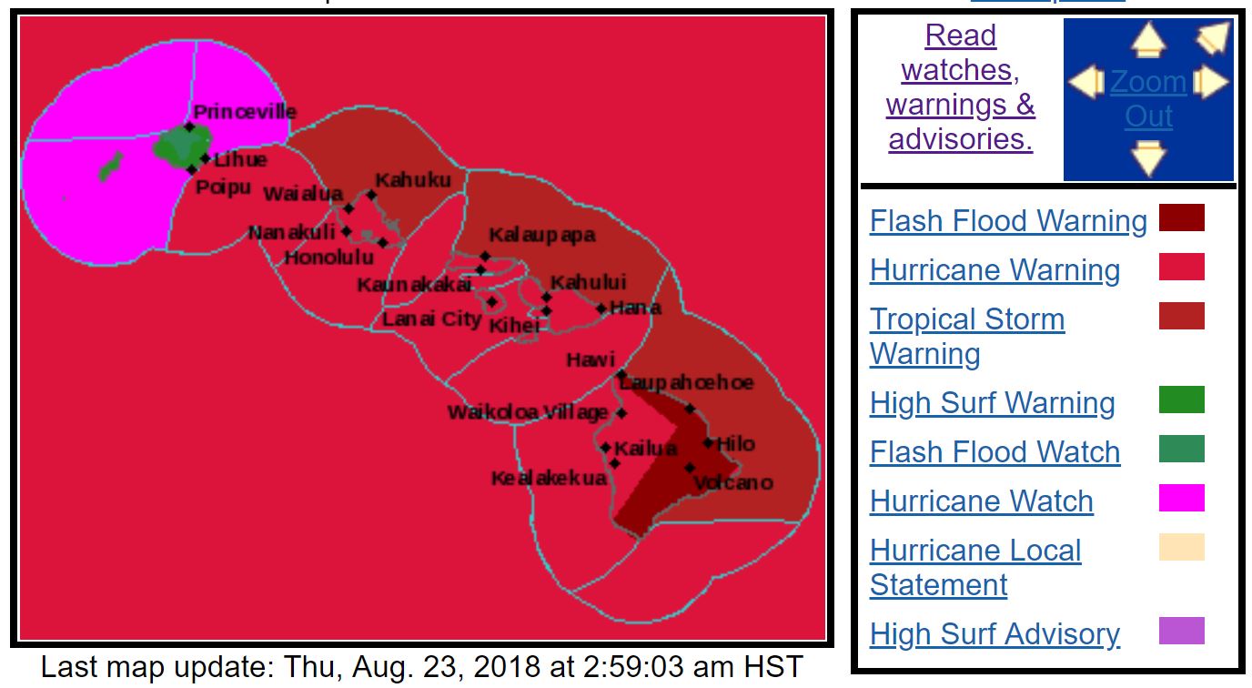
Hurricane Lane, a Category 4 storm in the central Pacific Ocean with 150 mph (241 km/h) winds, is now lashing Hawaii with rain and tropical-storm-force winds from its outer bands as it approaches the state, according to the National Weather Service (NWS). The peak of the storm is likely to arrive sometime today or tomorrow (Aug. 23 or 24), depending on the storm's track. [Hurricane Season 2018: How Long It Lasts and What to Expect]
The NWS issued a flash flood warning for Hawaii's Big Island and other hurricane-related warnings and alerts for the rest of the state. Hawaii Gov. David Ige announced that President Donald Trump had approved his request for a federal disaster declaration, freeing up funds and resources to help the state. Ige also warned Hawaii residents, who haven't experienced a major hurricane since Hurricane Iniki killed six people and caused $1.8 billion in damage back in 1992, that the storm's heavy rainfall would cause dangerous floods and landslides, and urged people not to attempt to cross moving water.
It's not yet clear from forecast maps whether Lane will actually make landfall, meaning that its eye wall crosses over land, in Hawaii.
However, the NWS has said that the storm, which is more than 200 miles (322 kilometers) wide, will cause significant dangerous weather in Hawaii even if it only skirts the state.
CNN reported that state officials were encouraging people outside coastal evacuation zones to shelter in place with enough supplies for two weeks after the storm. Many state workers were sent home indefinitely, according to CNN, and buses had been dispatched to pick up vulnerable people in Honolulu and move them to the state's limited public shelters.
The state has published a guide on storm preparedness for Hawaiians.
Original article on Live Science.
Sign up for the Live Science daily newsletter now
Get the world’s most fascinating discoveries delivered straight to your inbox.


