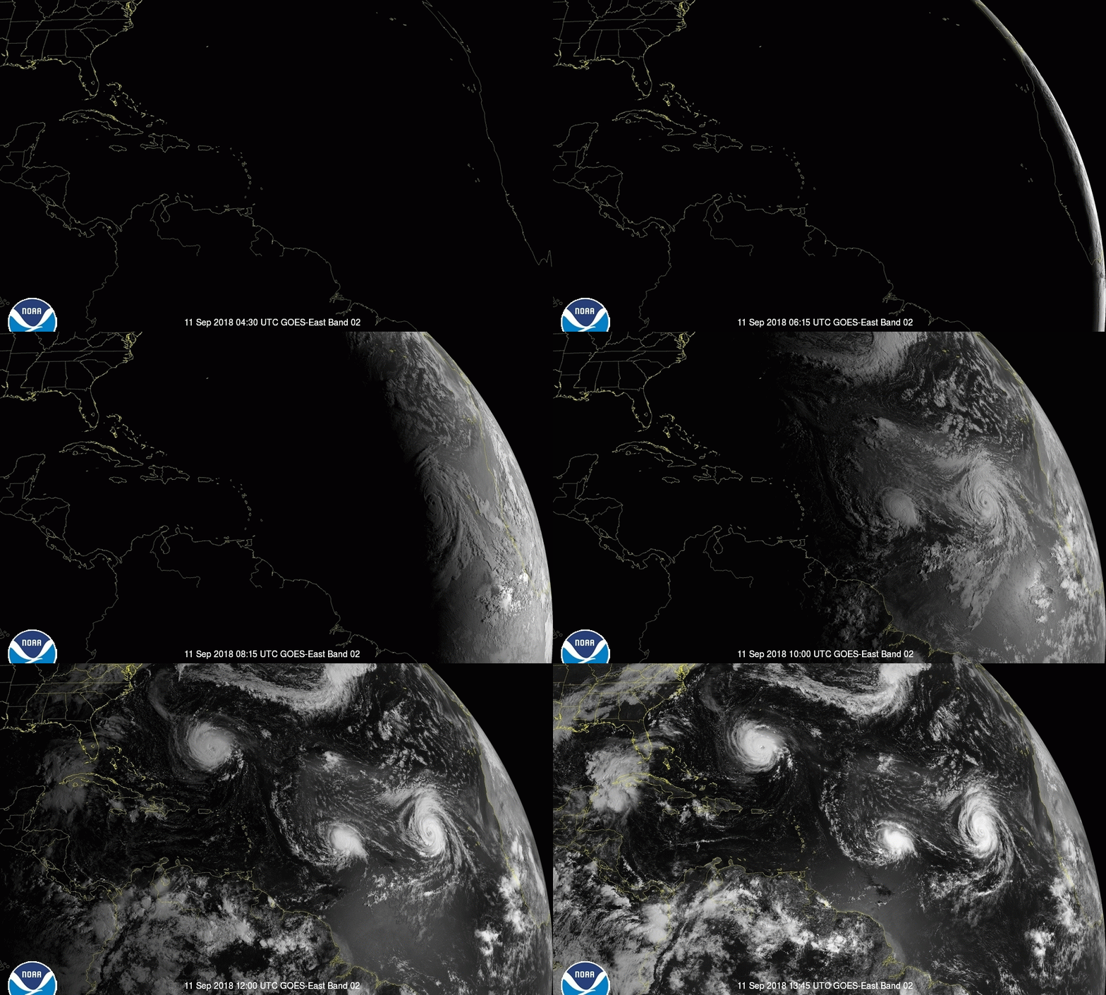
New Eye Means Hurricane Florence May Get Stronger Before Slamming into the US

Hurricane Florence's eye wall has grown since yesterday, now measuring approximately 35 to 40 miles (48 to 56 kilometers) in diameter, according to a report issued this morning (Sept. 11) by the National Hurricane Center (NHC).
The larger eye increases the storm's stability, "with the potential for some additional slow strengthening over the next 24 hours," Stacy Stewart, an NHC senior hurricane specialist, said in a Facebook Live update.
Hurricane-force winds whip around Florence's larger core, traveling at speeds of at least 74 to 95 mph (120 to 150 km/h) and reaching outward from the eye to a distance of about 40 miles (64 km), NHC Director Ken Graham said in the update. Tropical storm-force winds — 39 to 73 mph (63 to 118 km/h) — further extend Florence's reach; these winds surround the eye to a distance of 150 miles (240 km) from the center, according to the report. [Hurricane Florence: Photos of a Monster Storm]
Yesterday (Sept. 10), as Florence drew closer to the coastal U.S., the hurricane's eye reorganized, a process known as an eye-wall-replacement cycle, Stewart explained. These cycles occur naturally in major hurricanes; when some storms reach a certain level of intensity, their eyes contract to diameters of about 5 to 15 miles (10 to 25 km), according to the Atlantic Oceanographic and Meteorological Laboratory (AOML).
At the same time, an outer eye wall can take shape around the central eye from a ring of thunderstorms, which siphon moisture and momentum from the innermost vortex. This can cause a temporary weakening of the storm, AOML explained. But eventually, the inner eye dissipates, replaced by the outer eye wall, and the storm can restrengthen.
Changes in Florence's eye are visible in an animation of the storm captured by satellite cameras in the microwave spectrum, shared on Twitter earlier today by Michael Ventrice, a meteorological scientist with IBM's The Weather Company.
Florence's new eye appears to be stable enough that the storm is unlikely to undergo another eye-wall-replacement cycle; this means that Florence can continue to build in power, which could spell trouble for the U.S. states that lie in the storm's path, Stewart said in the report.
Sign up for the Live Science daily newsletter now
Get the world’s most fascinating discoveries delivered straight to your inbox.
Based on the latest models of that path, Florence is expected to hold together to points well inland as it moves into North Carolina. Virginia, Maryland and Delaware will also face much of the hurricane's power, Graham said. Florence brings a double threat of flooding from both rainfall and storm surges, with rainfall accumulations of up to 30 inches (76 centimeters) anticipated in some areas and storm surges from 10 to 12 feet (3 to 4 meters) predicted, according to the NHC.
Original article on Live Science.

Mindy Weisberger is an editor at Scholastic and a former Live Science channel editor and senior writer. She has reported on general science, covering climate change, paleontology, biology and space. Mindy studied film at Columbia University; prior to Live Science she produced, wrote and directed media for the American Museum of Natural History in New York City. Her videos about dinosaurs, astrophysics, biodiversity and evolution appear in museums and science centers worldwide, earning awards such as the CINE Golden Eagle and the Communicator Award of Excellence. Her writing has also appeared in Scientific American, The Washington Post and How It Works Magazine. Her book "Rise of the Zombie Bugs: The Surprising Science of Parasitic Mind Control" will be published in spring 2025 by Johns Hopkins University Press.


