Humans Crossed the Bering Land Bridge to People the Americas. Here’s What It Looked Like 18,000 Years Ago.

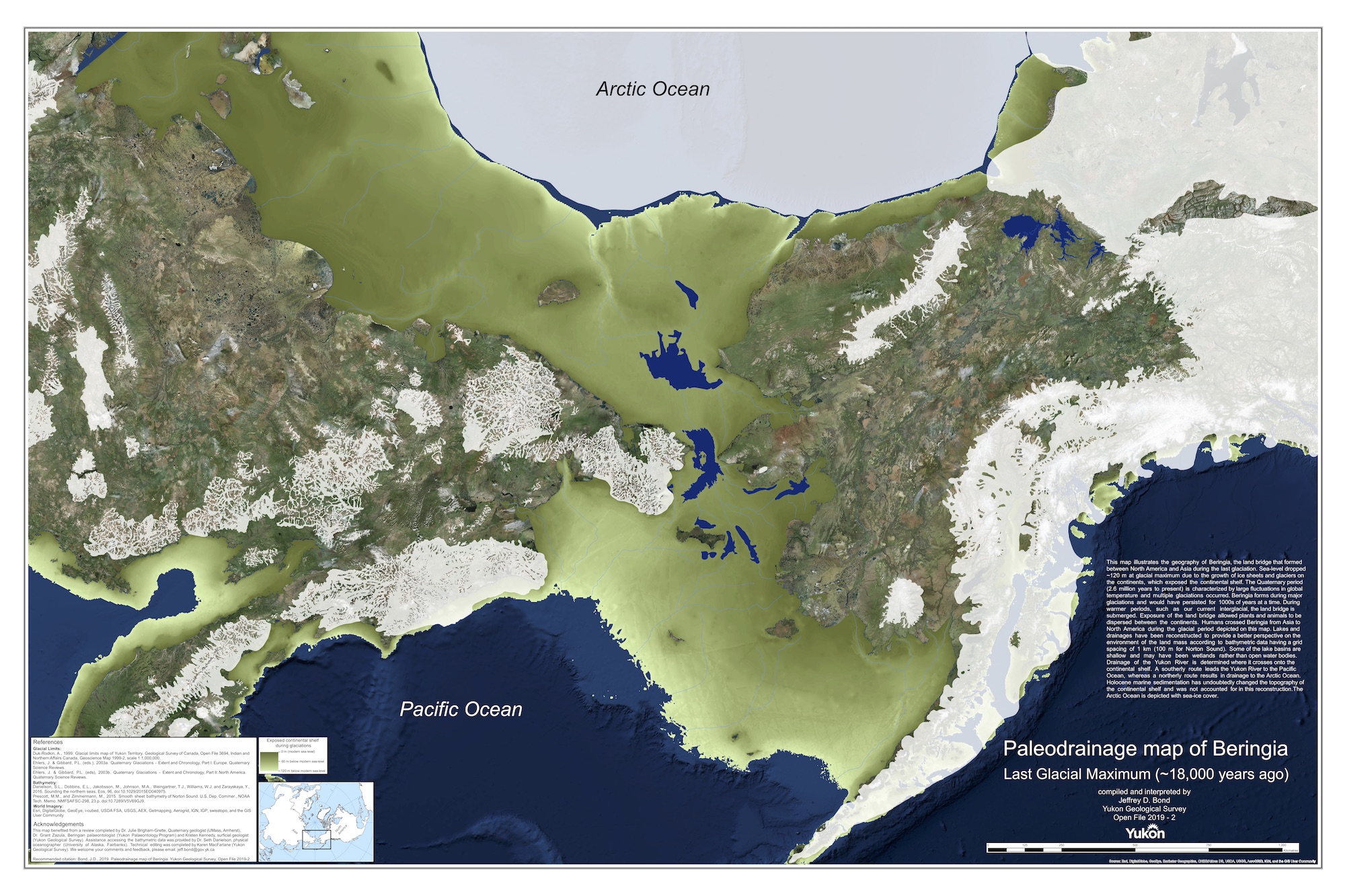
During the last ice age, people journeyed across the ancient land bridge connecting Asia to North America. That land is now submerged underwater, but a newly created digital map reveals how the landscape likely appeared about 18,000 years ago.
In fact, the map shows all of Beringia — the sprawling region that includes parts of Russia, known as western Beringia; Alaska, called eastern Beringia; and the ancient land bridge that connected the two.
The timing was nigh for a new Beringia map, said Jeffrey Bond, who studies the geology of ice age sediments at the Yukon Geological Survey in Canada. The 2008 map at the Yukon Beringia Interpretive Centre was out of date, and he wanted visitors, who come to learn about Beringia's ice age humans and animals, to get a better sense of what the region used to look like. [10 Extinct Giants That Once Roamed North America]
Moreover, two new datasets recently became available that helped Bond create the new map: Global satellite imagery from World Imagery, and a topography of the region's sea floor, produced by the University of Alaska Fairbanks.
"These two freely available datasets, along with the glacial limits (distribution of ice during the last glaciation), combined for a fantastic set of base layers to create a new map," Bond told Live Science in an email.
Although it's gone now, the Bering Land Bridge persisted for thousands of years, from about 30,000 years ago to 16,000 years ago, according to global sea level estimates, said Julie Brigham-Grette, a professor and department head of geosciences at the University of Massachusetts-Amherst. Brigham-Grette, who advised Bond on sea levels and geography, was one of the many scientists who offered helpful information to Bond during the making of the map.
"The drop at 30,000 years ago was very rapid with the build up of ice sheets over North America," Brigham-Grette told Live Science in an email. "So for most of the time from about 30,000 to 18,000 years ago, the land bridge was nearly 1,000 kilometers [620 miles] wide in the north-south direction."
Sign up for the Live Science daily newsletter now
Get the world’s most fascinating discoveries delivered straight to your inbox.
That's why, in part, Bond chose to portray Beringia at 18,000 years ago, he said. After that, the ice began to recede and sea levels began to rise.
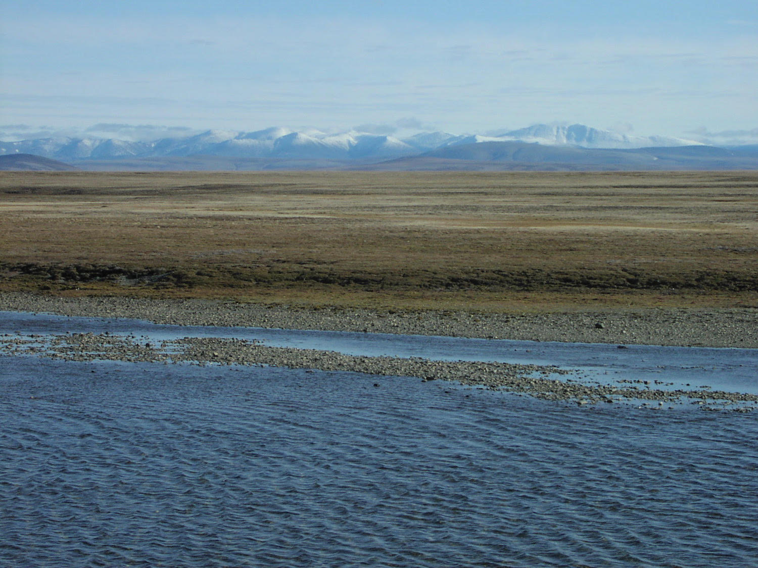
At 18,000 years ago, Beringia was a relatively cold and dry place, with little tree cover. But it was still speckled with rivers and streams. Bond's map shows that it likely had a number of large lakes.
"Grasslands, shrubs and tundra-like conditions would have prevailed in many places," Bond said. These environments helped megafauna — animals heavier than 100 lbs. (45 kilograms) — thrive, including the woolly mammoth, Beringian lion, short-faced bear, grizzly bear, muskox, steppe bison, American scimitar cat, caribou, Yukon horse, saiga antelope, gray wolf and giant beaver, according to the Yukon Beringia Interpretive Centre.

This vast, open region allowed megafauna and early humans to live off the land, Brigham-Grette said. However, it's still a mystery exactly when humans began crossing the land bridge. Genetic studies show that the first humans to cross became genetically isolated from people in East Asia between about 25,000 to 20,000 years ago. And archaeological evidence shows that people reached the Yukon at least 14,000 years ago, Bond said. But it's still unclear how long it took the first Americans to cross the bridge and what route they took.
"The fact that this land bridge was repeatedly exposed and flooded and exposed and flooded over the past 3 million years is really interesting because Beringia, at its largest extent, was really a high latitude continental landscape in its own right," Brigham-Grette said.
Now that the Bering Strait is filled with water, it's a gateway linking the Atlantic to the Pacific oceans through the Arctic Basin. "There are few places like it on our planet that have such a complex paleo geography," Brigham-Grette said.
To download a free digital version of the new map, visit here.
- Photos: Is Ice Age Cat Mummy a Lion or a Lynx?
- Photos: Ice Age Mammoth Unearthed in Idaho
- Photos: Ice-Age Animal Bones Unearthed During LA Subway Construction
Originally published on Live Science.

Laura is the archaeology and Life's Little Mysteries editor at Live Science. She also reports on general science, including paleontology. Her work has appeared in The New York Times, Scholastic, Popular Science and Spectrum, a site on autism research. She has won multiple awards from the Society of Professional Journalists and the Washington Newspaper Publishers Association for her reporting at a weekly newspaper near Seattle. Laura holds a bachelor's degree in English literature and psychology from Washington University in St. Louis and a master's degree in science writing from NYU.


