Cedar Break National Monument
The Mighty Five
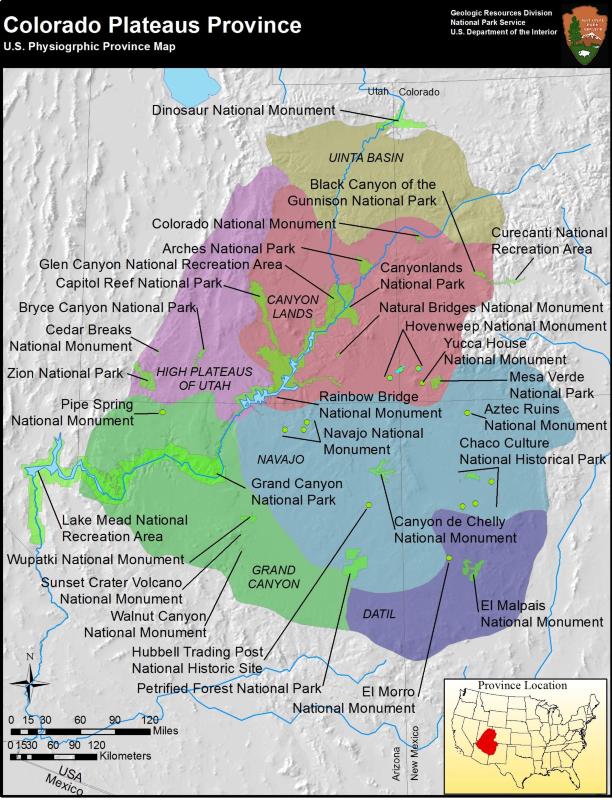
"The Mighty Five" — Zion, Bryce, Capitol Reef, Canyonlands and Arches — are the five spectacular national parks found within the State of Utah. All are found on the Colorado Plateau which is the world's premier location to see, marvel and enjoy the creations of earth's geological history. The National Park Service oversees a total of 32 parks, national monuments, recreational areas and historic sites, shown above, that are located on the Colorado Plateau, many rivaling the geological beauty of Utah's Mighty Five. Cedar Breaks National Monument is one such geological paradise of the Colorado Plateau and well worth consideration for a summertime visit.
Breathtaking landscapes
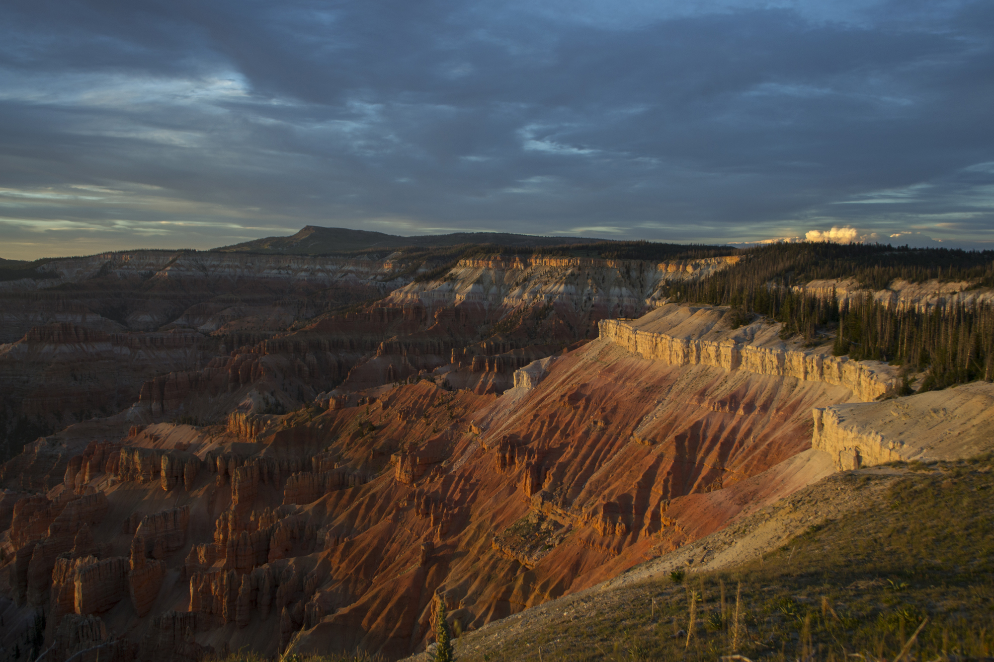
Cedar Breaks National Monument is a 6,155 acre (2,469 he) preserve of high desert landscapes. The park ranges in elevation from 10,662 feet (3,250 m) in the northern region to 8,100 feet (2,469 m) near Ashdown Creek on the western boundary. Cedar Breaks is the crown jewel of the Markagunt Plateau and marks the the top of the "Grand Staircase" of the Colorado Plateau. Long used by Archaic as well as the modern Paiute people, the land encompassing Cedar Breaks was described in 1868 by early Mormon settlers as "a paradise on the mountain."
Remote location
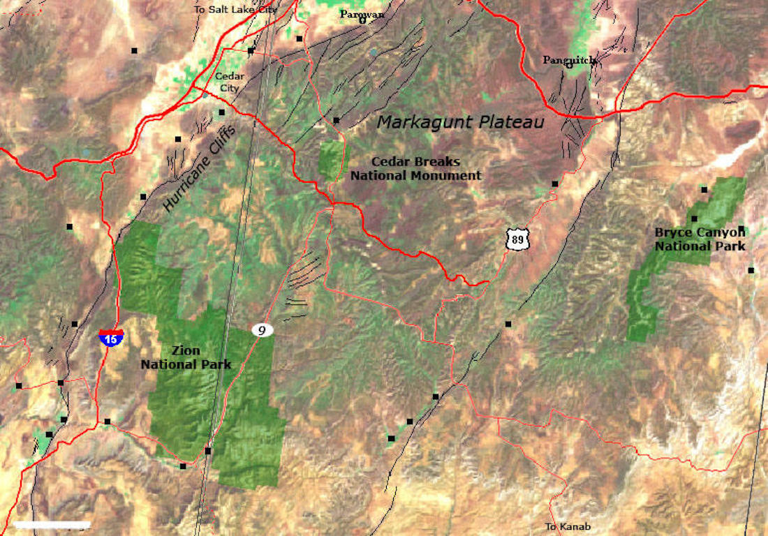
Even for this modern world, Cedar Breaks National Monument is located in a remote area. There are no park dining or lodging accommodations. The closest town is Brian Head, Utah, best known for its winter ski resorts and cool summer lodging, shopping and rentals. Due to the high average elevation, Cedar Breaks National Monuments and the roads that connect it to the outside world are usually closed from mid-November to late May. During the summer months the monument does offer a 28-site campground that has grills, restrooms, showers and fresh water. An overnight stay at the monument allows visitors to experience the regions world famous dark skies. Warm clothing and sunscreen are a must even during the days of summer.
Dramatic views
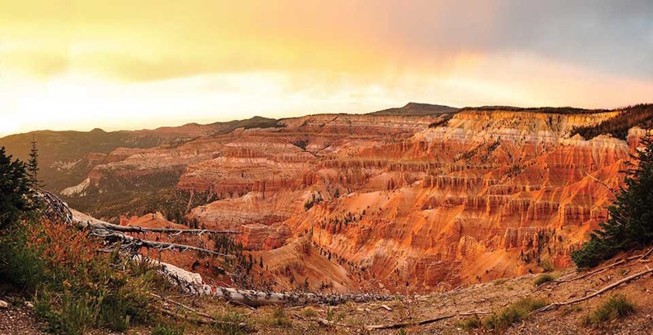
Cedar Breaks National Monument is home to some of the most dramatic desert erosional features on earth. The interactions of water, tectonic forces, climate and geology have resulted in a place of architectural magnificence on the landscape. Mesozoic rocks are the bedrock of Cedar Breaks underlying the entire monument region. The strata of the higher elevations are capped with Tertiary and Quaternary rocks which, due to glacial and periglacial processes of erosion are on spectacular display. The multi-colored geological amphitheater found at Cedar Breaks, shown above, eroded from the Claron Formation, shown above, is 2,500 feet (762 m) deep, 3 miles (5 km) wide with the highest point of the amphitheater's rim standing at 11,000 feet (3,353 m).
Ancient processes
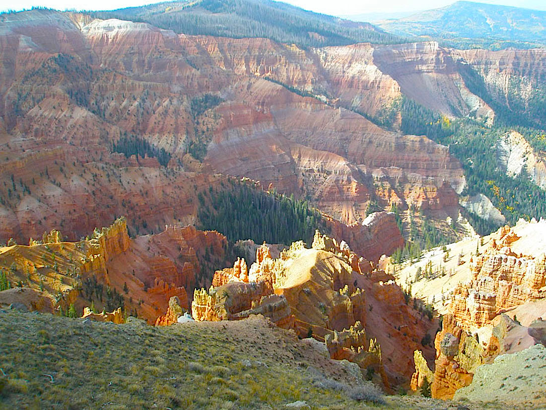
Even while gazing upon the colorful palette of weathered pinnacles and cliffs, the real story of Cedar Breaks are the multiple ancient seas, long-ago eroded mountain ranges, violent volcanoes and ancient seashores. Some 60 million years ago Lake Claron covered the region while local streams brought sand, silt and mud into the lake along with calcareous skeletons. Small amounts of iron in the deep sediment colored the layers into hues of red, orange and pink. Climatic changes over 25 million years slowly dried the area while volcanic activity and faulting due the rise of the modern Rocky Mountains all played a role in creating the landscape that is so magical today. All of this movement of the land actually has resulted in oyster and gastropod fossils being found in the older rocks of Cedar Breaks amphitheater nearly 11,000 feet ( 3,353 m) above sea level.
Nature's handiwork
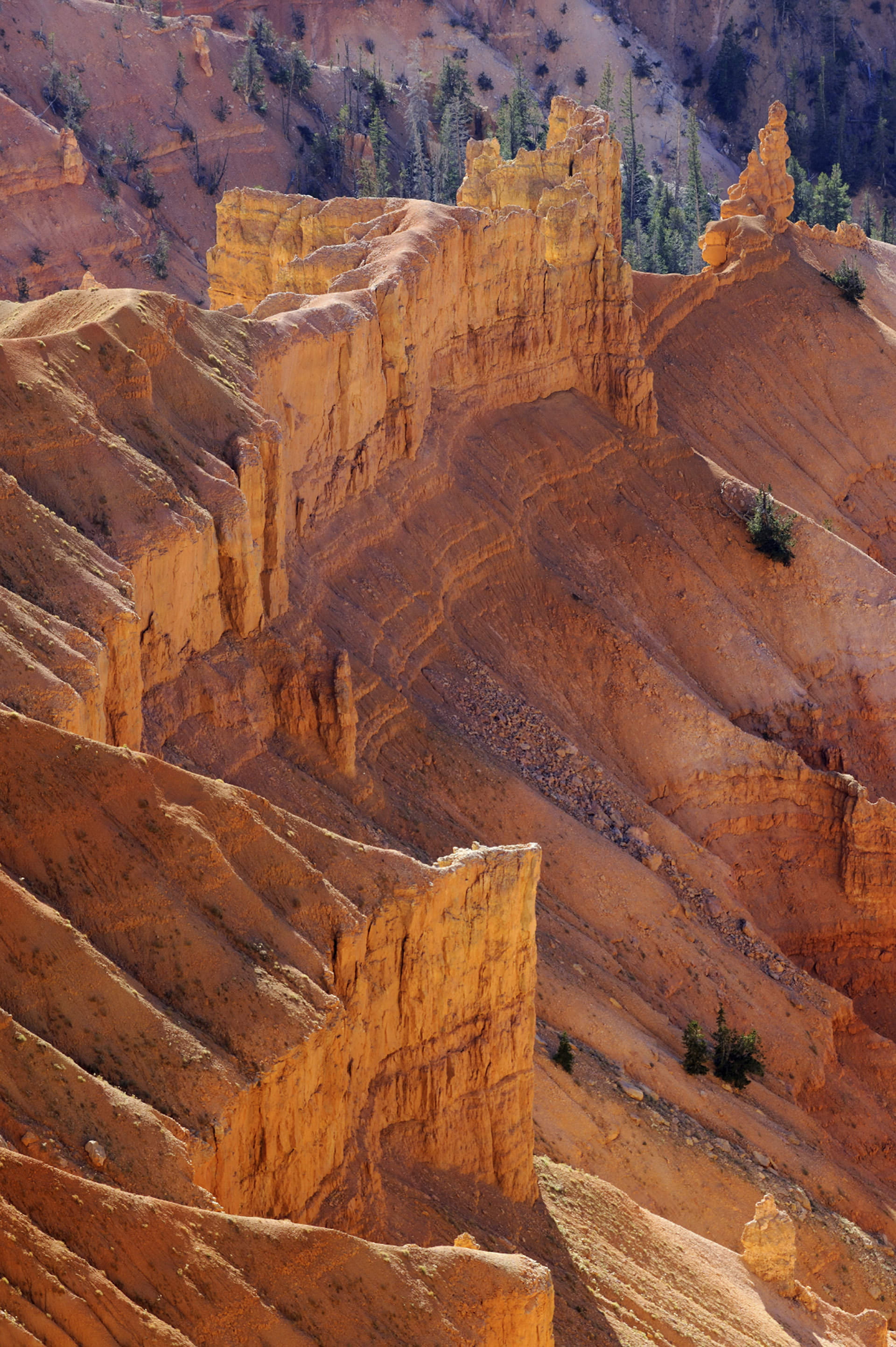
Weathering and erosion were the hands of nature that sculptured the multicolored cliffs, spires, pinnacles, and other unique features at Cedar Breaks. Without such geologic processes, Cedar Breaks would be just another of the many alpine plateaus so common in the American West. Thousands of years of freezing and thawing of water has acted as a wedge to pry the rocks apart while chemical alteration and dissolution of minerals from percolating ground and surface water have resulted in the dramatic fins, shown above, arches and hoodoos of Cedar Breaks that visitors from around the world come to see today. The landscape of Cedar Breaks National Monument has been under construction for nearly 100 million years and those slow moving forces of nature continue to shape and reshape the landscape today.
Ancient population
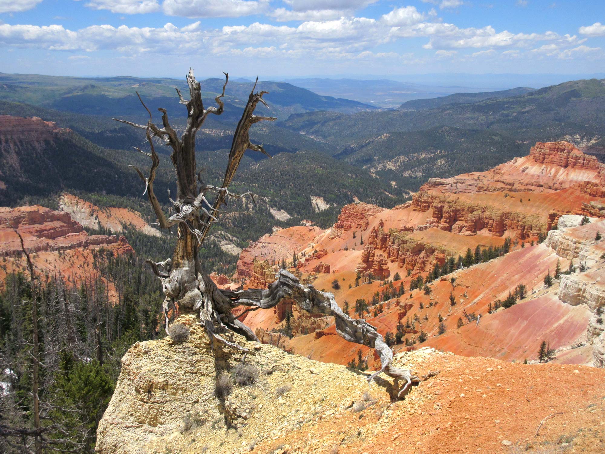
Archeologist believe that the Southern Paiute people have lived in the Cedar Breaks region since at least 1100 CE. They called the giant amphitheater "u-map-wich" which when translated to English means "place where the rocks are sliding down" The Paiutes believed that the stone hoodoos seen in the amphitheater were actually people who had done bad things and were punished by being frozen into stone. Earliest American settlers called the area "the badlands" or "breaks" in reference to common cliff like edges that they came upon while traveling across the relatively flat plateaus. These "breaks" often cause time-consuming and dangerous detours as settlers sought ways to travel around them. Utah juniper trees, Juniperus osteosperma, were the common vegetation of the area and early settlers incorrectly called these trees "cedars" thus soon giving rise to the name Cedar Breaks for the entire area. Shown above, the remains of a "cedar" tree stands at the edge of a "break" in the plateau.
Stargazing destination
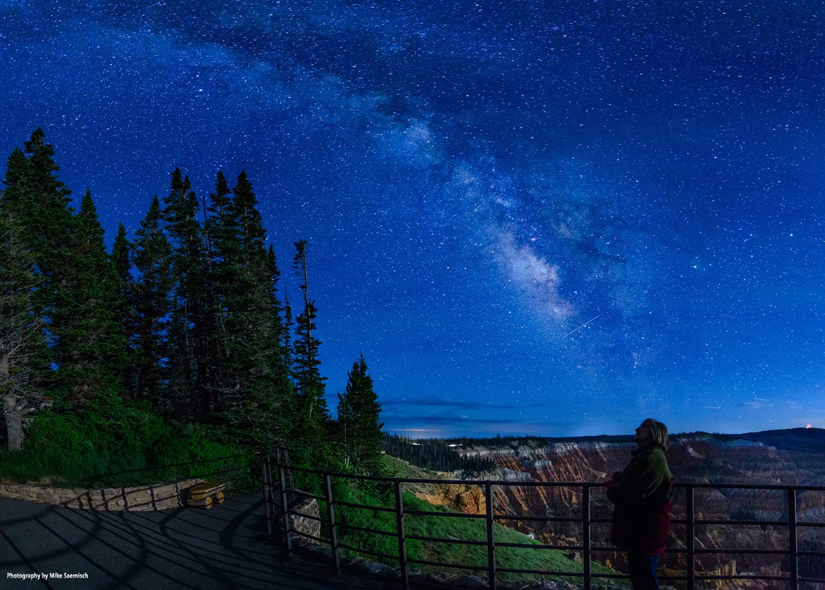
An incredible dark sky is one of the real attractions for tourists to visit Cedar Breaks National Monument. In January 2018 the monument was designated a Dark Sky Park by the International Dark Sky Association. Cedar Breaks is the 16th of the 417 National Park Service units to be so designated. In fact, the State of Utah now has seven, designated IDA Dark Sky Parks, more than any other American state. To become an IDA International Dark Sky Park the land must possess "an exceptional or distinguished quality of starry nights and a nocturnal environment that is specifically protected for its scientific, natural, educational, cultural heritage, and/or public enjoyment."
Mammal crowd
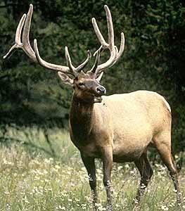
Since Cedar Breaks lacks the large crowds of tourists, wildlife can often be seen and enjoyed. The high elevation of the national monument results in no species of native fish in the area, only 1 species of amphibian — the western chorus frog, Pseudacris triseriata — and 1 species of reptile — greater short horned lizard, Phrynosoma hernandesi. Bird species that naturally visit or live within the park number 108 while 50 species of mammals are known to frequent the park. Mountain lion, black bear, mule deer and elk, shown above, are the park's dominate large animals.
Trees, trees everywhere

The flora of Cedar Breaks is a typical mixture of spruce/fir forest and subalpine meadows. Wildflowers like the ones shown above bloom in profusion during the summer months with the national monument holding an annual Cedar Breaks Wildflower Festival each July. Utah Juniper, Douglas Fir, Pseudotsuga menziesii, Engelmann Spruce, Picea engelmanii, and Limber Pine, Pinus flexilis, make up a diverse and dense forested region. At the highest of elevations, the ancient Bristlecone Pine, Pinus longaeva, is found. The oldest Bristlecone Pine found within the boundary of Cedar Breaks is believed to be about 1,700 years old.
Local lore
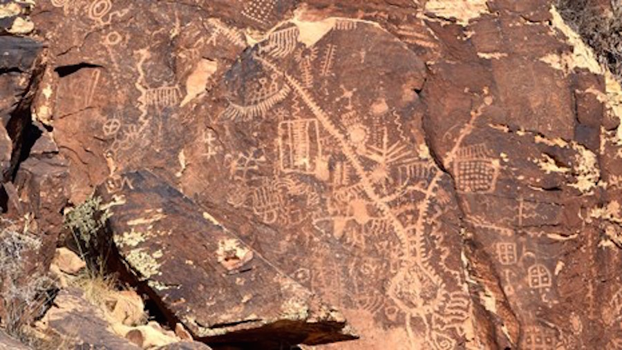
The Southern Paiute and other Numic speaking people who began moving into the Great Basin and Colorado Plateau regions around 1000 CE. Numic is a part of the Uto-Aztecan language family whose linguistic roots are in the Ute language of the Western United States and Nahuan languages of the pre-Columbian indigenous people of the Valley of Mexico. Their lifestyle was nomadic, following the herds of grazing animals and harvesting seasonal plants. Their origin goes back to Tabuts, the wise wolf who decided to make many different people out of sticks. Tabuts' plan was to scatter the people equally around the earth so all had a good place to live. But younger brother, Shinangwav the coyote, ripped open his sack and the people all fell in the same location causing them to fight amongst themselves. The only people left in the sack were the Southern Paiutes that Tabuts blessed by putting them in the very best place on earth — the Cedar Breaks region of today's Colorado Plateau.
Sign up for the Live Science daily newsletter now
Get the world’s most fascinating discoveries delivered straight to your inbox.
