Record Number of Hurricane Hunters Swarm Karl

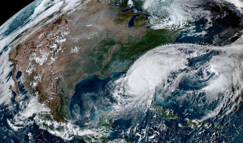
As Hurricane Karl gets ready to slam into the Gulf coast of Mexico, NASA's hurricane hunters are heading back into the storm today (Sept. 17) after a successful series of flights yesterday (Sept. 16).
Yesterday was the first time that all three of the space agency's research aircraft zoomed through a storm at the same time.
"It went really well," said Scott Braun, a mission scientist with the Genesis and Rapid Intensification Processes mission, or GRIP experiment, which kicked off in mid-August.
The three aircraft arrived inside the storm around 4 p.m. ET, when Hurricane Karl was a relatively minor Category 1 storm swirling above the Gulf of Mexico's warm, tropical waters and heading for Mexico's eastern coastline.
The National Oceanic and Atmospheric Administration (NOAA) and the Air Force also had planes inside the storm, possibly setting a record for the number of aircraft flying through a storm system simultaneously.
NASA's massive flying weather laboratory, a DC-8 jetliner packed with instruments and about two dozen people, took off from Fort Lauderdale, Fla., and spent several hours making passes through Karl.
The WB-57, a smaller plane manned with just a pilot and a co-pilot, joined them from Houston, Texas.
Sign up for the Live Science daily newsletter now
Get the world’s most fascinating discoveries delivered straight to your inbox.
Rounding out NASA's flying threesome was the Global Hawk, a California-based unmanned drone that spent a whopping 14 hours of its 25-hour flight in Hurricane Karl — a feat only possible because it is unmanned.
"That's the advantage of having these long-duration aircraft," Braun told OurAmazingPlanet. "Long after the other aircraft went home, the Global Hawk was still flying."
The DC-8 and the Global Hawk conducted six coordinated passes through the storm, giving the instruments aboard both planes several chances to examine the same regions of the hurricane simultaneously. Comparing those data will be a boon for GRIP researchers trying to understand the still-mysterious mechanisms that drive some storm systems to intensify, while others weaken and die.
The extra time aloft meant Global Hawk got to soar over Karl's churning eye 20 times, and capture the storm as it was swiftly intensifying.
"The thing that was really amazing to me was just how easily the plane was able to operate over an intensifying storm," said Braun, a research meteorologist at NASA's Goddard Space Flight Center in Greenbelt, Md., adding that although the Global Hawk spent time in Hurricane Earl, that storm was already mature at the time of data capture. Braun said yesterday's flights showed the research plane is capable of handling tougher weather.
Today (Sept. 17), Karl is a Category 2 hurricane, packing maximum sustained winds of 110 mph (175 kph), and rushing toward the Mexican coastline; and scientists are flying into the storm yet again.
The DC-8 and WB-57 are back in the air, ready to capture data that will help reveal what happens when a hurricane makes landfall, predicted for this afternoon.
Steve Cole, a NASA spokesperson, said GRIP researchers are calling Karl a storm for the record books, not because of its power, but because of the detailed data they've taken on its lifecycle.
"They've been flying it since before it was Karl, even before it was a tropical storm, so they were able to watch it evolve," Cole told OurAmazingPlanet. "That's a hard thing to capture and I think they were really happy to get it."
The Global Hawk is back in California, where scientists are working on installing another weather-sensing instrument, with hopes to be back in the air next week.
- Wild Hurricane Facts as Season Gets Super Stormy
- A History of Destruction: 8 Great Hurricanes
- Hurricane-Hunting Tech: A Brief History
This article was provided by OurAmazingPlanet, a sister site to LiveScience.


