The 'Spanish Stonehenge' Is Above Water for the First Time in 50 Years
Visit now — soon, this megalithic monument will return to the water again.

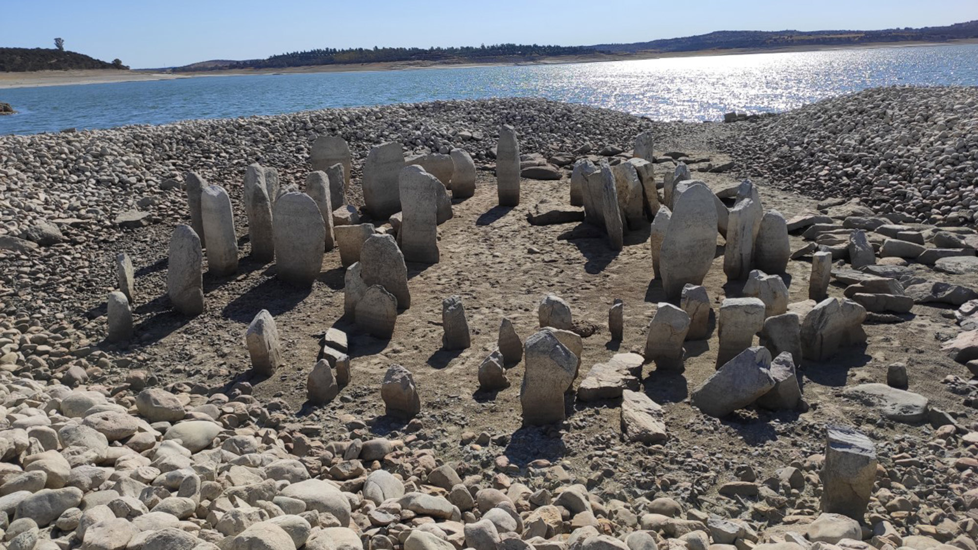
After 50 years out of sight beneath the waters of a manmade lake in western Spain, the 7,000-year-old megalithic monument known as the Dolmen of Guadalperal is finally back on dry land — emphasis on dry.
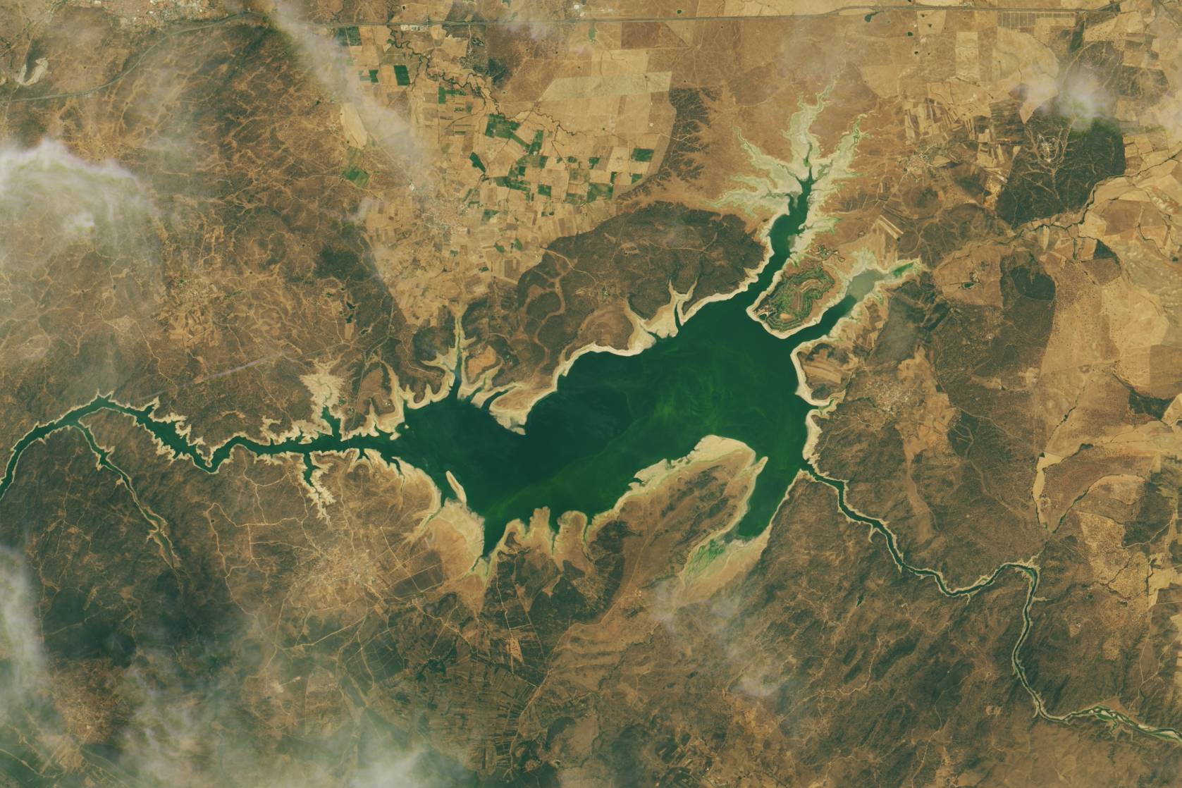
As new imagery taken from NASA's Landsat 8 satellite shows, the reappearance of the ancient monument is owed to very low water levels in Spain's Valdecañas Reservoir following a summer of record heat and drought across Europe (and most of the rest of the planet.)
Sometimes labeled the "Spanish Stonehenge," the Dolmen of Guadalperal is a large circle of about 150 standing stones, some more than 6 feet (1.8 meters) tall, arranged around a central, open oval. Archaeologists speculate that the structure was built in the 4th or 5th millennium B.C. (possibly making it thousands of years older than Stonehenge in England). The mysterious megalith may once have supported a massive stone cap that enclosed the space for ritual uses.
One particularly large stone (a "menhir") seems to mark the entrance. This rocky threshold is engraved with a human figure on one side, and a squiggly symbol on the other side that could represent a snake or the nearby Tagus River. If a waterway is indeed being depicted, that could make the stone one of the oldest maps in Europe, NASA wrote on its Earth Observatory website.
According to Atlas Obscura, the dolmen was first excavated in Spain's Extremadura region, just east of the Spanish-Portugese border, in the 1920s, but no research on the site was published until the 1960s. By then, the site's fate was sealed; in 1963, former Spanish dictator Francisco Franco undertook a sweeping civil engineering program that involved flooding the valley where the dolmen stood. Suddenly, the dolmen sat at the bottom of the Valdecañas Reservoir, a manmade lake abutting a hydroelectric dam that continues to generate power today.

Since the creation of the reservoir, the tips of some megalithic rocks have occasionally pierced the surface of the water, but never has the entire site been revealed at once. Before long, with the rains of autumn and winter approaching, the stones will likely be submerged again. Local groups have petitioned to move the entire monument to higher terrain, so that the stones can be studied in open air and visited by the general populace. However, some archaeologists worry that moving the monument could accelerate its decay, especially if the job is done hastily, in a race against the rising waters.
- The 25 Most Mysterious Archaeological Finds on Earth
- In Photos: Stone Monument Discovered in Scotland
- In Photos: A Walk Through Stonehenge
Originally published on Live Science.
Sign up for the Live Science daily newsletter now
Get the world’s most fascinating discoveries delivered straight to your inbox.

Brandon is the space/physics editor at Live Science. His writing has appeared in The Washington Post, Reader's Digest, CBS.com, the Richard Dawkins Foundation website and other outlets. He holds a bachelor's degree in creative writing from the University of Arizona, with minors in journalism and media arts. He enjoys writing most about space, geoscience and the mysteries of the universe.


