Easter Island (Rapa Nui) and its famous Moai statues
The island of Rapa Nui, the most isolated inhabited landmass on Earth, is known for its massive Moai statues.
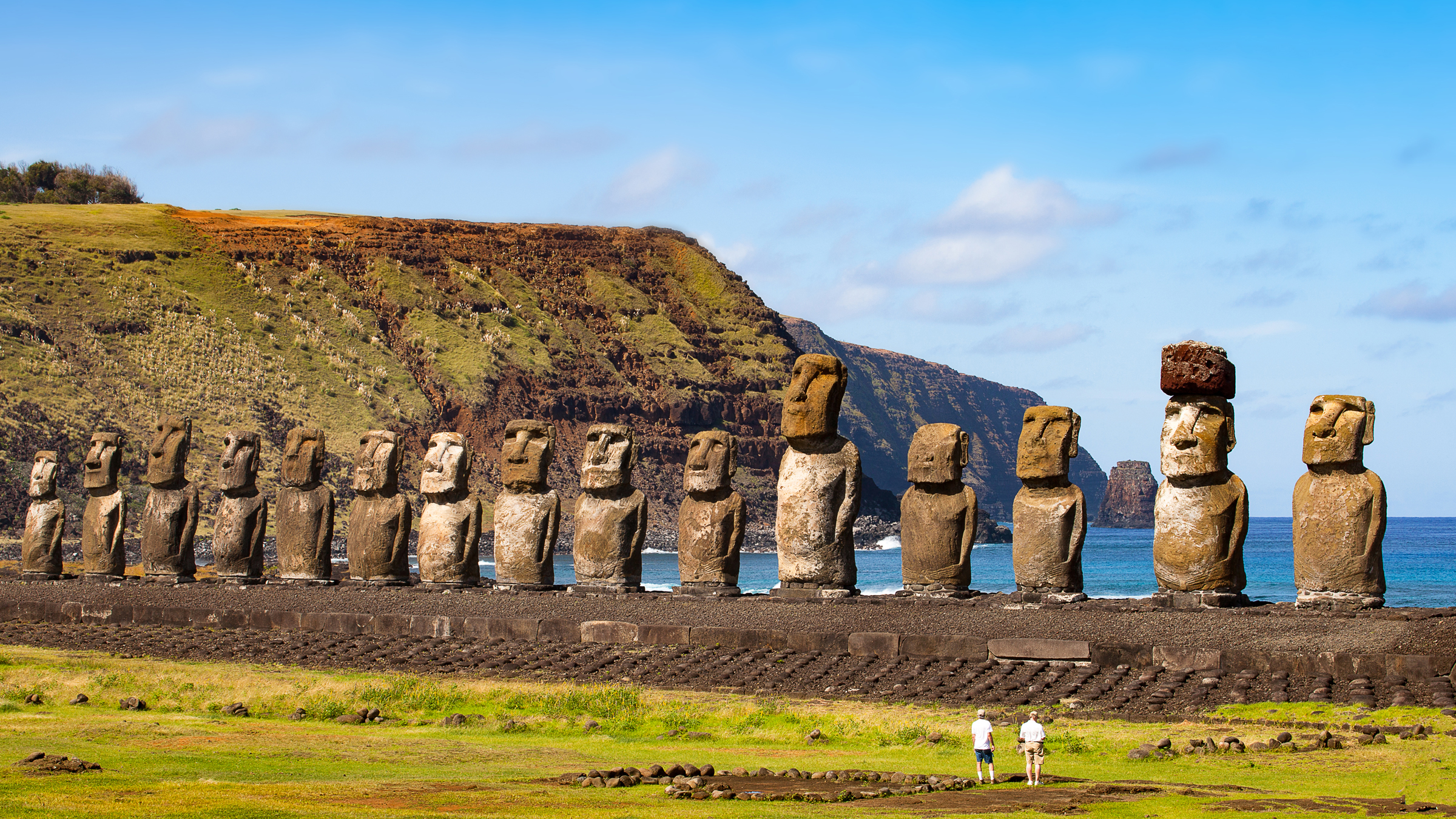
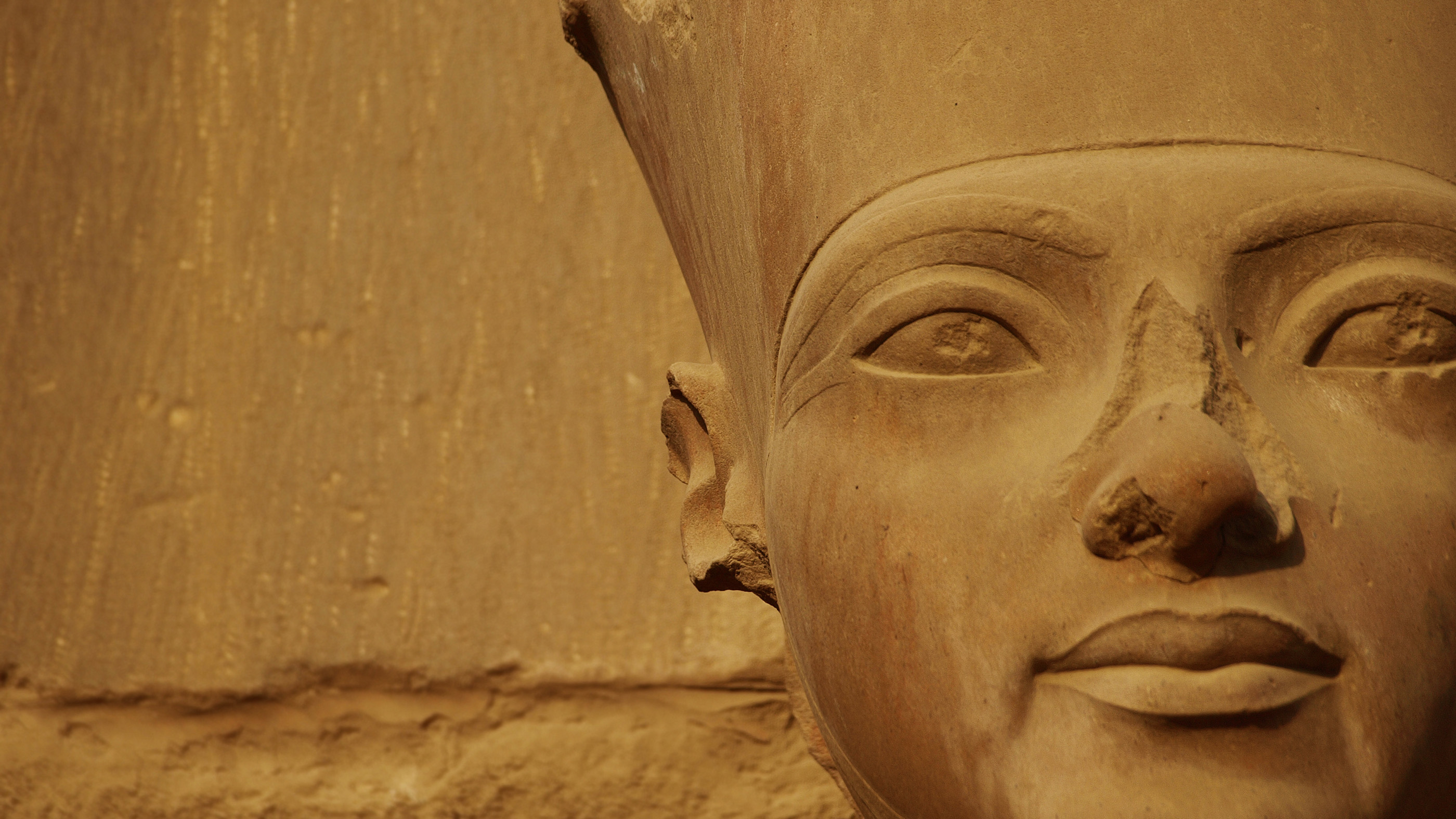
Rapa Nui, also known as Easter Island (a name given to it by Europeans), is located in the southeast Pacific and is famous for its approximately 1,000 carvings of moai, human-faced statues.
The island measures about 14 miles (22 kilometers) by 7 miles (11 km) at its furthest points and it is often said that it can be traversed by foot in a single day. The volcanic island is the most isolated inhabited landmass on Earth. The closest inhabited land is the Pitcairn Islands, located about 1,200 miles (1,900 km) to the west. Chile, the closest South American country, is located about 2,300 miles (3,700 km) to the east.
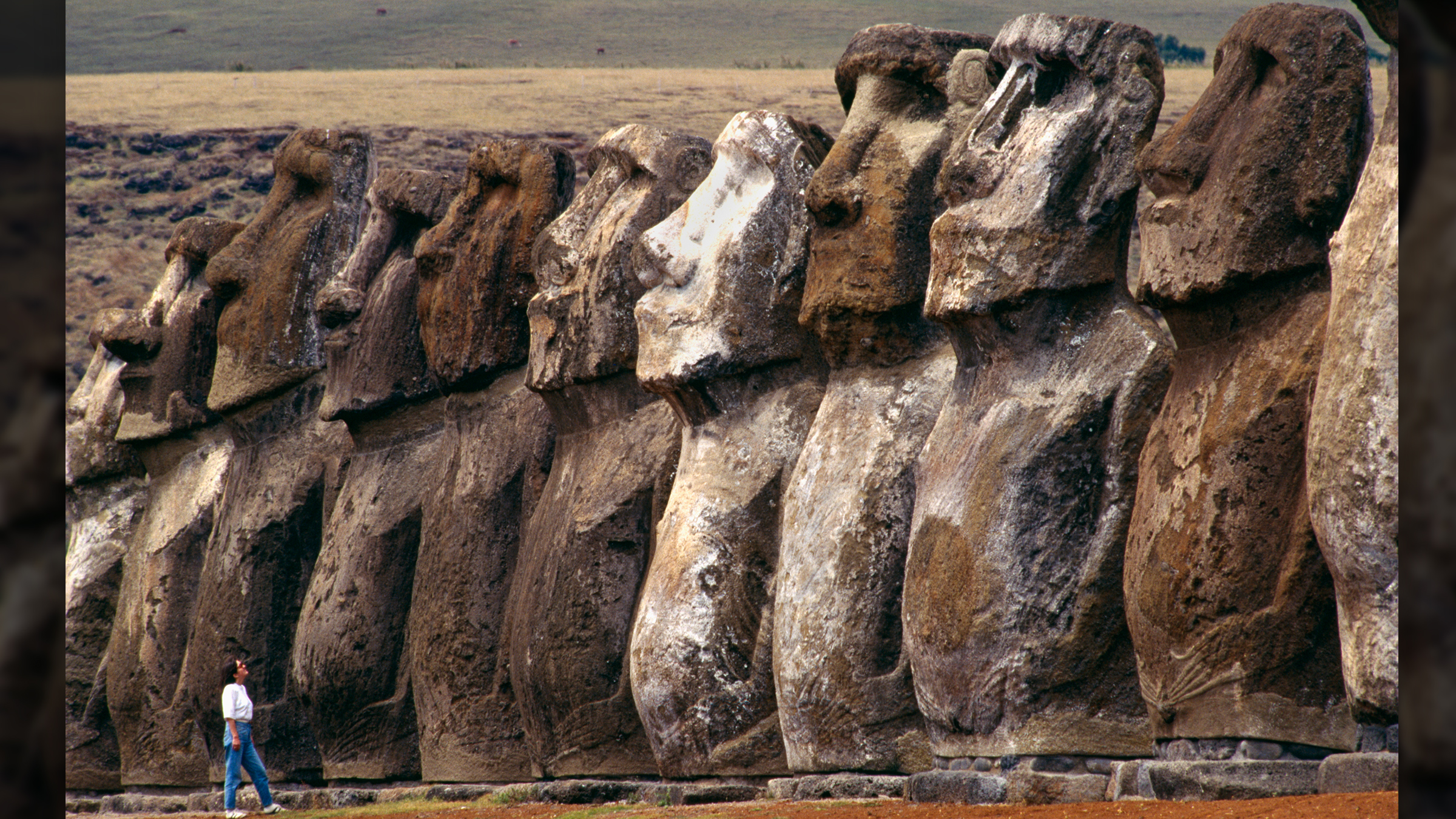
The famous carvings are massive, up to 40 feet (12 meters) tall and 75 tons in weight. They were decorated on top with "Pukao," a soft red stone in the shape of a hat. The statues also have torsos buried beneath the heads.
Scientists are still finding new moai, including one that was slightly smaller than others that researchers unearthed in a dried up lake bed in 2023. Meanwhile, a suspected arson attack on the island left a number of moai "totally charred" in 2022.
When was Rapa Nui settled?
Radiocarbon dating of starchy food on obsidian blades revealed that humans settled Rapa Nui by at least A.D. 1000, a period in which Polynesians voyaged to the east Pacific and perhaps also to South America. For instance, a 2020 genetic study revealed that Polynesians and Native Americans in what is now Colombia paired up in around A.D. 1200, although it's unclear where this happened. It's possible the Polynesians traveled to Colombia, paired up with locals and then their descendants returned to Polynesia. Or, perhaps people from Colombia traveled to Polynesia, the researchers said.
As for when Rapa Nui was originally settled, according to legend, a chief named Hotu Matu'a, having learned of Rapa Nui from an advance party of explorers, led a small group of colonists, perhaps no more than 100 people, to the island.
Their place of origin is a mystery and may have been the Marquesas Islands, located 2,300 miles (3,700 km) to the northwest of Rapa Nui. Another suggestion is Rarotonga, located 3,200 miles (5,200 km) to the southwest of the island. In any case, the voyage would have been an arduous one that may have involved tacking against the wind.
A deforested environment
When people first came to Rapa Nui, around 1,000 years ago, they would have found the island overgrown with palm trees, among other vegetation. In the centuries that followed Rapa Nui was deforested until, by the 19th century, the landscape was utterly barren.
How this occurred is a matter of debate. When people arrived at Rapa Nui they brought with them (whether intentionally or not) the Polynesian rat, a creature that reproduces rapidly and which the Polynesians sometimes consumed. This species had no natural enemies on the island and may have played a major role in deforestation.
The popular claim that the island's palm trees were felled to create devices to move the moai statues is probably incorrect. According to ancient stories the statues "walked" from the quarries to their place on stone platforms (known as ahu) and, indeed, research has shown that two small teams using ropes can move the statues vertically. A recent demonstration of this was recorded on a YouTube video (below) by Terry Hunt, a University of Hawaii professor of anthropology, and Carl Lipo, a professor of anthropology at Binghamton, State University of New York.
It is also noted by Hunt and Lipo that the deforestation of the island may not have led to a food crisis. They point out in their book, "The Statues that Walked: Unraveling the Mystery of Easter Island" (Free Press, 2011) that abundant rocks on the island allowed for the construction of stone-protected gardens known as "manavai." These stone gardens would have been supported by lithic mulching, a process by which minerals from rocks fertilize the soil.
In a 2024 study published in the journal Science Advances, Lipo, Hunt and colleagues found that the population of Rapa Nui never had a rapid rise or catastrophic fall, as it never exceeded about 3,900 prior to European arrival. Their team came to this conclusion by using shortwave infrared satellite imagery and machine learning to find archaeological rock gardens on the island, as these gardens were used by Indigenous people to fortify the soil with nutrients. These rock gardens could not have supported more than 3,900 people, the team argued, but other scientists called these methods too simplistic to determine population numbers.
Rongorongo script
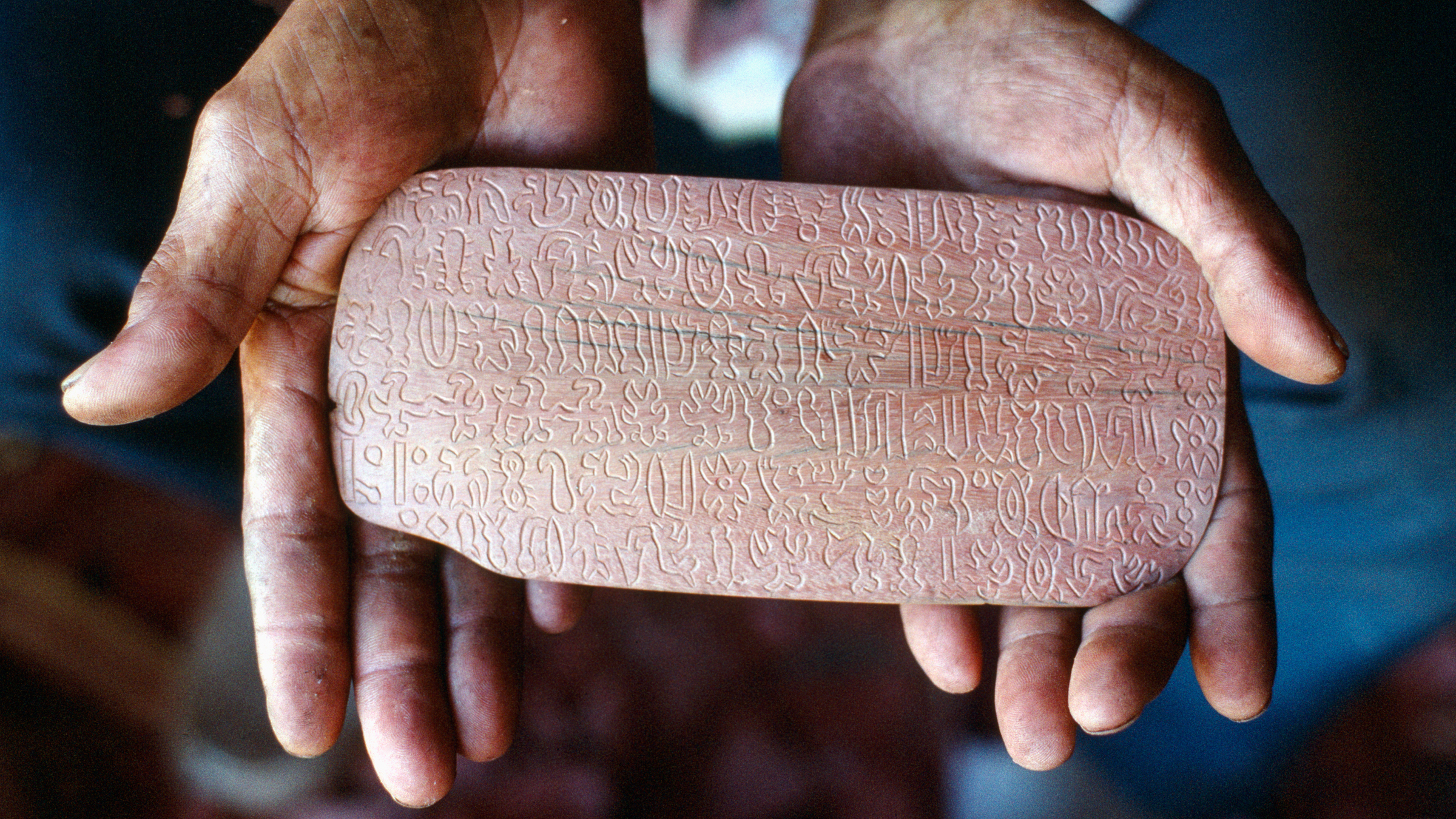
The people of the island, it appears, had enough food not only to build and move statues, but also to develop a written script, today known as Rongorongo, which researchers are still trying to decipher. Radiocarbon dating of four wood tablets on which the script was carved suggests that the wood was harvested 200 years before Europeans arrived at Rapa Nui in the 1720s. It's possible the Indigenous people of Rapa Nui carved the script on old wood, but if they carved it on freshly cut wood, then their writing system would be one of the few independently invented writing systems in the world.
Moai mystery
In their book, Hunt and Lipo provide more evidence for the idea that the statues were moved vertically. They note the presence of pathways or "roads" that lead from quarry sites to moai locations in the southeast, northwest and southwest parts of the island.
"The evidence on the ground revealed that roads were not part of some overall planned network. Rather they are the remnants of paths that moai transporters took as they walk the statues across the landscape," they write.
While this helps explain how the statues were moved around the island, it doesn't explain why. Scholars don't know what the reasons were for creating the statues, but they have noted several features that provide clues.
The statues on their platforms can be found ringing almost the entire coast of the island. Remarkably, despite their seaside location, every single one of the moai appears to face inland and not out to sea, suggesting that they were meant to honor people or deities located within Rapa Nui itself.
Construction of the moai statues appears to have stopped around the time of European contact in 1722, when Dutch explorers landed on Easter Day. Over the next century the moai would fall over, either intentionally pushed over or from simple neglect. Why construction was abandoned is another mystery. It's known that disease ravaged the island's people after contact and that the islanders had a desire for European goods. Early explorers recorded that hats were particularly popular among the people of the island.
Regardless of what the moai were intended for, and why construction of them stopped, today the popularity of the statues is higher than ever. Many statues have been re-erected on their ahu bases and Rapa Nui now has a population of more than 5,000 people, its hotels and facilities supporting a thriving modern tourism industry.
Editor's note: This article was originally published on Oct. 16, 2012 and updated on June 21, 2024 to include updated information about when Rapa Nui was first settled, the Rongorongo script and whether the Indigenous people there experienced a catastrophic population decline.
Sign up for the Live Science daily newsletter now
Get the world’s most fascinating discoveries delivered straight to your inbox.

Owen Jarus is a regular contributor to Live Science who writes about archaeology and humans' past. He has also written for The Independent (UK), The Canadian Press (CP) and The Associated Press (AP), among others. Owen has a bachelor of arts degree from the University of Toronto and a journalism degree from Ryerson University.
- Laura GeggelEditor

