Texas and Louisiana face a double whammy of tropical cyclones
The last time something like this happened was 1959.

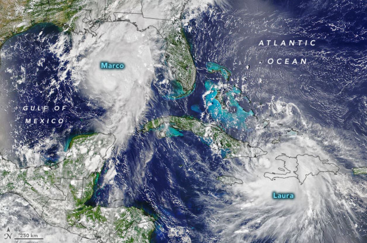
Tropical storm Marco will hit Louisiana and Texas later today (Aug. 24), and will likely cause significant flooding. Just a day and a half later, another cyclone, Laura, will likely ram itself against the same stretch of coastline — and will pack an even greater punch.
Marco never developed into a hurricane, so last week's uncertain forecast of a record-setting two simultaneous hurricanes in the Gulf of Mexico didn't materialize. But the one-two punch of tropical storm Marco Monday afternoon and Laura Wednesday (Aug. 26) afternoon still poses a rare and serious threat. Marco will drop a deluge of water on Louisiana and Texas, according to the National Hurricane Center (NHC) — 3 to 6 inches (8 to 15 centimeters) in most areas, maxing out at 10 inches (25 cm) in the hardest hit spots. The land will have little time to dry between the storms. And when the ground is already wet, according to the National Weather Service, each additional drop of rain is more likely to sit on the surface rather than absorb into the dirt or drain away into rivers and streams.
"From Wednesday afternoon into Friday, Laura is expected to produce rainfall of 4 to 8 inches [10 to 20 cm], with isolated maximum amounts of 12 inches [30 cm] across portions of the west-central U.S. Gulf Coast," according to the NHC. "This rainfall could cause widespread flash and urban flooding, small streams to overflow their banks, and minor to isolated moderate river flooding."
Related: Hurricane season: How long it lasts and what to expect
Marco is already forecast to cause a significant storm surge as it comes ashore in Louisiana before its likely trek into Texas. Two to 4 feet (0.6 to 1.2 meters) of storm surge is likely across a stretch of coastline in Louisiana and Mississippi. Laura's track isn't yet predictable enough for storm surge watches, but the NHC could release the earliest forecasts this evening.
Louisiana has ordered evacuations along the coast, and Texas said evacuation orders for Laura are possible later in the week. That brings the total number of states ordering natural disaster evacuations across the country this month to five, with California, Oregon, Washington and Colorado all also evacuating residents in the face of major wildfires. Texas would be the sixth if it evacuates its coastline. Iowa, where a destructive derecho wind storm caused major damage statewide, also saw some small local evacuations, but they were not state-ordered.
As Live Science previously reported, evacuations during a global pandemic are even more complicated than usual. Evacuations will potentially contribute to the virus's spread, as people who would otherwise shelter in place are forced to gather with others, according to research from Columbia University.
Sign up for the Live Science daily newsletter now
Get the world’s most fascinating discoveries delivered straight to your inbox.
Wildfires, major hurricanes and global pandemics are all becoming more severe threats due to climate change, several studies have shown.
The last time two tropical cyclones shared the Gulf of Mexico was 1959. And it was only ever recorded once before that, in 1933. Marco and Laura are also record setters as the earliest 12th and 13th tropical cyclones in a year, as meteorologist Matt Lanza noted.
The 2020 season has set the record for the earliest C, E, F, G, H, I, J, and K storms. Go ahead and snipe about some of these storms being subpar or maybe not named in the pre-satellite era, but whatever the case...we're beating 2005 in quantity (not quality).August 14, 2020
Eight other storms this year have set similar records, making 2020 already one of the busiest tropical cyclone seasons ever.
Originally published on Live Science.


