Photo tour of Jezero Crater: Here's where Perseverance landed on Mars
NASA made history when it landed the Perseverance rover and Ingenuity helicopter on Mars on Feb. 18, 2021. And the agency chose the perfect spot for a touchdown: Jezero Crater. The crater is located in the so-called Isidis Planitia region, just north of the equator in the eastern hemisphere of Mars. This flat plain is located inside a giant 750-mile-wide (1,200 kilometers) basin that was carved out 3 billion to 4 billion years ago when a comet or big asteroid slammed into the Red Planet. A smaller meteorite, some time later, created Jezero within this larger impact basin. Evidence suggests a river once flowed into Jezero, where it formed a delta that has long since dried up, according to NASA. Here's a look at Perseverance’s landing spot.
Not alone
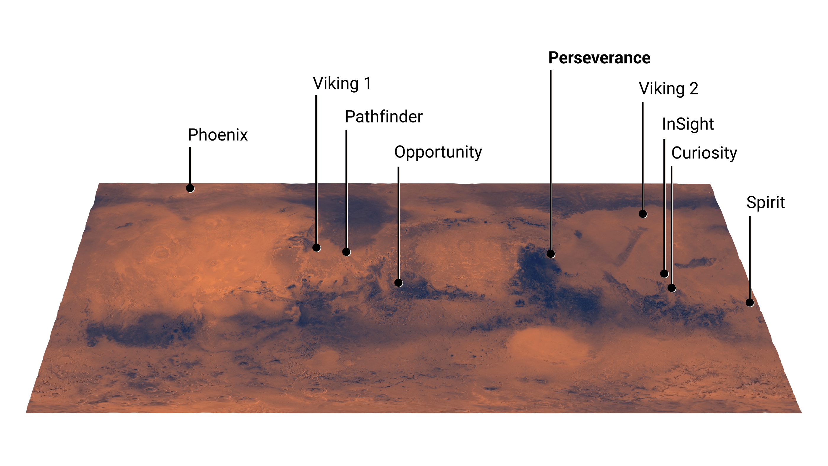
Perseverance follows a line of successful Martian landings. For instance, the robotic spacecraft called Phoenix landed in a region of Mars' Vastitas Borealis on May 25, 2008, and operated until Nov. 2, 2008. That location was the equivalent of Alaska in terms of latitude. Then, on July 20, 1976, Viking 1 it became the second spacecraft to land on Mars. It was also the first lander to complete its mission successfully.
Ancient delta
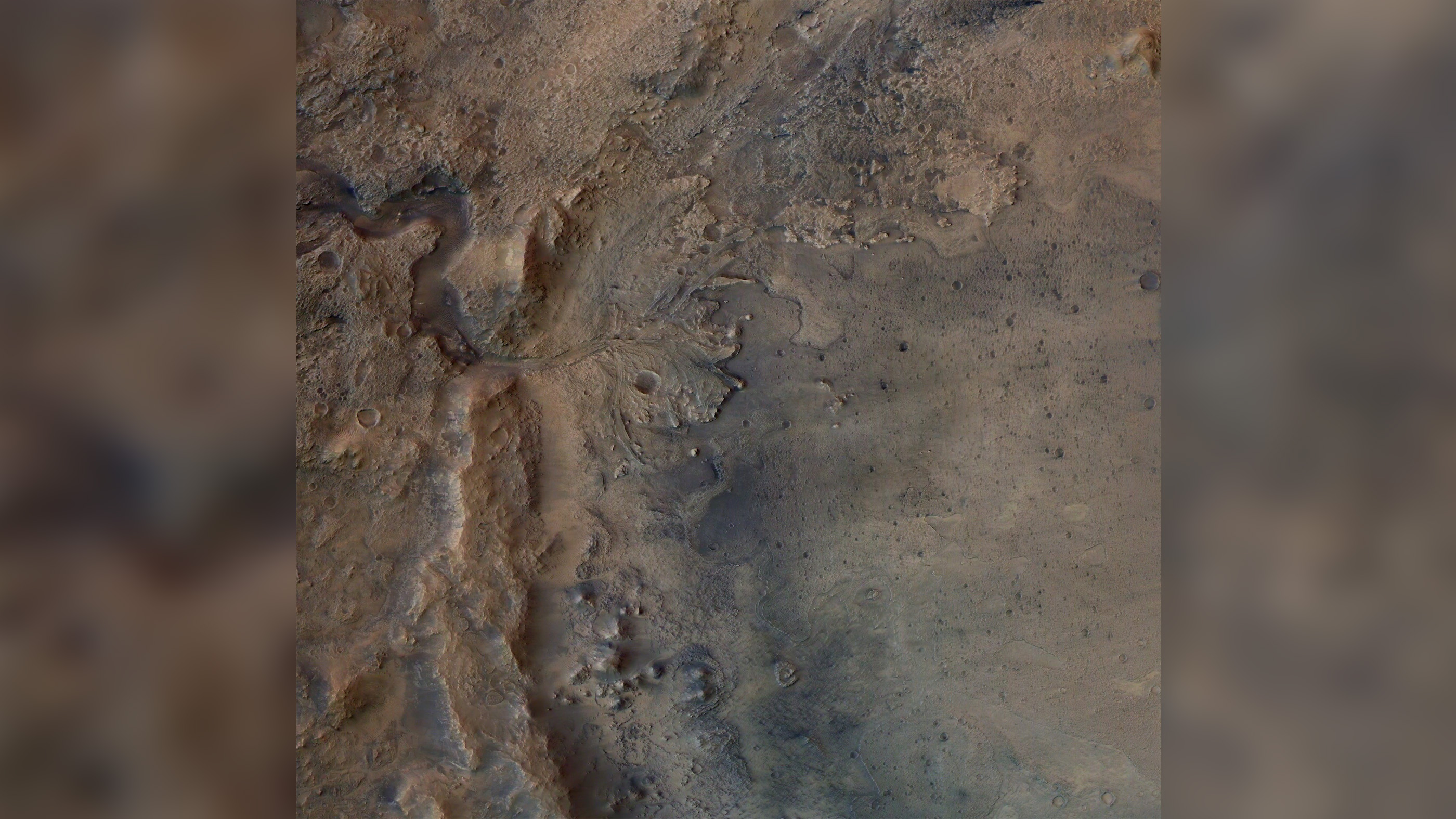
Here, the remains of an ancient delta in Jezero Crater, where Perseverance will scour for signs of fossilized microbes. The image was captured by the High Resolution Stereo Camera onboard the European Space Agency's Mars Express orbiter.
Ancient lake

Perseverance has a landing target (white circle) that measures 4.8 by 4.1 miles (7.7 kilometers by 6.6 kilometers) in diameter inside Jezero Crater. The crater’s fan-shaped delta and rim can be seen in this image. Once upon a time, Jezero was a lake that was several hundred feet deep.
Clays and carbonates
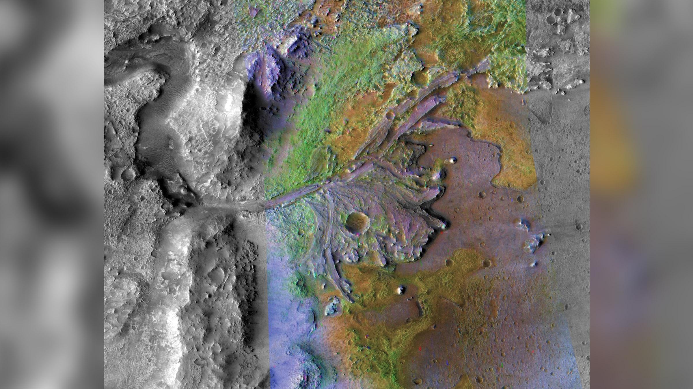
Scientists choosing the spot for the Perseverance landing knew that Jezero contains sediments with clays and carbonates — evidence that water likely once carved the channels that then carried sediments to form deltas there. Water, being one of the necessary ingredients for life, is a promising sign that the rover may discover fossilized microbes. This image was taken by instruments on NASA's Mars Reconnaissance Orbiter (MRO).
Mars mosaic
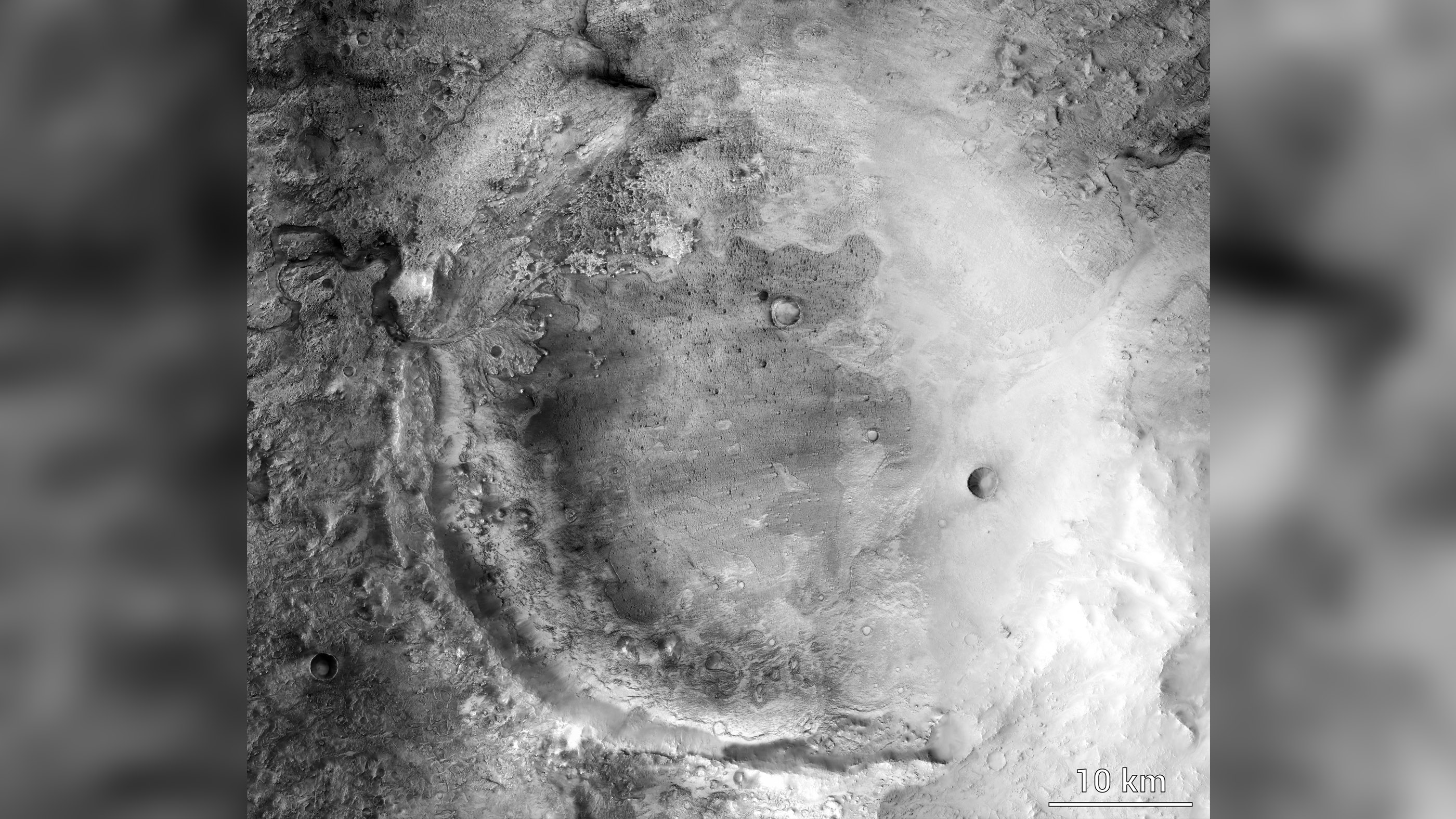
Images taken by the Mars Reconnaissance Orbiter Context Camera were put together to create this high-resolution mosaic of Mars' Jezero Crater.
Extreme close-up
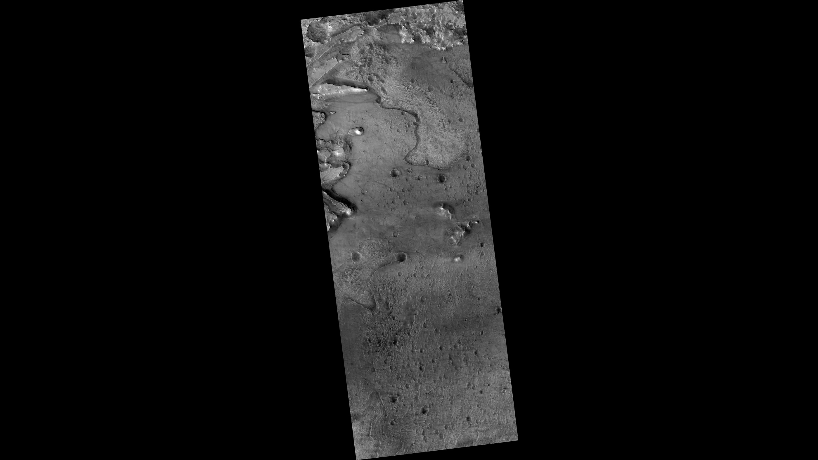
This close-up slice of Jezero crater reveals the beauty and intricacies of the basin on Mars.
Sign up for the Live Science daily newsletter now
Get the world’s most fascinating discoveries delivered straight to your inbox.
Long-ago lake
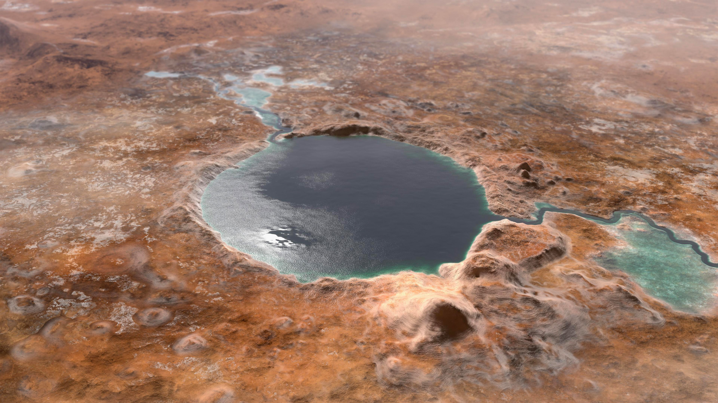
In this illustration, you can see what Jezero Crater may have looked like billions of years when it was filled with a lake. There was likely an inlet and outlet on either side of the lake. Once the rover has landed, Perseverance will take samples to help scientists understand the planet’s geology and past climate. In fact, this will be the first mission to collect and save rocks and regolith from Mars.
Circle marks the spot
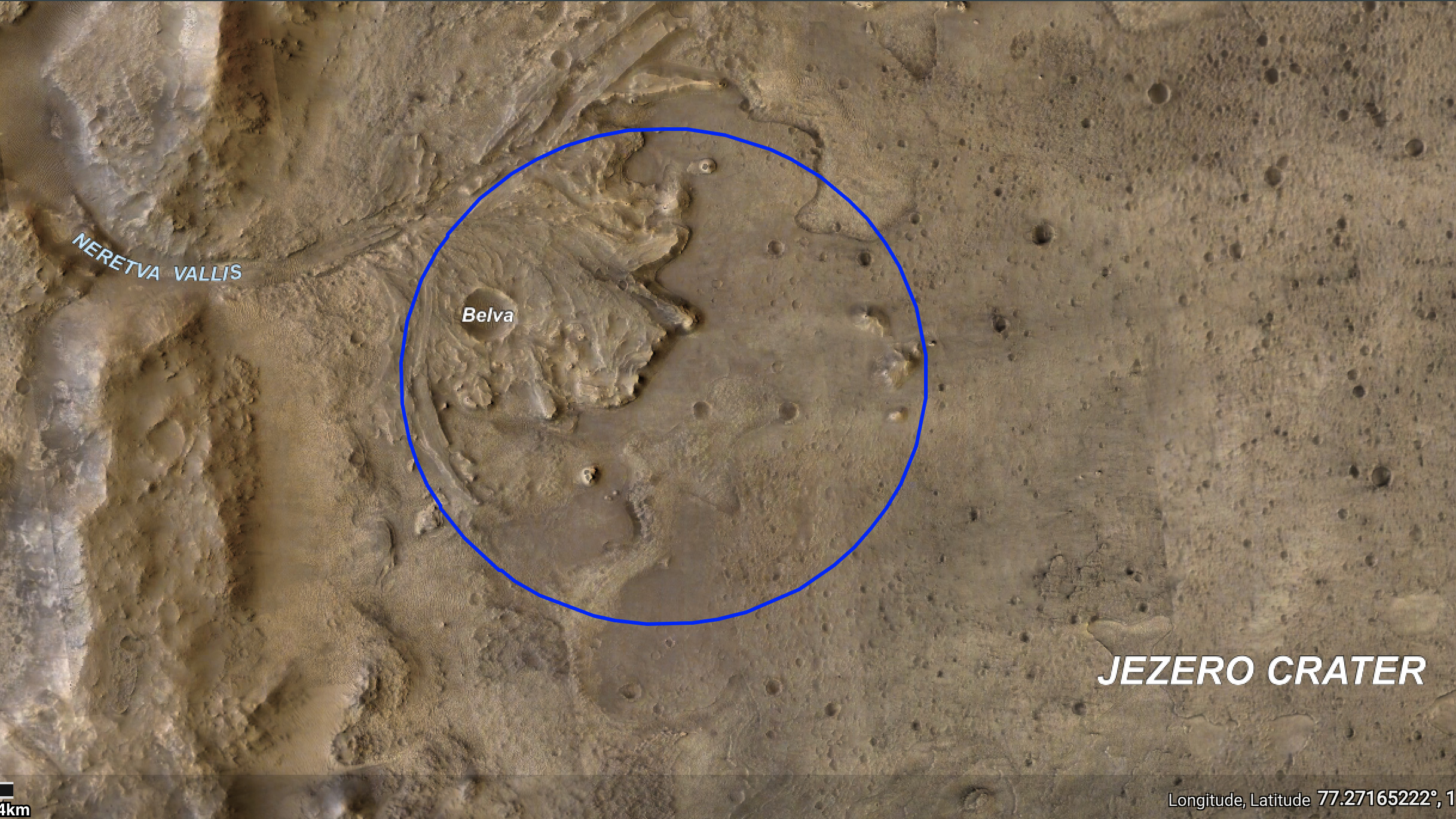
The NASA team is targeting a certain area in Jezero Crater (blue ellipse) for landing. They chose the location with the mission of Perseverance in mind: They are seeking signs of ancient microbial life. To find those clues, Perseverance will collect samples of rock and regolith, or broken rock and dust. NASA
Where on Mars?

Jezero Crater is located just above the Martian equator in the planet's easter hemisphere.
From the crater floor
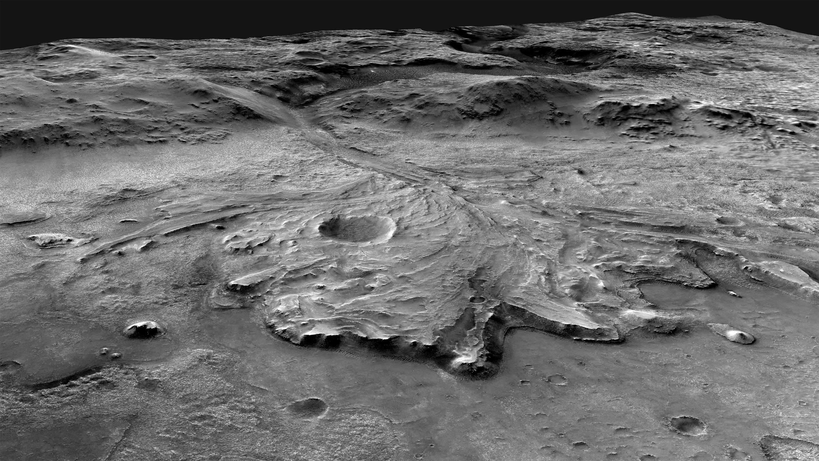
This oblique view of Jezero looks to the west from above the crater floor, over the fan-shaped delta and into the valley that cuts through the crater rim. On Earth, such deltas often concentrate and preserve evidence of lift. Scientists hope the same is true on Mars. The same mosaic used to generate this view (shown here) will be carried onboard the Mars 2020 spacecraft; it will be used to help the craft steer clear of hazards such as cliffs and dune fields on the Martian surface. To create this mosaic, researchers aligned multiple images from the Context Camera on the Mars Reconnaissance Orbiter.
Originally published on Live Science.
Jeanna Bryner is managing editor of Scientific American. Previously she was editor in chief of Live Science and, prior to that, an editor at Scholastic's Science World magazine. Bryner has an English degree from Salisbury University, a master's degree in biogeochemistry and environmental sciences from the University of Maryland and a graduate science journalism degree from New York University. She has worked as a biologist in Florida, where she monitored wetlands and did field surveys for endangered species, including the gorgeous Florida Scrub Jay. She also received an ocean sciences journalism fellowship from the Woods Hole Oceanographic Institution. She is a firm believer that science is for everyone and that just about everything can be viewed through the lens of science.
