Earth from space: Ghostly figure emerges in Greenland ice after underground lake collapses
In 2011, a ghostly depression, known as "the mitten," appeared on the surface of and ice sheet in Greenland after the unprecedented collapse of a concealed subglacial lake.
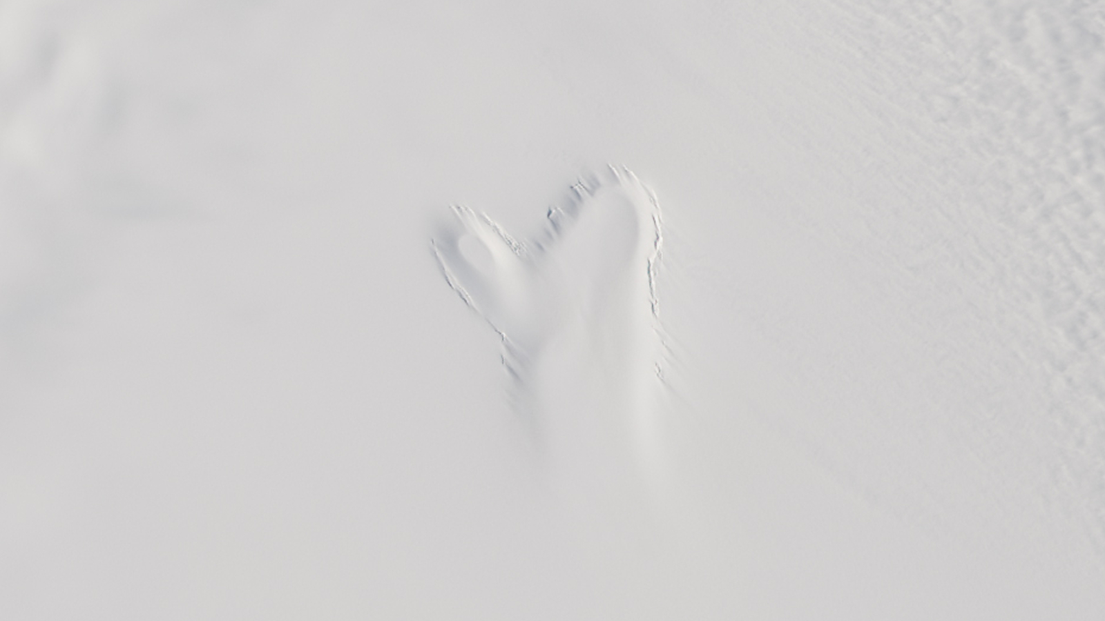
Where is it? Flade Isblink ice cap, northeast Greenland [81.298483222, -16.071359543]
What's in the photo? A ghostly-looking indentation in the snow
Which satellite took the photo? Landsat 8
When was it taken? June 21, 2014
Scientists were shocked when they discovered a large, ghostly figure that suddenly appeared in satellite images of Greenland 13 years ago. The icy apparition was created by a depression in the snow-covered surface, which formed when an underground lake located directly beneath the figure collapsed.
The blobby specter, which looked like a shapeless figure waving up at space, was spotted in the Flade Isblink ice cap — a roughly 3,300-square-mile (8,550 square kilometers) ice cap sitting on Greenland's northernmost coastline, deep within the Arctic Circle. The icy hole was around 2 miles (3 kilometers) long and just over 1 mile (2 km) across its widest point, and was 230 feet (70 meters) deep when it first appeared, according to NASA's Earth Observatory.
The spooky structure, which researchers also referred to as "the mitten" due to its glove-like shape, formed at some point between Aug. 16 and Sept. 6, 2011, when the area was obscured by cloud cover in satellite photos.
In a 2015 paper, researchers revealed that the depression appeared when a subglacial lake rapidly drained of water, leaving behind an underground cavern that swiftly collapsed. At the peak of this draining event, scientists estimated that 7,600 cubic feet (215 cubic meters) of water escaped the lake every second.
This event was "perhaps the first recorded instance of a rapid drainage of a subglacial lake in Greenland," Kelly Brunt, a glaciologist at NASA's Cryospheric Sciences Laboratory who was not involved in the study, told NASA's Earth Observatory in 2015. The majority of similar submerged lakes in the country are considered to be very stable, she added.
Related: See all the best images of Earth from space
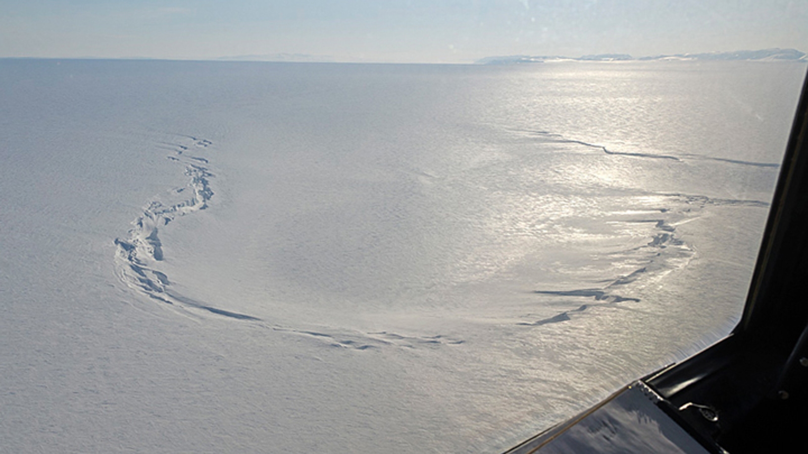
Researchers continued to monitor the depression, and in 2022, a follow-up study revealed that the subglacial lake had been slowly refilling since 2012. By 2021, the floor of the depression had risen by 180 feet (55 m) — rising to 50 feet (15 m) below the surrounding ice — despite a second, smaller draining event in 2019.
Sign up for the Live Science daily newsletter now
Get the world’s most fascinating discoveries delivered straight to your inbox.
Researchers initially believed the majority of the water that reentered the lake came from surface meltwater that trickled down below the ground. However, calculations later revealed that meltwater could only account for 65% of the water in the lake, meaning some other unknown source of water was also at work.
It is still unclear why the subglacial lake drained so quickly in 2011. However, researchers suspect that human-caused climate change may have played a role.
Several subglacial lakes in Antarctica have also undergone similar collapses in recent years, and scientists fear that the escaping water could further accelerate ice loss in some areas.

Harry is a U.K.-based senior staff writer at Live Science. He studied marine biology at the University of Exeter before training to become a journalist. He covers a wide range of topics including space exploration, planetary science, space weather, climate change, animal behavior and paleontology. His recent work on the solar maximum won "best space submission" at the 2024 Aerospace Media Awards and was shortlisted in the "top scoop" category at the NCTJ Awards for Excellence in 2023. He also writes Live Science's weekly Earth from space series.

