Live Science Plus


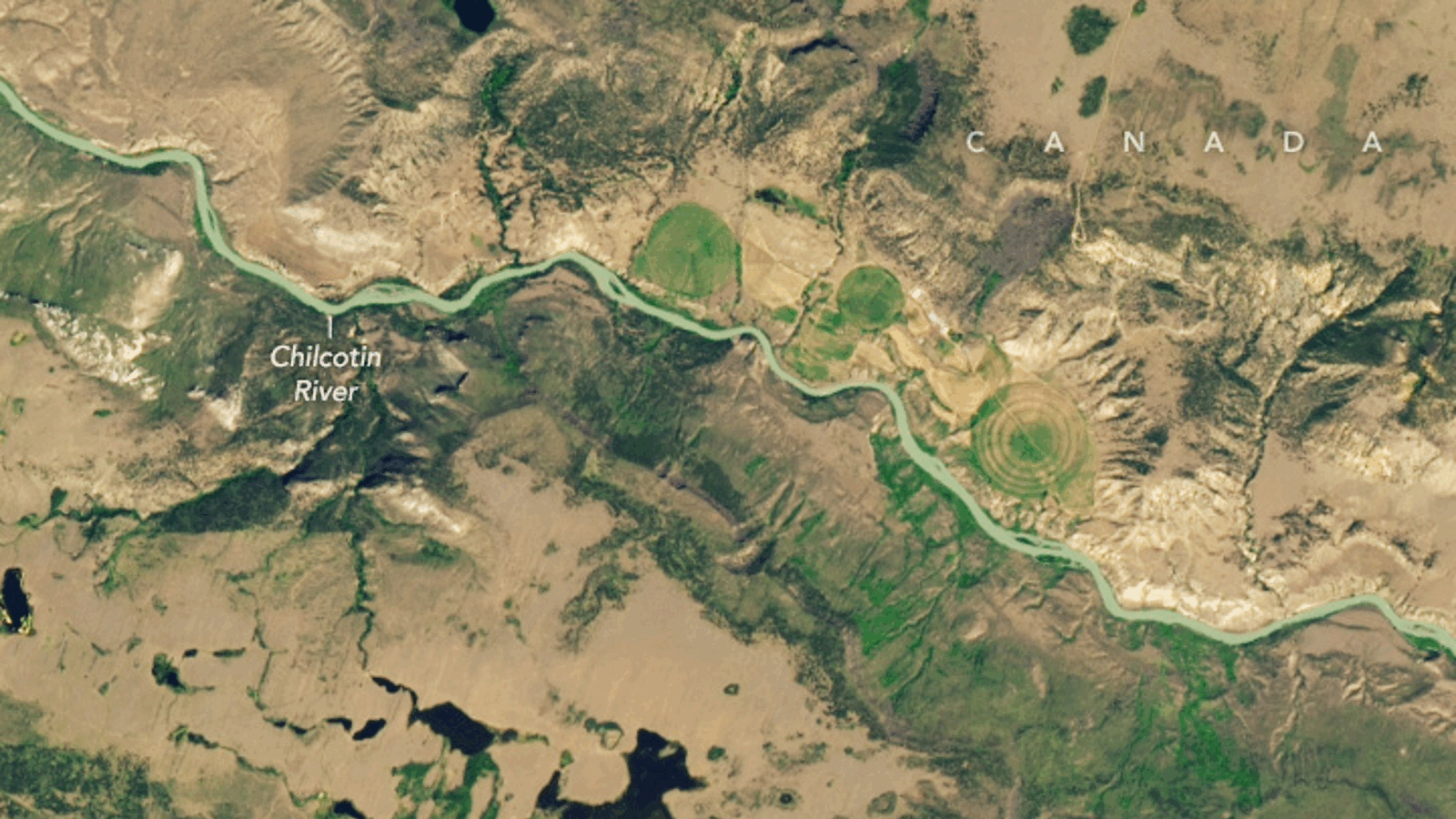
Where is it? The Chilcotin River, British Columbia [51.85860344, -122.82148613]
What's in the photo? Debris from a landslide blocking the flow of the river
Which satellite took the photo? Landsat 9
When was it taken? Aug. 1, 2024
Striking new satellite imagery shows a Canadian river quickly swelling in size after a massive landslide completely dammed the waterway. The obstruction may have also doomed an endangered salmon population by preventing the individuals that survived the sudden damming from reaching their spawning grounds upriver.
The massive landslide occurred late on July 30 near Farwell Canyon on the southern bank of the Chilcotin River — a 150-mile-long (240 kilometers) tributary of the Fraser River. The landslide took place around 14 miles (22 km) upstream from where the Chilcotin joins the Fraser, dumping roughly 640 million cubic feet (18 million cubic meters) of earth and rock across the waterway and completely blocking its flow, according to an emergency statement from the British Columbia government.
Within less than 48 hours, the river had swelled significantly, breaking its banks at several points and forming a debris-filled lake behind the blockage, images from NASA's Earth Observatory show. The stretch of the Chilcotin between the landslide and the Fraser River was left almost completely dry.
Article continues belowRegional authorities quickly issued evacuation orders for residents living close to the banks downstream of the blockage, fearing that the rocky dam would eventually break and release a surge that could cause flash flooding or trigger further landslides downstream. It is unclear how many people were evacuated.
Related: See all the best images of Earth from space

On Aug. 5, part of the dam finally broke, unleashing a torrent of water that violently raced through the previously emptied riverbed. Despite the water flowing at more than 12,000 cubic feet (3,500 cubic meters) per second, the surge of water did not cause any major damage.
However, the landslide will likely have a major impact on the river's resident sockeye salmon (Oncorhynchus nerka), most of which were likely downriver of the landslide when it occurred, according to a statement from the Tŝilhqot'in Indigenous nation.
Not only did some of the fish likely die after being stranded and suffocating in the dried-up section of the river, but any survivors that were in the Fraser River will now have a much harder time reaching their spawning grounds in Taseko Lake — around 45 miles (72 km) upstream of the remaining obstruction, according to NASA's Earth Observatory.
The International Union for the Conservation of Nature (IUCN) Red List of Threatened Species currently lists sockeye salmon as "least concern" due to rising numbers worldwide, but the Taseko population is listed as “endangered” by the Committee on the Status of Endangered Wildlife in Canada and was already experiencing record low levels of spawning before the landslide occurred. As a result, Tŝilhqot'in conservationists are worried about the population's future survival prospects.
Subsequent satellite images released by NASA's Earth Observatory show that the change in the Chilcotin River's flow has caused the water to pick up large amounts of sediment from the river bed, turning the waterway and the Fraser River yellow-brown. Although this effect will be temporary, the changes in water quality could further affect freshwater species downriver.
This is not the first time a landslide has impacted the Chilcotin River. The Tŝilhqot'in people named the area surrounding the waterway Nagwentled, meaning "landslides across the river" in the Athabaskan language, according to NASA's Earth Observatory. However, this is one of the most significant obstructions along the river in recent times.