Earth from space: Shapeshifting rusty river winds through Madagascar's 'red lands'
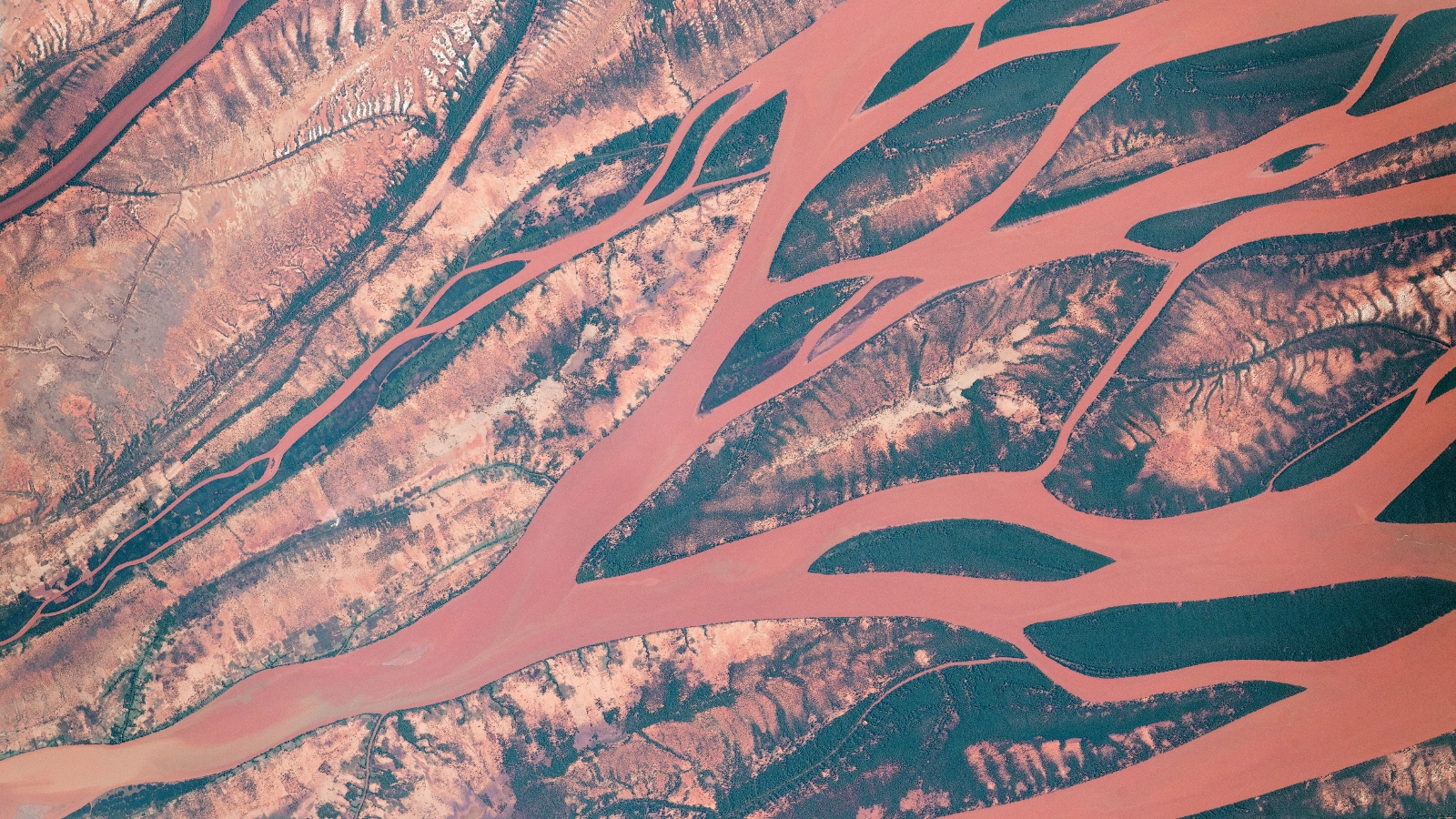
This 2018 astronaut photo shows the rust-colored waters of Madagascar's Betsiboka River winding through a complex series of mangrove islands. Both the river and islands have been altered in recent years by destructive human practices.

Where is it? The Betsiboka River, Madagascar [-15.920729, 46.367102].
What's in the photo? An intricate, rust-colored waterway shaped by mangrove islands.
Who took the photo? An unnamed astronaut onboard the International Space Station.
When was it taken? June 29, 2018.
This striking astronaut photo shows the intense color and intricate shape of Madagascar's Betsiboka River as it meanders through an archipelago of mangrove islands that have helped to stabilize and reshape the waterway as destructive human practices push it to the brink of collapse.
The Betsiboka stretches around 326 miles (525 kilometers) from one of Madagascar's central highlands to Bombetoka Bay on the island nation's northwest coast. As it approaches the sea, the river splits apart, forming a network of braided waterways, known as a delta, as the discolored water is diverted around a series of small islands.
These lemon-shaped islands are made of sediment held together by the deep intertangled roots of mangrove trees. Some of the larger islands have visible erosion features near their center where water has trickled through the stubborn trees, according to NASA's Earth Observatory. Without the roots, the islands would be quickly washed away by the river, which could destabilize the surrounding ecosystem.
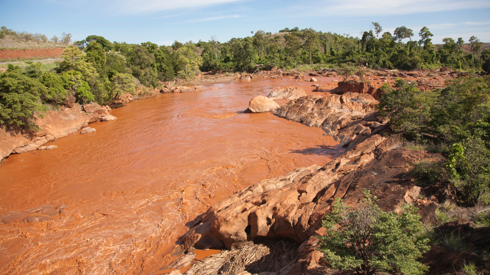
The Betsiboka delta is often referred to locally as the "red lands" due to the dark orange hues of the flowing water. This striking color is the result of heavy staining from soil rich in rust-like iron oxides, known as laterite, according to NASA's Earth Observatory.
Related: 12 amazing images of Earth from space

The color of the Betsiboka naturally intensifies when heavy rains from tropical storms wash more laterite from the surrounding land, according to Europe's Copernicus program. However, human activity is also changing the river.
Since 1950, around 40% of Madagascar's forest cover has been destroyed by wildfires, agricultural grazing and "slash and burn" clearances, according to NASA's Earth Observatory. As a result, the Betsiboka now runs across more unstable ground, making it easier for more sediment to be swept away by the river.
Sign up for the Live Science daily newsletter now
Get the world’s most fascinating discoveries delivered straight to your inbox.
A 2010 study using 30 years of Landsat satellite data between 1973 and 2003 showed that this increased erosion has made the river significantly darker.
The loss of forests has also increased the flow rate of the river because rainwater more easily drains into the waterway, which is putting more strain on the mangrove islands in the delta.
The changes to the Betsiboka are affecting local people who rely on the river for drinking water, bathing, laundry and agriculture, according to Madagascan news site Mada Magazine.

Harry is a U.K.-based senior staff writer at Live Science. He studied marine biology at the University of Exeter before training to become a journalist. He covers a wide range of topics including space exploration, planetary science, space weather, climate change, animal behavior and paleontology. His recent work on the solar maximum won "best space submission" at the 2024 Aerospace Media Awards and was shortlisted in the "top scoop" category at the NCTJ Awards for Excellence in 2023. He also writes Live Science's weekly Earth from space series.


