Earth from space: Lava bleeds down iguana-infested volcano as it spits out toxic gas
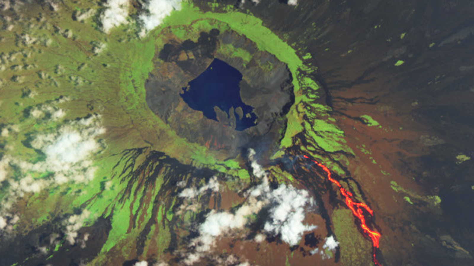
A satellite image of the Galápagos Islands' La Cumbre volcano shows lava seeping from the iguana-covered mountain days into an ongoing, months-long eruption.

Where is it? Fernandina Island, Galápagos Islands [-0.3738657, -91.5395414].
What's in the photo? The erupting La Cumbre volcano.
Which satellite took the photo? Landsat 8.
When was it taken? March 7, 2024.
This striking image captures the initial lava flow from the ongoing eruption at La Cumbre volcano. The active fissure is located on Fernandina Island — the third largest and most volcanically active island in the Galápagos Islands, around 700 miles (1,125 kilometers) off the coast of mainland Ecuador.
On March 2, La Cumbre erupted for the first time since 2020, NASA's Earth Observatory reported, when lava began slowly seeping out of a fissure near the summit of the volcano's 4,850-foot-tall (1,480 meters) southeast flank and dribbling down the mountain's tree-covered slopes.
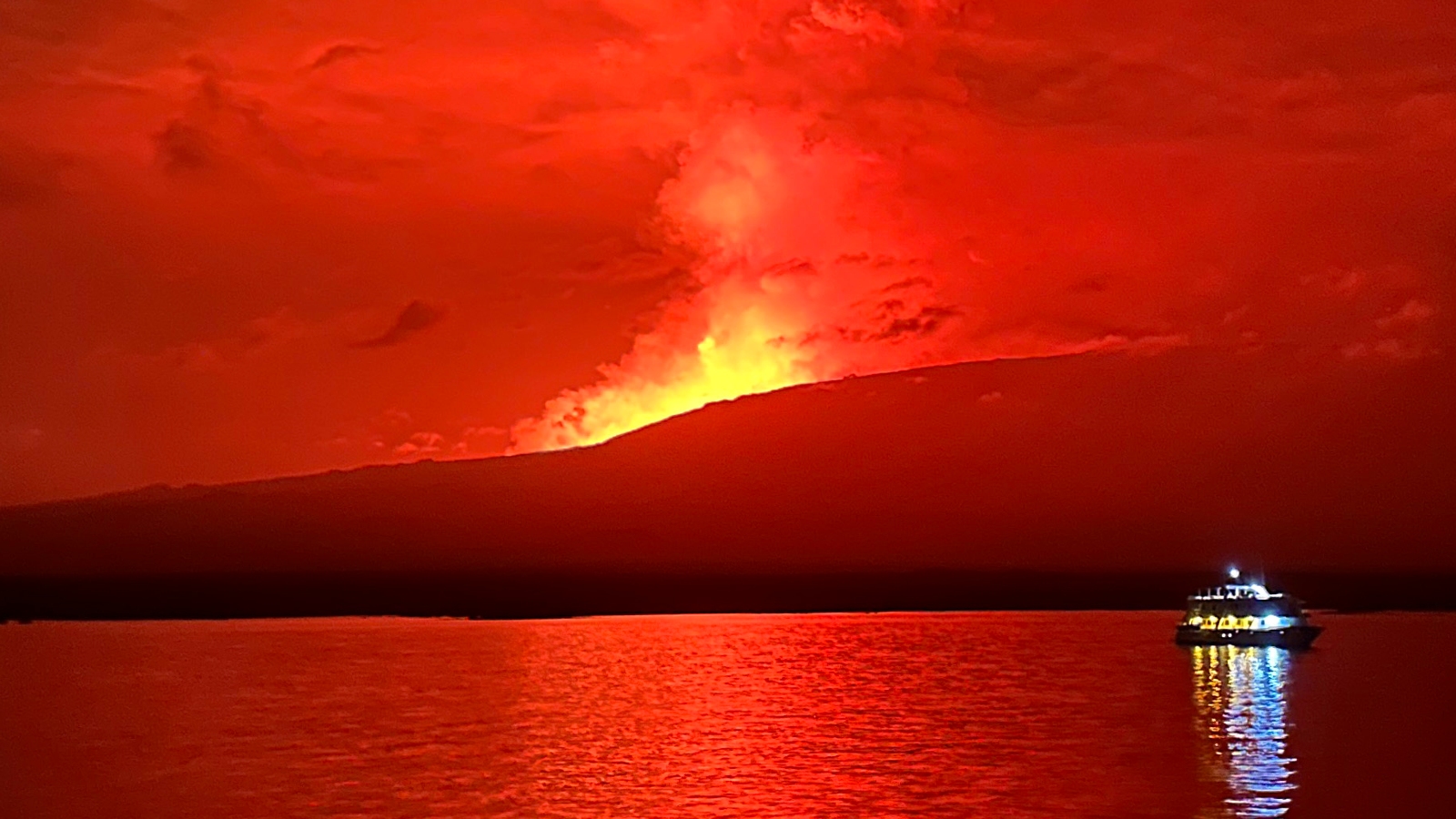
Since then, lava has continually poured out of the volcano, and in early April, the river of molten rock reached the island's coastline around 6 miles (10 km) from La Cumbre, the Galápagos Conservancy reported. As the lava met the ocean, large plumes of steam rose from the waves as the water cooled the superheated rock.
The eruption is still ongoing as of April 25, with no end in sight, according to the Smithsonian Institute's Global Volcanism Program.
Related: 12 amazing images of Earth from space

La Cumbre currently erupts around once every four years and is located directly above the magma hotspot, known as a mantle plume, that birthed this uninhabited Pacific island and the rest of the Galápagos.
The volcano has a large crater, or caldera, at its summit that harbors a permanent crater lake. This lake attracts a wide variety of animals including tens of thousands of Galápagos land iguanas (Conolophus subcristatus) that lay their eggs in nests within the caldera.
Get the world’s most fascinating discoveries delivered straight to your inbox.
During the first few days of the current eruption, satellites also detected invisible plumes of toxic volcanic gases rising above Fernandina. Instruments on board both the Suomi NPP and NOAA-20 satellites recorded high levels of sulfur dioxide being belched out by the volcano, according to Earth Observatory. However, the gas levels did not remain very high for long.
La Cumbre has previously experienced much more violent eruptions. The most recent example was in 1968, when water from the volcano's crater lake mixed with submerged magma, creating a powerful explosion. However, this is unlikely to happen during the current eruption, according to Earth Observatory.

Harry is a U.K.-based senior staff writer at Live Science. He studied marine biology at the University of Exeter before training to become a journalist. He covers a wide range of topics including space exploration, planetary science, space weather, climate change, animal behavior and paleontology. His recent work on the solar maximum won "best space submission" at the 2024 Aerospace Media Awards and was shortlisted in the "top scoop" category at the NCTJ Awards for Excellence in 2023. He also writes Live Science's weekly Earth from space series.

