
Satellite imagery provides a unique perspective on our planet and can encompass a wide range of different scientific disciplines including climate change, weather, volcanic eruptions and even animal behavior. Every week, we take a bird's eye view of Earth, and see how it affects the people living on it.
See more stunning pictures of Earth

-
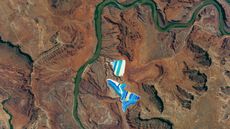 Bright-blue 'potash ponds' shine alongside a dark-green river in Utah
Earth from space A 2017 astronaut photo shows two sets of solar evaporation ponds alongside the Colorado River. The stripy structures are used to refine potassium chloride, or "potash," which is mined nearby.
Earth from space -
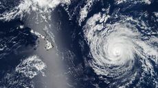 Shimmering silver 'sunglint' obscures Hawaii as hurricane approaches
Earth from space A 2025 satellite photo shows the swirling cyclone of Hurricane Kiko bearing down on Hawaii while the island state was obscured by a bright, reflective streak.
Earth from space -
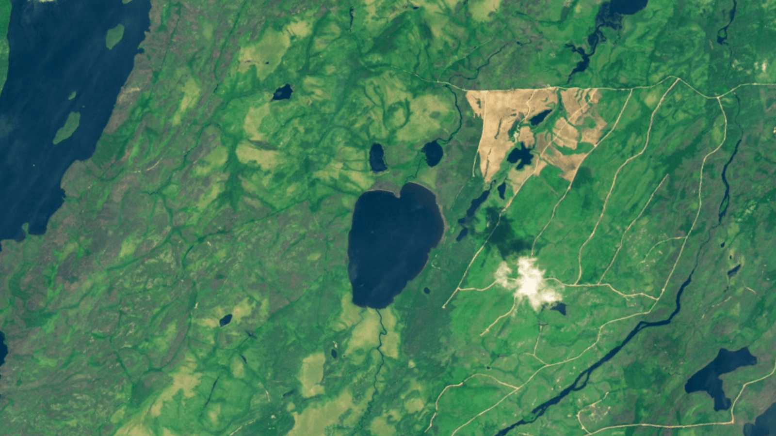 Canadian 'emoji' lake vanishes after dramatic, landslide-like collapse
Earth from space A pair of satellite photos reveals the drastic transformation of Canada's Lake Rouge, which was fully drained after the sudden collapse of one of its banks. A multitude of factors led to the demise of the shocked-emoji-like lake, experts say.
Earth from space -
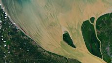 Full moon helps paint vibrant, muddy 'brushstrokes' in Indonesian river
Earth from space A 2024 satellite snap shows suspended sediments streaking across the mouth of the Rokan River, thanks in part to a particularly high tide caused by a full "Strawberry Moon."
Earth from space -
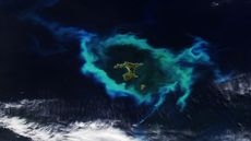 Glowing ring of plankton surrounding New Zealand islands linked to deadly underwater plateau
Earth from space A recent satellite photo captured a gleaming halo of phytoplankton encircling the remote Chatham Islands. The stunning sight is the result of a hidden underwater structure, which has also helped kill hundreds of cetaceans.
3 CommentsEarth from space -
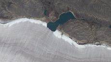 Mini lake meets snowy rim of Canada's oldest ice mass
Earth from space A 2010 satellite photo shows the point where a small lake bisects the snowy rim of an ancient glacier on Canada's Baffin Island. The rippling, snow-rimmed structure is the last remaining fragment of a colossal ice sheet that once covered large parts of North America.
Earth from space -
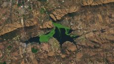 Deadly, vivid-green mass sprawls across South African reservoir
Earth from space A 2022 satellite photo shows a thick mat of blooming algae and invasive aquatic plants spreading across the surface of the reservoir at South Africa's Hartebeespoort Dam. The verdant mass is both toxic and capable of depleting the water's oxygen levels.
4 CommentsEarth from space -
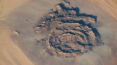 Concentric rocky rings adorned with ancient artwork wear a magma 'hat' in the Sahara
Earth from space A 2025 astronaut photo shows a massif made of concentric mountain ridges in the Libyan desert. The rocky walls contain ancient artworks and are occasionally used to contain herds of grazing cattle.
Earth from space -
 Extreme blast of Arctic air from polar vortex paints a picturesque plume off Florida coast
Earth from space A recent satellite photo captured a stunning scene of sediment swirling across the West Florida Shelf after an extreme cold snap that covered large parts of the eastern U.S. in snow.
Earth from space


